If you need to plot out a hiking route, try CalTopo. CalTopo allows you to print USGS topo maps using the 1:24000 USGS scale. You can also measure the length of your hikes and compute elevation profiles. Check it out!
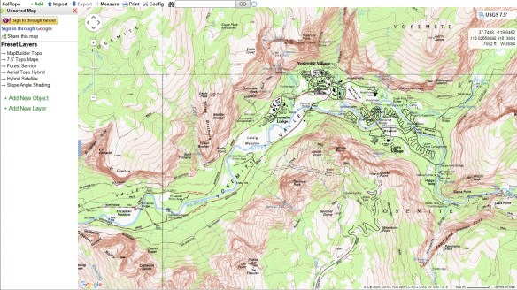

If you need to plot out a hiking route, try CalTopo. CalTopo allows you to print USGS topo maps using the 1:24000 USGS scale. You can also measure the length of your hikes and compute elevation profiles. Check it out!
Check out this essay comparing the cartography between Google Maps and Apple Maps. In summary:
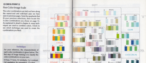
Trying to find that perfect color palette for your choropleth map? Check out this posting about using the right tool to choose that perfect set of colors for data visualization.
The US Wildfire Activity Public Information Map shows US wildfire locations, both active and recent, and other sources of information related to wildfires, including social media. The map contains live feed sources for US wildfire reports (I-209), perimeters, MODIS hot spots, wildfire conditions / red flag warnings, wildfire potential and weather radar. Each of these layers provides insight into where a fire is located, its intensity and the surrounding areas susceptibility to wildfire. Check it out!

It is not much of a place to visit. In the middle of a vast ocean with no land in sight with the only distinguishing feature being a lonely buoy. Seems like a “non-place”, but you might be surprised to learn that your GIS has probably visited the place a few times, maybe quite a bit. Add up all the operating GIS’s in the world and it may be the one of the most visited places on Earth … Null Island at 0,0.

Join MaptimeLA on July 20th when they visit the Los Angeles Central Library to check out the library’s huge map collection! Click below for more info.

Every semester, I give my GIS students (generally planners and public administrators) a rundown of how GIS is being used in our communities. At the Esri conference this year, I saw many new applications and thought I’d ask my colleagues what they are doing now with GIS. If you could send me a map, picture, screen shot or something similar along with a sentence or two of what you are doing, I’d be delighted to have it. I will be happy to share when it is all compiled. You can reach me at barrywaite@outlook.com. The focus is on how we use GIS to solve problems.
By the way, for those of you who hadn’t heard, I have graduated from the City of Carson after 29 years. I’m thinking of becoming a cowboy or an astronaut, but I’ll keep teaching and want to stay in contact with all my GIS friends!
Many thanks!
Barry Waite
Instructor, USC Price School of Public Policy
Google announced on their blog that both Google Earth and Maps have new sharper satellite imagery from Landsat 8. Continue reading
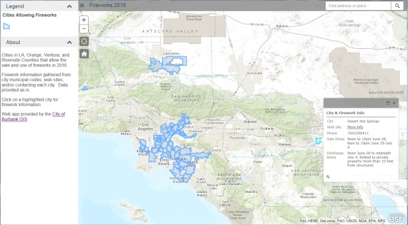
Our next stop for California Friday is actually many locations. July 4th will be here soon and that means Fireworks! The fireworks app I have used for the past few years has been updated once again. This year I added Riverside County. If you love fireworks and want to find out where you can legally buy and shoot them off in SoCal, check out the app!
You can view cities in LA, Orange, Ventura, and Riverside County that allow the sale and discharge of fireworks. Included are days and times when fireworks will be sold and when you can light them up, as well as links to city web sites and telephone numbers. Data was collected from municipal codes, web sites, and/or contacting each city. Enjoy!
For a list of 296 communities permitting state-approved fireworks in California, check out the California Fireworks Newswire website.
Check out this article about Tom Harrison, a Californian cartographer who started his own mapmaking business in the 1970’s. His maps are made for hiking, backpacking, and mountain biking in the parks and wilderness of California. He explains what goes into a good map and why making one can take nearly two years.
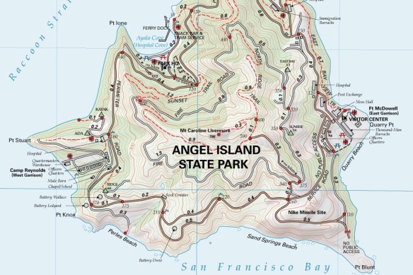
You can order his maps from here.

