The Future of Programming: Wolfram Language

Stephen Wolfram has worked on the Wolfram Language for about 30 years now. The Wolfram Language is a knowledge based programming language. It’s a language with a vast amount of knowledge about how to do computations and it’s a language that has a model of the world built in. The symbolic nature of the language allows it to accommodate any style of programming. It can even use natural language. And it makes it really easy to create really powerful programs.

The goal of the Wolfram Language is to encapsulate as much computational knowledge as possible so people can go from ideas to deployed products as quickly and easily as possible. The Wolfram Language is a huge language, but it’s built on a small set of powerful principals:

  • Coherence – everything in the language must fit together.
  • Maximum Automation – the language should take care of as much as possible.
  • Symbolic Nature – allow the language to define and describe its own deployment.

You can run the Wolfram Language in the cloud and access it via mobile devices. You can take any Wolfram Language function and setup an instant API for it that you can call from anywhere on the web. For example, asking for a JSON output of some weather data for a user’s geo-location. The Wolfram Language can interact with connected devices using the Wolfram Data Framework (WDF).

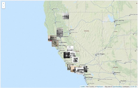
And yes, the Wolfram Language has detailed maps of everywhere built in! This is the future of programming my friends! Check it out.

Disasters in the Golden State

The talented archivists at Calisphere have curated a range of subjects on California history as part of their Local History Mapped series. This particular feature takes on Disasters in the Golden State by looking into the way disasters have affected buildings during the 19th and early 20th centuries. It’s a great subject and visitors can use the View Map feature to explore the state.

calisphere

The homepage provides a brief synopsis of each major disaster type, along with resources for teachers, including class activities based on thematic collections of these images. Additionally the site includes a helpful document titled “How to Use Local History Mapped” and some complementary links from the Joint Committee on Geographic Education.

That reminds me of this book:

It’s very interesting with first hand accounts of California disasters from 1800 to 1900.

Government: Use Your Own Data!

Here is a small but very good example why government should be using their own authoritative data and not depend of Google or Bing!  Too many times I hear “just use Google maps, why should we spend money developing our own data, maps, and apps”.

LA County GIS is constantly setting the bar on developing great data and apps, using it, and sharing too!  -mike

California GIS Council Meeting Thursday May 22nd

Hi all,

Attached you will find the agenda for the GIS Council Meeting to be held this Thursday May 22nd from 9am until noon in Sacramento. The address and teleconference/webinar information is included. We encourage people from all regions of California to participate in Thursday’s meeting, and in future California GIS Council Meetings. One agenda item is to plan out the meeting times and locations for at least the coming year, so please think about where/when we may hold some of the meetings in Southern California.

Please remember that this is the first meeting of the Council in over three years, so we do have a lot to cover. The agenda is meant as a guideline for the discussion, and we will follow it as closely as possible while still remaining flexible.

If you have any questions, please contact one of us (below). We look forward to seeing you (or hearing from you) on Thursday at 9am.

Sincerely,

Karen Beardsley, PhD, GISP
Managing Director, Information Center for the Environment (ICE)
Department of Environmental Science and Policy
One Shields Avenue
University of California
Davis, CA 95616
Ph: (530) 752-5678
Fax: (530) 752-3350
Cell: (530) 848-3310
kbeardsley@ucdavis.edu

ESRI’s Small Government Departmental Platform Program

ESRI’s new Small Government Departmental Platform Agreement allows for unlimited deployments of core ArcGIS software within one governmental department. Departments that have plans to integrate GIS in multiple workflows, such as assessors, health and human services, public works, fire, and planning departments, can use this program to rapidly achieve their goals.

This program is ideal for departments that want to:

  • Increase ArcGIS software and Software as a Service (SaaS) deployments
  • Have flexibility when deploying GIS to desktops, servers, and mobile devices
  • Have a predictable annual licensing model

The Small Government Departmental Platform Agreement program is open to all governments in the United States with populations of 100,000 or less. For more information, call ESRI at 800-447-9778.

ArcGIS Pro … Soon

During the 2013 ESRI User Conference in San Diego, ESRI demonstrated what they called ArcGIS Professional.  It was still under development at the time, but they said it was slated for a Q4 2013 release.  That did not happen, though maybe it was for beta testing sites?  Not sure.

Now they are saying it will be part of the ArcGIS 10.3 release planned for the second half of 2014.  If you have not seen it yet, below is a video from the ESRI Federal GIS Conference in February 2014.

arcgispro

ArcGIS Pro has a ribbon interface that would be similar to Microsoft Excel and Word products.  I personally don’t like that type of interface, the functionality gets lost to me.  Others might find it natural though.

ArcGIS Pro is a 64-bit multi-threaded application that is designed to be the premier application for visualizing, editing, and performing analysis using your local content or content from your ArcGIS Online account or Portal for ArcGIS.  You can author content in both 2D and 3D and publish it as feature, map, and analysis services, 3D web scenes, and web maps.

ESRI states that ArcGIS Pro will not replace ArcGIS for Desktop.  Prediction: I give them 3 years before Desktop goes to live with ArcView 3.

The initial release will not have all the functionality that ArcGIS for Desktop has, but Pro will have capabilities that Desktop does not right now:

  • Project based workflows
  • Combined 2D/3D visualization
  • 64-bit support
  • Multiple layout support

Map documents (.mxd), scenes (.sxd), and globes (.3dd) can be imported into ArcGIS Pro and saved as projects (.aprx).  WHAT?  Having ArcView 3 flashbacks?!!!

ESRI did state that projects are not backward compatible so you cannot go back to ArcMap.  But keep in mind the geodatabases you use in Pro will also be accessible by ArcMap so there can be collaboration at the data level.  Services published with Pro can be shared with ArcMap.  Also, both can run side by side on the same machine.

ArcGIS Pro is part of ArcGIS for Desktop, so only ArcGIS for Desktop customers will be able to receive ArcGIS Pro.  ArcGIS Pro will come in three licensing versions that correspond to Desktop license levels Basic, Standard, and Advanced.  Also, the initial release of Pro will be able to work with the following Desktop extensions: 3D Analyst, Spatial Analyst, Network Analyst, Workflow Manager, and Data Reviewer.

ArcGIS Pro will run on Windows 7 or 8 on a 64-bit machine.  8GB of RAM or more is recommended.

There is no doubt that ArcGIS Pro will be featured at the ESRI Conference in San Diego this year!  Looking forward to it. -mike

Free Python Courses

Looking to learn a little Python programming?  Take a look at these free courses:

Learn to Program: Crafting Quality Code

An Introduction to Interactive Programming in Python

Codecademy: Python

Pythonmonk: Learn Python

ESRI: Python for Everyone

Using Python in ArcGIS Desktop 10

PennState: Geography 485

Google: Python Class

Learnpython.org

The Python Tutorial

MIT: A Gental Intro to Programming Using Python

Other Python Training


Pacific Region Geospatial Data Announcements

From Drew Decker at USGS:

  • National Hydrography Dataset (NHD) releases Web HEM Tool.  HEM stands for Hydrography Event Management and is a tool developed to help relate users’ data to the NHD network as events.  Please see announcement on pages 4 and 5 in the latest NHD Newsletter here:  http://nhd.usgs.gov/newsletters/News_13_6_April.pdf
  • New urban imagery is now available for a number of California cities.  The datasets are natural color and have a one foot resolution.  The data cover the Fresno, Modesto, Oxnard, Stockton, and Sacramento urban areas.  Data can be downloaded through the EarthExplorer site: earthexplorer.usgs.gov (all cities) and The National Map Viewer site: nationalmap.gov/viewer (all except Modesto).

Time-lapse LA

I found this great video of time-lapse photography in and around Los Angeles at night.


Note that in most of the shots the camera is also moving while the time-lapse shots are taken, which makes for a great effect.  It’s best to watch the full HD version here and read about the photographer and his projects.  Here are the other two: