Ever get that annoying “Required Microsoft driver not installed” message when you try to open an Excel file in ArcGIS Pro? Check out ESRI’s guide to connecting to Excel files in ArcGIS Pro and fix it for good!


Ever get that annoying “Required Microsoft driver not installed” message when you try to open an Excel file in ArcGIS Pro? Check out ESRI’s guide to connecting to Excel files in ArcGIS Pro and fix it for good!
Here is a cool video of a year through the distant eyes of meteorological satellite Himawari-8, from December 21, 2015 to December 21, 2016. The satellite observes Earth in geostationary orbit at 140.7 degrees East following Earth’s rotation by travelling at approximately 11068 km per hour at a distance from Earth at 35768 km. Check it out and look for the March 9, 2016 total solar eclipse!
According to Google Maps Help, there is a COVID-19 layer that you can turn on in the Google Maps app on your phone. It displays the 7 day average for the number of new cases per 100,000 people. It also indicates whether cases are increasing or decreasing. More info on the Google blog.
I updated Google Maps on my phone, but it was not there in the layer list. I found this on a Google Maps Help page that new features are rolled out in stages and you might not get it right away. Perhaps it is working for you? Add a comment if you got it to work along with type of cell phone and carrier you have.
UPDATE 9/29/2020 – The COVID-19 layer magically appeared in Google Maps on my Android phone. Looks like the info is at the county level.
Need to automate data prep and aggregation? ArcGIS Notebooks might be your ticket! Sign up for a 60-minute webinar by ESRI’s spatial data science experts as they walk through how you can leverage the latest updates to ArcGIS Notebooks along with popular open source frameworks to automate, data prep and aggregate for a variety of workflows. The webinar is on September 30, 2020 at 9am PDT. Click here to register.
This webinar is an intermediate level session and serves as a follow up session to the previous recorded webinar, “How to use ArcGIS and Jupyter for Geospatial Data Science.” Watch the recording to learn about the fundamentals of ArcGIS Notebooks, data engineering concepts and more, prior to this session.
Check out this article about how a globemaker at Replogle Globes keeps globes up to date and keeps certain countries happy with what they want to see on their globes.

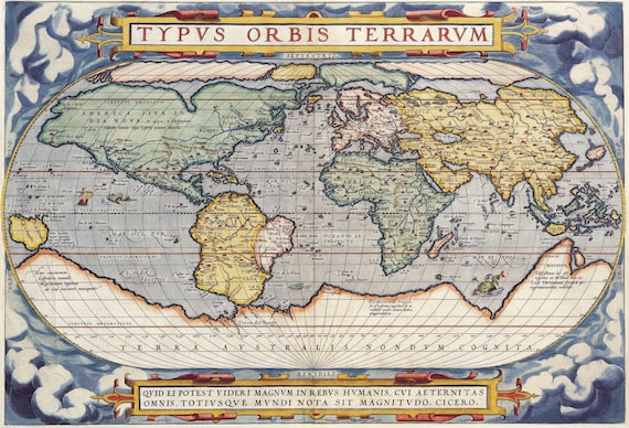
Here is an interesting article about why cartography still matters today. Check it out!
On September 29, from 5pm to midnight (PDT), ESRI plans to update ArcGIS Online. The update includes streamlined item sharing with groups, configurable tabs in the navigation bar, more reports for admins, and improvements in ArcGIS Configurable Apps.
| Configurable tabs in the navigation bar Administrators will be able to configure which tabs appear in their organization’s navigation bar for both members and visitors. Hiding unused tabs will help simplify the user experience. |
| Additional reports for administrators Asynchronous reporting continues to expand in ArcGIS Online giving administrators more ways to monitor and assess activity.
|
| Streamlined item sharing with groups Group owners and managers will be able to batch add items to a group. |
| ArcGIS Configurable Apps improvements ArcGIS Configurable Apps with express setup (Media Map, Minimalist, Interactive Legend, Zone Lookup, Nearby, and Attachment Viewer) continue expanding to make sharing your maps quick, easy, and insightful. Planned improvements include Support for Google Analytics. Screenshot widget that allows you to capture the entire app including the pop-up and legend. |
The ESRI Infrastructure Management & GIS Conference will be held virtually October 27-30, 2020. The conference will welcome GIS leaders, managers, and professionals across critical infrastructure industries including electric, gas and pipeline, water, telecom, transportation, and architecture/engineering/construction (AEC).
The conference is complimentary for all ESRI users who are current on their maintenance or subscription. For more info and to register, click below!

Autumn aficionados can track the changing leaves using the new Fall Foliage Prediction Map. Leaves have already started turning in the North East and parts of the West and Midwest. Check it out!

URISA’s GIS-Pro 2020 will be held virtually on September 29 to October 2. Because it will be virtual this year, the cost to attend has been reduced. For more info and to register, click here.
