How to Review a Geospatial Strategy

Found this interesting article how how you can use a checklist as a guide to review your geospatial strategy or as a final checklist to see if you hit the mark. The checklist includes the following 13 factors:

  1. Is it aspirational?
  2. Is it business driven?
  3. Is it inclusive?
  4. Is it geospatial?
  5. Is it modern?
  6. Is it aligned with the IT strategy?
  7. Is it holistic?
  8. Does it commit to tough decisions?
  9. Is it traceable?
  10. Does it adopt best practices?
  11. Is it practical?
  12. Is leadership on board?
  13. Does it tell a good story?

Click here to read all about it.

World Imagery Wayback

World Imagery Wayback is a digital archive, providing users with access to the different versions of world imagery created over time. Each layer in the archive represents a snapshot of the entire World Imagery map, as it existed on the date it was published. Wayback currently provides access to all published versions of World Imagery, dating back to February 20, 2014. There is an ArcGIS Online item for every version which can be accessed directly from this app.

Available versions of the World Imagery map are presented within a timeline and as layers in a list. Versions that resulted in local changes are highlighted in bold white, and the layer currently selected is highlighted in blue. Point and click on the map for additional imagery details within the selected layer. One or more layers can be added to a queue and pushed to a new ArcGIS Online web map. Check it out!

ESRI Infrastructure Management & GIS Conference

There will be an ESRI Infrastructure Management & GIS Conference in Palm Springs from October 25-28, 2021. This crossover event provides learning opportunities to users from infrastructure sectors, creating a richer, more valuable experience for organizations to move their location intelligence and GIS forward. Join professionals specializing in the management of infrastructure from several interconnected industries—water; electric and gas; district heating and cooling; pipeline; telecom; transportation; and architecture, engineering, and construction (AEC). Requires proof of vaccination for all those attending this event, and masking is mandatory. More info and to register here.

Which Way Are Things Going?

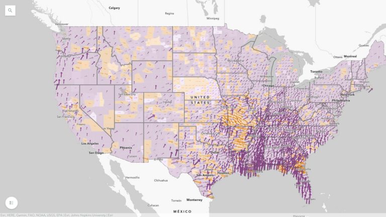
The United States is experiencing the fourth wave of COVID-19 infections, due to the Delta variant of the virus. The mutation with a coinciding spike in cases was expected, but the rampant nature of the spread across the country poses many questions. First and foremost is, Where do I need to be especially careful?

The interactive map “Which Way Are Things Going?” gives a county-by-county view of active cases for a week-by-week perspective on COVID-19 trends. The map aims to provide accurate and actionable information for everyone, with data from state level to county level that makes it easy for anyone to zoom in and see the trends that will help them make decisions about when and where to better safeguard their health and that of their family.

Click below to view the story map.

By the way, the source map is also available in ArcGIS Living Atlas for your use in your own apps, dashboards and story maps.