You can have your map cake and eat it too! Check out these OpenStreetMap birthday cakes!
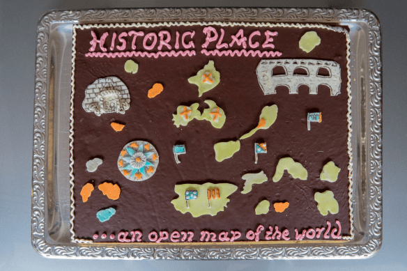

You can have your map cake and eat it too! Check out these OpenStreetMap birthday cakes!
Do you use the Map Viewer in ArcGIS Online? If so, the new version in Beta will be ready for you to try out! Click below to read more about it and what to do to be able to use the new functionality.

Looking for an interesting place to visit and keep to a mapping theme? If you are in Boston, check out the Mapparium, a three story tall glass globe that you stand in the middle of. Click below for the article about it.

Looking to get the latest air quality info for your area? Try South Coast AQMD’s new app that offers up to date air quality information at your finger tips. Click below to read more about it!

For many people, commuting to work is an almost ubiquitous daily occurrence that most strive to keep to a reasonable length. But is this a uniquely modern difficulty, or did workers in past eras have similar commuter struggles? That question is the focus of a CityLab article, which opens by introducing what is known as the Marchetti Constant, an idea coined by the Italian physicist Cesare Marchetti, which basically describes that people have always been willing to commute for about a half-hour, one way, from their homes each day. The average speed of our transportation technologies does more than anything to shape the physical structure of our cities. This article, which includes several illustrative maps and images, offers you a quick overview of the history of transportation and urban development. Check it out!

Interested in Deep Learning using ArcGIS tools? Sign up for this webinar, held October 1st, to learn more about how to implement Deep Learning tools in ArcGIS to perform analysis faster. Topics include Deep Learning in ArcGIS best practices, the Deep Learning tools, tips, and a deep dive into technical use cases. Sign up now!
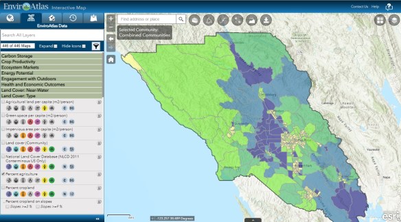
The EPA’s EnviroAtlas interactive map includes over 400 different data sources and provides information about ecosystems and how they benefit us. Check it out!
The ESRI Disaster Response & LivingAtlas teams authored this StoryMap Swipe with recent Maxar imagery showing before and after Hurricane Dorian in the Bahamas. Check it out!

GIS Essentials Workshop Announcement: Thursday, September 26th, 2019
In the GIS Essentials: Mapping Your Community™ workshop you’ll learn to create maps and analyze data about your local community. The class is perfect for beginners and anyone that would like a refresher on mapping and ArcGIS. Workshops are taught by bestselling author Gina Clemmer using the GIS 20: Essential Skills (included in registration) as a guide.
These half day, hands-on workshops run from 9 AM / 12 EST to 2 PST / 5 EST. Each workshop is taught online, by a live instructor. Students dial in to a conference call and login from any computer to view the screen share. The interactive class makes it easy for students to ask questions and participate in group discussions. The cost is $495.
► The workshop: Focuses on teaching the fundamentals of using a Geographic Information System (GIS) for community analysis and mapping. Participants will learn how to create basic reference maps, color shaded maps and geocoded maps (address mapping).
► Upcoming Dates: Visit https://thegis20.com to sign up.
Thursday, September 26th
Thursday, October 10th
Thursday, November 14th
► Materials: The GIS 20: Essential Skills, Third Edition is included with your registration. The book is currently in the top ten Cartography books on Amazon and is the only ESRI book in the Library of Congress. It will be used for exercises and class discussion. The book includes a six month version of the software.
► Instructor: The class is taught by Gina Clemmer, bestselling author and GIS expert.
► Praise: Class participants consistently give the workshop the highest rank. Students appreciate the direct teaching method which offers a fast and comprehensive learning experience.
“Great materials, great instructor and great organization. Thanks!” – Institute for Health Research and Policy, University of Illinois at Chicago
“I especially liked the comprehensiveness of the course as well as the 2-hour segments of learning. Breaking up the learning really helped me retain what I learned. I have taken many IT trainings, but I have to say that Gina Clemmer is one of the best instructors I’ve ever had. I recommend this training to anyone that is interested in learning or improving their GIS skills.” GIS Project Coordinator, NYS Council on Children and Families
“I knew I needed to learn geo-analysis skills and I had to start somewhere. The GIS Essentials course was just the right level to get me where I needed to go. Starting with the basics, working through real-life examples, and upping the complexity made it worth my time. I also appreciated being able to ask questions specific to the projects I was working on. ” Research Data Analyst, Stanford University, School of Medicine
Looking for GIS data from the feds? You are probably familiar with data websites and portals such as The National Map, the USDA’s Geospatial Data Gateway, and geospatial data within Data.gov and the GeoPlatform. Check out this article that explores online sources whose data sets are lesser-known, starting with the U.S. Department of Housing and Urban Development.
