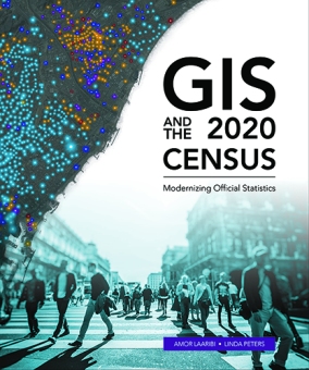
GIS and the 2020 Census

gisandcensus_lgESRI has released their new book GIS and the 2020 Census.  The book provides statistical organizations with the most recent methodologies and technological tools to support all stages of the census.  The book covers planning, enumeration and field data collection, and post-enumeration tasks: converting existing data, field operations, data processing and dissemination, developing geographic products, and much more. Case studies from Albania, Portugal, Republic of the Philippines, Jordan, Arab Republic of Egypt, Ireland, and Canada demonstrate the successful application of the tools.  Ancillary materials are available online and include the updated census data model Global Statistical Geospatial Framework, the United Nations (UN) Handbook on the Management of Population and Housing Censuses, and much more.

GIS and the 2020 Census has 264 pages and is available in soft-cover and as an e-book.  Sample text can be found here.

Every California Earthquake of the Last 30 Years

A new video from the Pacific Tsunami Warning Center maps every earthquake recorded in California in the last 30 years.  Check it out below.

The video starts in August 1989 and ends July 5, 2019 with the magnitude 7.1 quake in Ridgecrest.  The largest earthquake in the last 30 years was the magnitude 7.3 quake in the small Mojave Desert town of Landers in June 1992.

There is a composite image at the end of the video of all earthquakes, and really there are only a few areas in California that are earthquake free!

calearthquakes


2019 StoryMapper of the Year Contest

To give you the opportunity to demonstrate your skills using this next generation story builder, ESRI invites you to enter the 2019 StoryMapper of the Year Contest. The contest will also give you the chance to give back to your community at the same time!

The StoryMapper of the Year Contest started July 8, 2019, and the deadline for submission is 5:00 p.m. (PDT), September 30, 2019.  The contest submissions must be created using ArcGIS StoryMaps, not classic ESRI Story Maps apps.

The 2019 contest will work differently than contests in years past. To up the ante, ESRI added a monetary prize and community element.  When participants submit their entries, they will also describe how they would use a $5,000 donation from ESRI to make a positive impact on their communities through storytelling.

The winners will be announced by ESRI president Jack Dangermond on November 13, 2019, which is GIS Day.  Good Luck!

Geography 2050

Geography 2050 is a multi-year, strategic dialog about the vital trends reshaping the geography of our planet in the coming decades. Initially organized by the American Geographical Society (AGS) in 2014, the ongoing Geography 2050 dialogue convenes thought leaders from academia, government, industry, and the social sector to facilitate discussion of the major forces that will shape our planet’s future. In the late 20th century, talk of a borderless world began to take hold among many in both academia and the media as the end of the Cold War and the forces of globalization rapidly impacted the planet. While many aspects of globalization led to greater fluidity across international borders in terms of trade, capital, technology transfer, and the movement of people, this same period witnessed the creation of more international borders, not fewer. This symposium questions what the world map will look like in 2050 and how our practice of defining, maintaining, and even understanding the meaning of borders might change. Within each theme, we will look both at scenarios of increasing interdependence and division and how they could play out by 2050.

This year’s Symposium will focus on how geography and geospatial science impact the role of borders in our future economy, environment, and geopolitical situation.  Click below for more info.

geography2050

Charging for Landsat Data?

Landsat data has been free and open since 2008.  In 2017 there was a request from the Department of the Interior that the USGS consider the possibility of fee recovery for Landsat data.  The Landsat Advisory Committee (LAG) took up the task to review it.  Their analysis focused on three cost-sharing approaches: charging for traditional data, charging for value added products and services, and private-public partnership (P3) structures.

The LAG has finally released their findings in a report, “Evaluation of a Range of Landsat Data Cost Sharing Models”.  Spoiler alert: the committee did not recommend charging for Landsat 8 and 9 data stating, “The LAG believes that charging a fee for Landsat data will generate little net revenue.”  They note that doing so would “result in negative economic impacts to the U.S. commercial remote sensing satellite and value-added industries.” Laws and regulations would need to be changed in order charge for data and that the revenue gained would not be worth the economic, legal, societal or political costs.

For more info and to view the report click here.

The Last Commercial Orange Grove

Back in the 1920’s agriculture played a dominant role in the San Fernando Valley region.  At one point 75,000 acres of Valley land between towns and subdivisions was used for farming, which included 750,000 citrus trees.

By the 1990’s the Valley’s working citrus industry dwindled to just one, the Bothwell Ranch.  It is located in Tarzana at the corner of Oakdale Ave and Collier St, just a half mile south of Ventura Blvd.

orangegrove1

Now it is up for sale.  The asking price is $13.9 million.  Collier International and Coldwell Banker is billing the property as “an incredibly rare infill development opportunity”.  Marketing materials include a site plan that would split the 14 acres into 26 half acre lots for development into 2-4 million dollar single family homes.  How sad.  Click below to read the article about it.

orangegrove2

The good news is that not too far away is the last historic orange grove of San Fernando Valley owned and protected by CSUN.  The area includes 400 orange trees, a pond, bistro, and observatory.  The orange grove has thousands of fresh, free oranges waiting to be picked by you!  Anyone from anywhere can pick oranges at any time from the orange grove.  Have fun, and make sure to feed the red-eared slider turtles in the pond too!

orangegrove3