Just received an email that ArcGIS 10.4.1 is now available to download. If you have current maintenance, you can download it from https://my.esri.com.
Here is a list of issues addressed in the 10.4.1 release.
Just received an email that ArcGIS 10.4.1 is now available to download. If you have current maintenance, you can download it from https://my.esri.com.
Here is a list of issues addressed in the 10.4.1 release.
Jeff Orton, the President of Central Cal URISA, did a brief write-up on the CalGIS conference in Anaheim. Check it out.
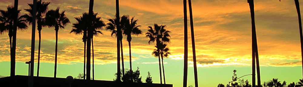
Our next stop for California Friday is Gravity Hill in Sylmar. For those of you that grew up in the San Fernando Valley, you probably remember going to Gravity Hill to experience your car rolling “uphill” without any power. To make it extra creepy, it was best to experience this phenomena in the dark of night because Gravity Hill was next to a cemetery. Then add in a legend about a school bus crash that happened there and the children that died will push your car to keep you from the same fate … that makes it even more creepy! Continue reading
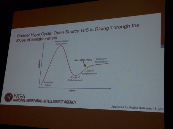
Didn’t get to go to the ESRI Developer Summit in Palm Springs? Here is a recap of the top technology takeaways with some videos as well. Looks like ArcGIS API 4.0 for JavaScript and Vector Tile Maps will be a big thing this year. Check it out.
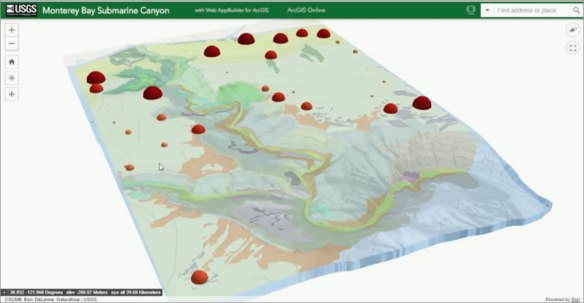
The National Geodetic Survey (NGS) deployed the NOAA Office of Marine and Aviation Operation’s King Air aircraft to complete the collection of geo-referenced oblique imagery of the West Coast. More than 3,000 images were collected from the U.S.-Mexico border to Cape Flattery, WA. The imagery will be used to assess impacts of the ongoing El Niño event in several NOS mission areas, including navigation and coastal zone management. Continue reading
Our friends over at LA County have announced that the Park Needs Assessment has been published. You can download the executive summary or the full report. Continue reading
For what its worth, at least take the survey to tell them what you think of GIS certification.
For more info, see the LA County Enterprise GIS posting about it here.
Check out this article about how Google Maps has changed from emphasizing cities at the expense of roads to emphasizing the road network at the expense of cities. Also the article shows how a 1960’s era paper map does a better job balancing roads and city names.

I thought I would start a fun blog series called California Friday which focuses on underrated or unusual places to visit in California. Sure, it’s not GIS related, but might make for interesting weekend trips or places to stop at while staring at your GPS as it recalculates your route! We will see how this goes for a few months. Let me know how you like it, or if you visited the place add a comment to tell us some insider stuff to do.
Our first stop is little Amador County, just southeast of Sacramento. Here you can step back in time and visit wine country as it was with tiny, family owned wineries tasting vinos you would not find elsewhere. Continue reading
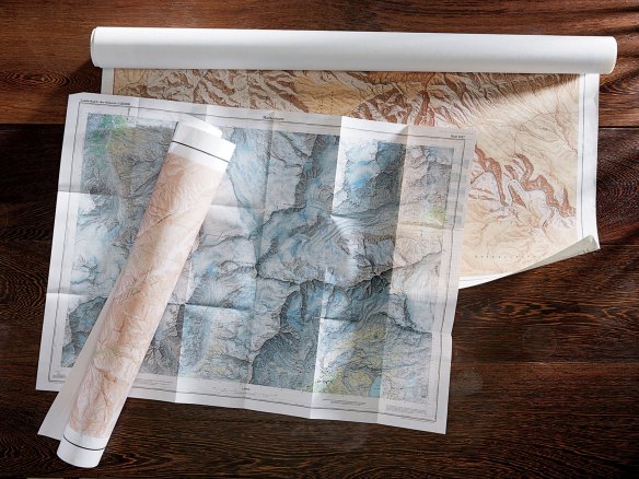
At the close of the Second World War, the United States government embarked on an enormous artistic enterprise. It is estimated to have cost nearly $3 billion and, at its height, employed more than 2,000 people. I am talking about the topographic mapping program of the United States Geological Survey.
Read more on the New York Times Magazine website by clicking below.