Thought that traditional paper maps are dead? Well, at least not yet! Here is a Minneapolis mapmaker that has stayed in business making custom maps in niche markets from dog parks to UFO sightings.
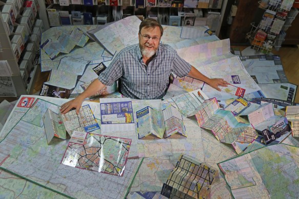
Thought that traditional paper maps are dead? Well, at least not yet! Here is a Minneapolis mapmaker that has stayed in business making custom maps in niche markets from dog parks to UFO sightings.
Guerrilla Cartography has a kickstarter for their upcoming Water Atlas project. Contribution options include adding your location to the collaborators map, receiving a copy of the book, or even donating a copy of the book to your favorite school, library, or community center with your name printed on the inside cover. Check it out.

Thanks goes to Chandler Sterling for pointing this one out!
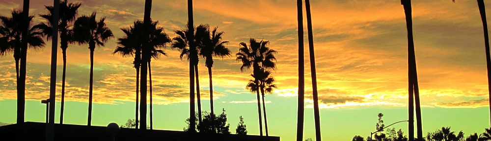
Once a footpath for the native Tongva people, now Sepulveda Canyon supports the busy Sepulveda Blvd. and 405 Freeway between the valley and the west side. Check out this article about the history and construction of the highway and freeway that goes through what we now call the Sepulveda Pass.

GIS Fall Semester classes starts August 21st
Pursue your GIS Certificate at Rio Hondo College. Registration starts next week. Apply for admission and register for classes entirely online.
Fall semester classes include two Introduction to GIS (GIS 120) courses including one located off site at the LA County Department of Public Works (DPW) at 900 S Fremont Ave, Alhambra. Also offered is Cartography (GIS 221) and Intermediate GIS (GIS 220).
For more information visit http://riohondo.isteaching.com/fall-semester-2017.html or contact Prof Warren Roberts gisteacher@gmail.com .
Looking to get some hands-on GIS learning in a fun, interactive group environment? Perhaps the ESRI Geodata Academy is the place for you! Each no-cost Geodata Academy session is under 4 hours, with morning and afternoon offerings. Check it out!

Interesting infographics and maps about roadway fatalities by substance type. Data includes drug and alcohol related roadway deaths from 1995 to 2013. Looks like LA County drivers like stimulants.

World Imagery Firefly was created for thematic maps. Currently in beta, Firefly is an alternative view of the default World Imagery basemap, and is designed with desaturated colors. When zoomed out, the map appears grayscale, but as you zoom in, the colors become more saturated until the full color detail of the imagery appears. World Imagery Firefly is especially useful for overlays of brightly styled layers when you want an imagery basemap, but do not want the imagery to compete with the layer styling. Check it out.

URISA is conducting their annual GIS Salary Survey. An executive summary will be provided for free after the survey. A comprehensive analysis of the results will be available for purchase. For more info and to participate, click here.

Monday was the opening day to the 2017 ESRI User Conference in San Diego. The Plenary session was full of info as usual. It was all about Web GIS, Exploratory Data Analysis (Insights for ArcGIS), ArcGIS Pro, and ArcGIS Server. Some highlights from my notes:
I’m sure the whole Plenary session from today will be viewable soon on ESRI’s video webite.
Looking forward to the 2017 ESRI User Conference on Monday? To help you prepare and make the most out of your UC experience, ESRI has created industry fliers for you to learn more about the industry events happening this year at UC. Use them to fill out your calendar for next week!

