Remembering Frank Gossette

For those of you that attended CSULB Geography/GIS, you might remember Dr. Frank Gossette. Frank passed away September 8th.

Frank was my mentor and taught me everything I know about GIS. I remember when he arrived at CSULB in 1985, he had many great ideas about using GIS, which this new technology was fascinating to me at the time. I ended up using GIS for my Master’s Thesis. Frank was one of my thesis committee advisors. My best memories of Frank are at the ESRI conferences in San Diego when we met at Kansas City BBQ. It was great to catch up with him and talk with other CSULB graduates and students. I will miss him greatly.

Below is an email that went out from CSULB Geography leadership:

It is with great sadness we share the news of the passing of Dr. Frank Gossette on September 8, 2026. Dr. Gossette was a Professor of Geography at CSULB from 1985 to 2009. He earned his B.A. in Sociology and M.A. in Asian Studies from the University of Oregon in 1971 and 1973, respectively, and his Ph.D. in Geography from UCLA in 1980. His dissertation, titled Social Ecology in a Contemporary Chinese City: Taichung, Taiwan, applied some of the most cutting-edge approaches in the field of geography at the time.

Before joining the Department of Geography at CSULB, Frank taught at Northwestern University and the University of Delaware. A cultural geographer with interests in Asian studies, economics, and viticulture, he was fluent in Mandarin and a pioneer in the geospatial sciences. Frank was instrumental in developing and contributing to the department’s courses and research in geospatial technologies. Through numerous contracts and grants with local private and public agencies, he created applied internships for scores of undergraduate and graduate students. Frank and the students he mentored helped establish GIS programs in communities throughout Southern California and many geospatial practitioners in the region started their careers under his guidance, cultivating excellence. Frank also developed a unique student exchange program with the University of Salzburg, Austria bringing students from CSULB to Salzburg and Salzburg students to our campus, providing our students with an otherwise inaccessible international experience. He shared his love and deep knowledge of wine by hosting tastings for our student association. His graduate seminars, often culminating at Avenue 3 Pizza, were legendary. For more than two decades, former and current students have gathered every July at the Esri Conference at the Kansas City BBQ, a tradition that has become a tribute to Frank and his geospatial legacy.

The Frank Gossette scholarship was developed in Frank’s honor to support graduate student research. He wrote the following words to share at our 2026 Department banquet last May “…Giving – Is a wonderful act. Both the receiving part and the give benefit. We have been fortunate to have picked a field which is growing and opportunities for giving and giving back abound! We award some of our best with prizes for creative work and celebrate good ideas. I am proud to have my name attached to one such award and congratulate the current and former winners! I hope this is just the beginning of sharing good ideas…

We raise a glass to you, Frank, to ideas, wine and travel.

In lieu of flowers, his wife Sarah London requests donations be made to the Frank Gossette Scholarship to continue supporting geography graduate student research.

https://giveto.csulb.edu/campaigns/frank-gossette-endowed-scholarship

Please share any memories. We will collect these to share with Sarah and to continue to honor Frank and his legacy.


Call for Entries: Fifth Annual Student Exhibition Competition

The California Map Society and the David Rumsey Map Center invite all US-based undergraduate and graduate students to apply for an opportunity to curate an original exhibition of maps from our collections based on the topic of the applicant’s choice. Proposals will be judged on the strength of the topic, the effective use of maps in support of the topic, and overall quality of research and writing. Applications are due Friday, June 26, 2026, at 11:59pm to rumseymapcenter@stanford.edu. Use the subject: “Exhibition Competition Submission.” 

The winner of this competition will receive:

  • Installation of physical exhibition in the Rumsey Center and hosting of a digital companion exhibition
  • A pre-tax $1,000 award
  • One year membership in the California Map Society
  • Opportunity to present at the California Map Society’s spring meeting, and up to $1,000 for related travel expenses

Learn more about the award, past winners, and how to apply.

Federal Accessibility Deadline Will Be Delayed One Year

On April 20, 2026, the Department of Justice published an Interim Final Rule extending both compliance deadlines for the 2024 Title II web accessibility rule by one year. State and local government entities with a total population of 50,000 or more, which faced a deadline of April 24, 2026, now have until April 26, 2027. Smaller public entities and special district governments, which had until April 26, 2027, now have until April 26, 2028.

This means that all your GIS applications and PDF maps do not have to be compliant until next year. If you have been working diligently to get everything together by the deadline, you now have a reprieve!

More info about it here: https://www.govtech.com/policy/federal-accessibility-deadline-will-be-delayed-one-year

2025 ESRI UC

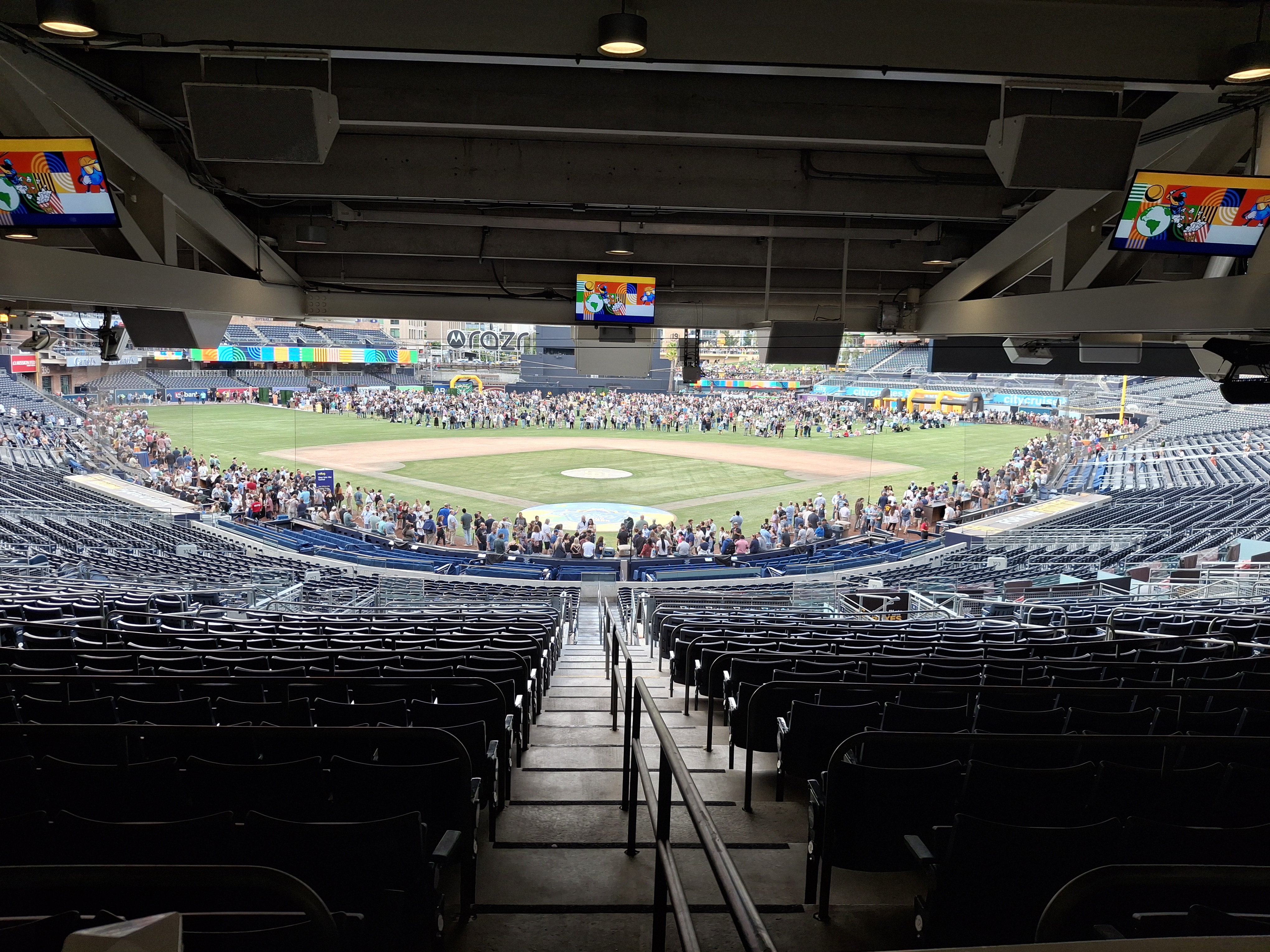
The 2025 ESRI User Conference is wrapping up. The Thursday night party is at Petco Park this year … unfortunately you cannot run the bases!

If you have not seen the Plenary videos, you can view them here.

I would say the most interesting thing for me at the conference were the new AI Assistants in ArcGIS Pro. Be part of the beta program for 3.5. The 3.6 beta will be available in September 2025.

Another thing that was interesting was the soon to be available Google Photorealistic 3D Tiles in ArcGIS. Read more about it here.

CGIA Awards Social @ ESRI UC 2025

Dear SoCalGIS,

Get ready to celebrate innovation in geospatial technology!

The California Geographic Information Association (CGIA) is thrilled to invite you to our annual **CGIA Awards Social**, where we will honor California’s most innovative geospatial projects and ideas.

This is a fantastic opportunity to join us for an evening of recognition, networking, and celebration with fellow professionals. We’re excited to announce that this year’s social is generously sponsored by **ParcelQuest**.

**Event Details:**

* **What:** CGIA Awards Social
* **When:** Tuesday, July 15, 2025
* **Time:** 6:00 PM – 8:00 PM
* **Where:** Revel Revel, 868 5th Ave, San Diego, CA 92101

Enjoy **complimentary food** throughout the evening, and be sure to arrive early – the **first 75 guests will receive a drink voucher!**

Don’t miss out on this exciting event. Please RSVP at cgia.org.

We look forward to celebrating with you!

Best regards,
Tracy Tober
CGIA CHair

USGS Data Collaboration Announcement Webinar

On August 6th at 10:00 AM Pacific Time, USGS will host an informational webinar to provide an overview of the Fiscal Year 2026 (FY26) 3D National Topography Model (3DNTM) Data Collaboration Announcement (DCA) for the 3D Hydrography Program | U.S. Geological Survey (3DEP) and the 3D Hydrography Program (3DHP).

For more info and to register, click here.

LA Riot Map

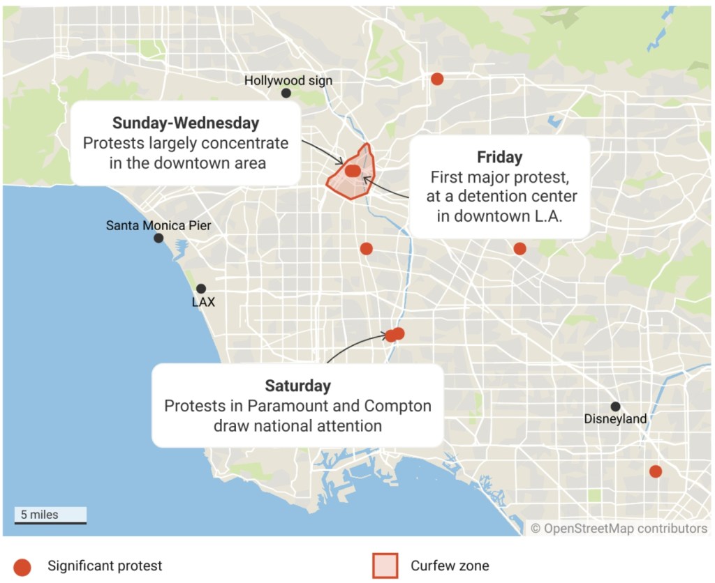
Is LA really under siege with all these riots? This article and map shows it really is not.

Los Angeles is a sprawling metropolitan area that’s home to nearly 13 million people. Unlike a lot of big cities, it doesn’t have one main population center. Angelenos are much more spread out than New Yorkers or Chicagoans. Most of the protests this week have taken place in a radius of just a few blocks of downtown L.A., where City Hall, LAPD headquarters and a federal detention center are clustered together.

One-Year MS in GISci @ CSULB

The Master of Science in Geographic Information Science (MSGISci) in the Department of Geography at California State University, Long Beach is accepting applications for our 1-year 30-unit MS degree starting in Fall 2025 (August 25, 2025 to August 14, 2026).

This graduate degree provides students with advanced analytic and technical training in geospatial technologies and professional skill building to prepare graduates for the geospatial workforce. The culminating team-based applied research project is informed by industry professionals.

Why CSULB?

  • We are the #1 Geography Program in the CSU, #5 in CA, #9 in the West and #28 in the USA!
  • CSULB Geography alumni are among the highest wage earners in 2-year income post-graduation from the College of Liberal Arts.
  • Join a network of over 200 MSGISci graduates.
  • You will receive excellent mentorship, instruction, and skill development to support your future professional goals.

Please visit www.BeachGIS.com to learn more about our program and register for an upcoming information session. Act Soon! Applications must be submitted via Cal State Apply by the June 1st deadline.