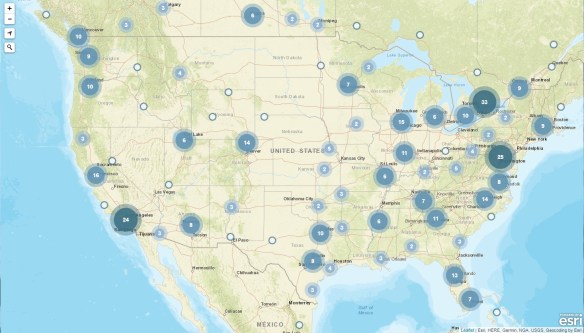
Check out this interactive map by The San Francisco Chronicle which provides information on wildfires burning across California. The map displays the ongoing/contained fire origins, current/previous fire perimeters, current hot spots, and current air quality.
Category Archives: News
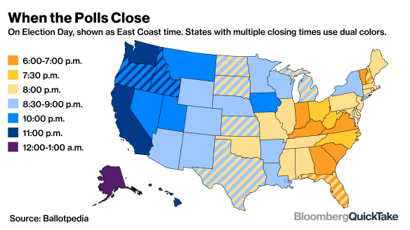
Map of When Polling Places Close
Wondering what time your local polling place closes today? Check out the map below. Note times are shown as East Coast time.

Halloween Candy Map 2018
Americans are expected to spend about $9 billion on Halloween this year as they buy costumes, decorations, greeting cards and candy for the annual Oct. 31 event.
The National Retail Federation estimates that more than 175 million Americans are planning to participate in Halloween activities this year, spending about $3.2 billion on costumes, $2.7 billion on decorations, and $2.6 billion on candy.
Bulk candy dealer CandyStore.com looked through 11 years of data to come up with the favorite Halloween candy in each U.S. state. Continue reading
The Measure W Map – Using GIS for Taxes
Ah taxes, don’t you just love em? Every year there seems to be a new tax we have to pay. And now there is Measure W for a new proposed property tax, and it uses GIS! Et tu, GIS? 🙂
Do you own property in LA County? Read on. You rent in LA County? Your landlord can raise your rent to cover the tax. You should read on too. Continue reading
The Kingdom of California
The Santa Barbara Museum of Natural History will exhibit “The Kingdom of California: Mapping the Pacific Coast in the Age of Exploration” through January 2nd. The exhibition displays 17th to 19th century maps and books, including maps showing California as an island as well as 19th century coastal charts. Entry to the exhibit is free with paid museum admission. Check it out!
A Map of Every Building In America
This one is interesting! The New York Times has created a page with an interactive map showing every building in the US. How did they do this? They used data from a huge database that Microsoft released to the public this year. Microsoft’s computer engineers trained a neural network to analyze satellite imagery and extract out shapes of 125,192,184 buildings across the country. Click below and read on!
Citizens Favor a More Digital Government
In a recent survey of citizens across the world it was found 86% view digital delivery of public services “as equally or more important” than traditional methods of public service delivery. And most are willing to provide personal or potentially sensitive data to improve the personalization of services. For example, 73% of citizens polled would provide biometric data such as fingerprints, retinal scans, or voice identification to government in exchange for more personalized service. Of course Americans were about 10 percent less likely than their global counterparts to share personal information to improve government service delivery … I don’t blame them! Click below to read more.
Harvard WorldMap
Harvard University’s Center for Geographic Analysis (CGA) has created Harvard WorldMap, an online open-source mapping platform developed to lower barriers for scholars who wish to explore, visualize, edit, and publish geospatial information. WorldMap was created to provide a mapping platform that supports large datasets that also allows collaboration. Anyone can create their own online mapping portal, upload large GIS layers and overlay them with other layers, and control access to their data. Check it out!
Free Pass to GIS-Pro/CalGIS 2018
If you do not have the cash to attend the GIS-Pro/CalGIS 2018 conference in Palm Springs next week, you can get a free pass to visit the exhibit hall area October 10 or 11. Click here for more details.
IPAWS National Test Today
FEMA and FCC will conduct a nationwide test of the Emergency Alert System (EAS) and Wireless Emergency Alert (WEA) system. That means today you will receive a WAS test message on your cell phones that are connected to wireless providers participating in WEA. Cell towers will broadcast the WEA test for approximately 30 minutes beginning at 2:18pm EDT (11:18am PDT).
So when your cell phones start screaming at you, that is what’s going on! For more information, visit https://www.fema.gov/emergency-alert-test.