Looking for a GIS class this Fall 2019? Here are some local colleges that are offering GIS classes:
Cal Poly Pomona – GIS (GEO 2400/2400L), GIS Programming (GEO 3220/3220L)
CSU Dominguez Hills – GIS (GEO 415)
CSU Fullerton – Intro to GIS (GEOG 481), GIS Principles and Apps (GEOG 485), Map Making with GIS (GEOG 281)
CSU Long Beach – Intro to Digital Cartography (GEOG 380), Enterprise GIS (GEOG 484)
CSU Los Angeles – Intro to Geospatial Sciences (GEOG 2680), Fundamentals of GIS (GEOG 3690), Spatial Analysis and GIS Modeling (GEOG 4690)
CSU Northridge – Intro to GIS (GEOG 206/206L), Intermediate GIS (GEOG 306/306L), Advanced GIS (GEOG 406/406L), GIS Project Management (GEOG 408C/408CL)
CSU San Bernardino – Intro to GIS and Cartography (GEOG 202)
Claremont Graduate University – GIS Essential Concepts (IST 370)
Cypress College – Intro to GIS (GEOG 230C/F), GIS Spatial Analysis (GEOG 231C)
East Los Angeles College – Intro to GIS (GIS 025)
Loyola Marymount University – Intro to GIS (EVST 1010 or URBN 1010)
Mt. San Jacinto College – Intro to GIS (GEOG 115)
Occidental College – GIS I (GEO 150/150L)
Palomar College – GIS and Spatial Reasoning (GEOG 150)
Pasadena City College – Intro to GIS (GEOG 011), Map Interpretation and Spatial Analysis (GEOG 012), Data Acquisition and Management (GEOG 013)
Pierce College – Intro to GIS (GIS 025), Intermediate GIS Applications (GIS 033)
Pomona College – GIS in Environmental Analysis (EA 101 PO/EA 101 LPO)
Rio Hondo College – Intro to GIS (GIS 120), Intermediate GIS (GIS 220), Environmental GIS (GIS 230), Crime Mapping GIS (GIS 281), Cartography Design and GIS (GIS 221), Geospatial Programming & Web Services (GIS 280)
San Bernardino Valley College – Intro to GIS (GEOG 130)
San Diego Mesa College – GIS and Spatial Reasoning (GISG 104), Intro to Mapping and GIS (GISG 110), Spatial Analysis with GIS (GISG 112)
San Diego State University – GIS and Spatial Reasoning (GEOG 104), GIS Scripting Fundamentals (GEOG 383), Spatial Data Analysis (GEOG 385), GIS (GEOG 484)
Santa Monica College – Intro to GIS (GIS 20), Intermediate GIS (GIS 23), Applications in GIS (GIS 27)
UCLA – Intro to GIS (GEOG 7), Intro to Spatial Statistics (GEOG M171), GIS Programming and Development (GEOG 173), Geographic Data Visualization and Analysis (GEOG 208)
UCLA GIS Extension – Intro to GIS (GEOG XL 7), Intermediate GIS (GEOG XL 168), Advanced GIS (GEOG XL 170)
UCR GIS Extension – Essential GIS Skills (ERT X454.65), Principles of Web GIS Applications (ERT X453.61), GIS Applications Lab (ERT X453.4)
UCSB – Intermediate Geographical Data Analysis (GEOG 172), Intro to GIS and Science (GEOG 176A)
University of Redlands – Fundamentals of GIS (GIS 611)
USC – GIS for Policy, Planning, and Development (PPD 631)
USC Spatial Sciences – Maps and Spatial Reasoning (SSCI 301L), Statistics for the Spatial Sciences (SSCI 381), Spatial Computing (SSCI 580), Spatial Databases (SSCI 582), Spatial Analysis (SSCI 583), Geospatial Technology Project Management (SSCI 585), GIS Programming and Customization (SSCI 586), Web GIS (SSCI 591)
Ventura College – Fundamentals of Mapping and GIS (GIS V22), Intro to Mapping and GIS (GIS M01)


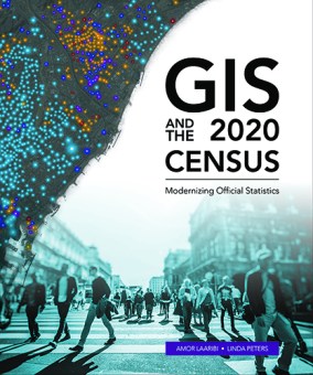 ESRI has released their new book GIS and the 2020 Census. The book provides statistical organizations with the most recent methodologies and technological tools to support all stages of the census. The book covers planning, enumeration and field data collection, and post-enumeration tasks: converting existing data, field operations, data processing and dissemination, developing geographic products, and much more. Case studies from Albania, Portugal, Republic of the Philippines, Jordan, Arab Republic of Egypt, Ireland, and Canada demonstrate the successful application of the tools. Ancillary materials are available online and include the updated census data model Global Statistical Geospatial Framework, the United Nations (UN) Handbook on the Management of Population and Housing Censuses, and much more.