The 2016 ESRI User Conference got off to a great start today in beautiful downtown San Diego.

Instead of giving you a blow by blow of what happened today in the Plenary, you can just watch it here.

The 2016 ESRI User Conference got off to a great start today in beautiful downtown San Diego.
Instead of giving you a blow by blow of what happened today in the Plenary, you can just watch it here.
Q: When will ArcGIS Pro support parcel editing?
A: ArcGIS Pro supports simple feature editing now and is adding topology support at 1.3. We expect full parcel support to be available next year.
Each year ESRI creates a set of questions and answers for the User Conference in San Diego. This information is designed to help you understand the latest enhancements to ESRI technology, emerging trends for GIS for your industry, and the road ahead for ArcGIS software. Check it out.
The 2016 ESRI User Conference in San Diego is just a week away. If you are using or plan to use some of the offerings in the ArcGIS for Local Government suite, check out these technical sessions and demos during the conference.
Also, you can check out the conference schedule to plan your week.
If you are looking to get more involved with GIS in California, please consider running for the Vice-Chair position on the California GIS Council. The Vice-Chair assists the Chair in leadership and administration of the Council, and will assume the role of the Chair at the expiration of the sitting Chair’s term. The nomination period has been extended to June 22.
If you plan on attending the ESRI User Conference in San Diego at the end of the month, you might want to know that they are brining back free GIS data health checks. You can bring in a sample of your data in either a file or personal geodatabase to the conference and an ESRI industry expert will perform a diagnostic on your data to assess its overall quality. For more info, click here.
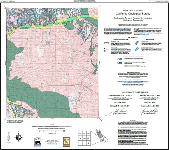
The Alquist-Priolo Earthquake Fault Zone Act (1972) and the Seismic Hazards Mapping Act (1990) direct the State Geologist to delineate regulatory “Zones of Required Investigation” to reduce the threat to public health and safety and to minimize the loss of life and property posed by earthquake-triggered ground failures. Cities and counties affected by the zones must regulate certain development “projects” within them. These Acts also require seller of real property (and their agents) within a mapped hazard zone to disclose at the time of sale that the property lies within such a zone.
The California Geological Survey has released 7 new Alquist-Priolo Earthquake Fault Zone maps in the San Bernardino County and Tahoe Basin areas. Check it out.
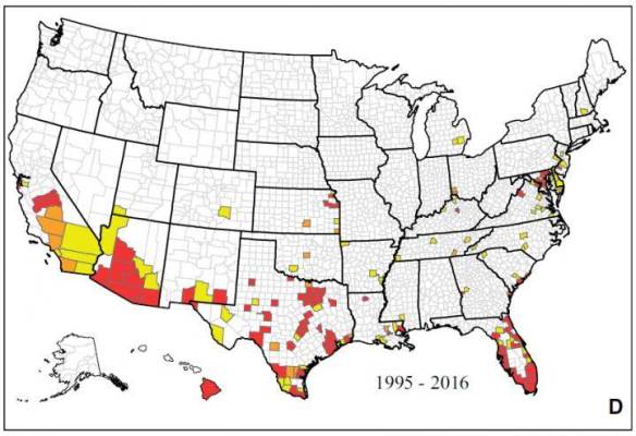
A new map showing where mosquitoes that can carry the Zika virus include 40 states and Washington D.C. The map was compiled by experts at the Centers of Disease Control and Prevention. The CDC used records from their mosquito-borne disease database, mosquito control agencies, university researchers and state and local health departments. Click the map to read the article.
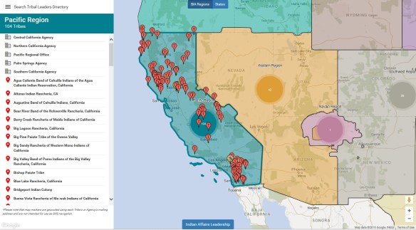
The Bureau of Indian Affairs (BIA) first developed the Tribal Leaders Directory as an internal reference document for its employees. It quickly became one of Indian Affairs’ most requested documents, and is now used by federal, state and local governments, news media, businesses, researchers, and the general public as a resource to help them connect with Indian Country. The BIA’s commitment to enhanced communication led to transforming this publication into the electronic interactive map. Check it out.
Beware of IP address mapping companies. They might be pointing to your house and make your life a living hell.

Just received an email that ArcGIS 10.4.1 is now available to download. If you have current maintenance, you can download it from https://my.esri.com.
Here is a list of issues addressed in the 10.4.1 release.

