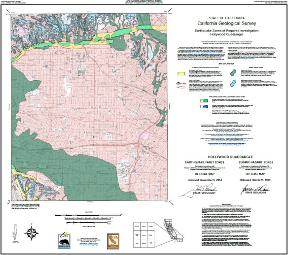
The Alquist-Priolo Earthquake Fault Zone Act (1972) and the Seismic Hazards Mapping Act (1990) direct the State Geologist to delineate regulatory “Zones of Required Investigation” to reduce the threat to public health and safety and to minimize the loss of life and property posed by earthquake-triggered ground failures. Cities and counties affected by the zones must regulate certain development “projects” within them. These Acts also require seller of real property (and their agents) within a mapped hazard zone to disclose at the time of sale that the property lies within such a zone.
The California Geological Survey has released 7 new Alquist-Priolo Earthquake Fault Zone maps in the San Bernardino County and Tahoe Basin areas. Check it out.