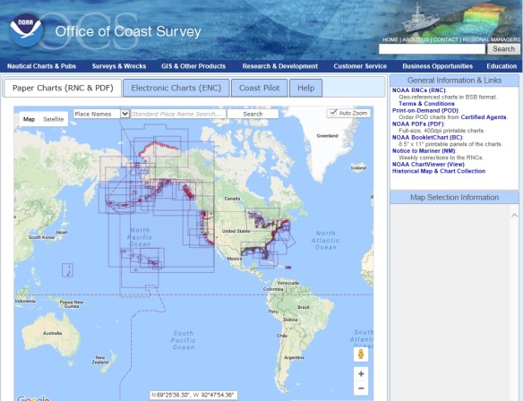
Nautical and International Waters Charts

Are you looking for nautical charts?  NOAA’s paper nautical charts are available as “print on demand” up to date to the time of purchase.  You can also download charts in PDF format for free.

noaanauticalcharts

Looking for open ocean and international waters charts?  They are produced by the National Geospatial-Intelligence Agency (NGA) and available through vendors as “print on demand” products.

Palomar College Drone-Con 2017

Palomar College is having a free Drone Conference on July 7th.  Join Educators, GIS Analysts, Precision Agriculture Specialists, Civil Engineers, Surveying and Mapping Technicians, Utility and Construction Inspectors, Photographers and Videographers along with Law Enforcement Officials, Emergency Responders, and Search and Rescue Personnel at the forefront of incorporating the use of drones in a rapidly emerging job market.

The Drone Conference for Educators and Industry Professionals will feature hands-on learning sessions, demonstrations, vendor exhibits, and guest speakers from various industry sectors including the University of California system, SDG&E, and DJI among others. The day will conclude with a networking reception followed by an evening show at the state-of-the-art Palomar College Planetarium.

To register for this FREE conference and for more information, visit their website.

Space is limited to 120 registrants, so be sure to register soon!

SCAG/ESRI Story Maps Student Challenge

Calling all students! The Southern California Association of Governments (SCAG) is currently accepting abstracts for a student showcase at our annual Regional Conference and General Assembly on May 4 and 5 in Palm Desert. SCAG is looking for outstanding student work in two categories: sustainability planning posters and ESRI Story Maps using SCAG data. Continue reading →

Intro to Web Programming for GIS Applications

From Mike Miller:

I just released a new course called “Introduction to Web Programming for GIS Applications” on Udemy. I would like to offer the members of SoCalGIS 50% off ($50 for 96 lectures covering 13 hours) using the following link.

https://www.udemy.com/introduction-to-web-programming-for-gis-applications/?couponCode=SOCALGIS

The course covers the basic of HTML, CSS, JavaScript, jQuery, Bootstrap, PHP, Leaflet, and PostGIS with an emphasis on the parts important for GIS Applications. Although I use examples from Open Source software for practical reasons, Most of the material is applicable to web mapping on commercial platforms as well.

This course is intended to be the fouindation for further courses I am developing on Client side GIS applications, Server side GIS applications, and Mobile application development.

Non-profits are eligible for further discounts. Just email me at lstomsl@gmail.com and tell me how you use GIS to make the world a better place.

Thanks,
Mike Miller
www.millermountain.com


Graduate Certificate in Digital Mapping

Greetings from the University of Kentucky Department of Geography!

Are you interested in web mapping? Check out the online Graduate Certificate in Digital Mapping program at the University of Kentucky – we can help take your GIS career to the next level. While there are a full range of courses, we recommend experienced GIS professionals begin with MAP 672 – Programming for Web Mapping.

In addition to MAP 672, we will also be offering MAP 671 – Intro to New Mapping (focusing on a desktop GIS workflow for web production) as well as MAP 673 – Design for Interactive Web Mapping. MAP 672 introduces students to JavaScript, HTML and CSS and is perfect for those who have work experience in desktop GIS, but have not yet begun web mapping.  If this describes you, please email us so we can review your experience and consider an advanced enrollment. Continue reading →