A Safer, Speedier Flu Clinic

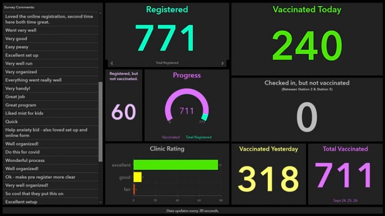
This one is interesting. The GIS Department for Carlton County, Minnesota, used ArcGIS Survey123, ArcGIS Hub, and ArcGIS Dashboards to help administer a drive-through flu vaccine clinic. Online forms created with ArcGIS technology made registration for the clinic safer, faster, and easier for the public. Dashboards provided real-time statistics, enabling county officials to quickly analyze how many people were being vaccinated. Click below to read the article.

SCAG 2021 Student Showcase

SCAG is inviting college and university students in the region an opportunity to conceptualize, create, and submit ArcGIS StoryMaps using SCAG’s open data. This is a meaningful way to tell a story or provide insight, showcase plans and projects, engage supporters and stakeholders, illustrate the possibilities of data, and highlight the usefulness of open data at the regional level.

The 2021 Student Showcase will be a virtual StoryMap competition with two award categories: Innovation and Planning. An internal staff of planning professionals will evaluate the projects and select four winners.

In all, there will be a total of $6,000 awarded (one $2,000 first place prize and one runner-up $1,000 prize each per category).

Click here for more info.

Want to learn more about ArcGIS StoryMaps? Attend the Toolbox Tuesday on StoryMapping: Transforming Data Into Interactive Stories on Tuesday, Feb. 23 at 10 a.m. Attendance is encouraged but not required. Entrants may also review meeting materials that will be posted online following the training to participate. 

First Public Publication of the 2020 Census Geography

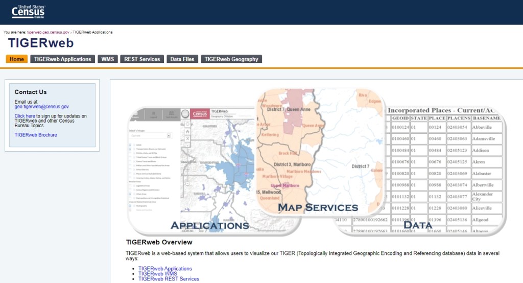
The US Census Bureau just released the first public publication of the 2020 Census Geography through TIGERweb. This includes the 2020 Census Blocks, Census Block Groups, and Census Tracts. Download the new Census Geography Files today!

For those of you that participated in the Boundary and Annexation Survey (BAS), the new files can be found here.

Top 5 of 2020

Happy New Year! Looking back at 2020 on SoCalGIS, we did not get as many viewers as 2019, but we all know why. However, here are the top 5 viewed posts of 2020, and Jobs was not one of them! And all were posts made before 2020!

  1. Add Google Maps to QGIS 3
  2. Feature Attributes to CSV
  3. California Friday: Gravity Hill
  4. Field Calculator: I Just Want The Third Word
  5. ArcMap: Dealing With NULLs

Hoping 2021 is all our best year yet!

ArcGIS Enterprise 10.9 Prerelease Is Available

Looks like ESRI has released the prerelease of ArcGIS Enterprise 10.9. You can download your software at my.esri.com.

Other info about this prerelease:

ArcGIS Enterprise 10.9 upgrades are not supported at the 10.9 prerelease. To see the new capabilities of the ArcGIS Enterprise 10.9 prerelease, a new installation is required. Upgrades from previous versions to the 10.9 prerelease are supported only for testing purposes. Do not upgrade production systems to the 10.9 prerelease. Upgrades from the prerelease version to the final released version are not supported. The final release of 10.9 will support upgrades from previous software releases as usual.

The following components are not included with the ArcGIS Enterprise 10.9 prerelease and will be available with the final release of ArcGIS Enterprise 10.9:

  • ArcGIS Enterprise Cloud Builder for Amazon Web Services
  • ArcGIS Enterprise Cloud Builder for Microsoft Azure

Next ArcGIS Online Update Dec 8

Received an email from ESRI a few days ago about them updating ArcGIS Online on December 8, from 5 pm-midnight PST. This update will include new features and enhancements that improve security policies and administrative capabilities, including HTTPS enforcement, end of support for Internet Explorer 11 and Microsoft Edge Legacy, managing the organization’s access to apps, adding a new Asia-Pacific region for new organization subscriptions, and new charts for monitoring Data Store usage.

More details below:

HTTPS Enforcement
ArcGIS Online will enforce the use of HTTPS on the night of the update. This change has been communicated over the past year, and the December update will enforce the policy across all of ArcGIS Online. The enforcement of HTTPS ensures that all data is encrypted, confidentiality is improved, and sensitive data is secure. For more information about how to prepare for this change and potential impacts, please read the following article.
End of ESRI Support for Internet Explorer 11
In accordance with Microsoft’s official retirement of Internet Explorer 11 and Edge Legacy, both Internet Explorer 11 and Edge Legacy have been deprecated with ArcGIS Online. With the December update of ArcGIS Online, customers will no longer be able to receive support with issues related to Internet Explorer 11 or Microsoft Edge Legacy. We recommend using the latest version of Google Chrome, Mozilla Firefox, Apple Safari, or Microsoft Edge in order to avoid any performance issues.

Starting with the December 2020 update, any users that use IE11 or Edge Legacy to view ArcGIS Online applications or the website will receive an information message indicating the usage of an unsupported browser.
Manage Organization Access to Included Apps
To enable organizations to comply with policies such as FedRAMP, and to have more control over which apps their organization members can use, administrators will have the ability to block access to included ESRI applications. Administrators can choose to block apps that are included with all user types and cannot be controlled through licenses, settings, or privileges.
New Asia-Pacific Region for Hosted Data
An Asia-Pacific region will be introduced as an option for any new ArcGIS Online subscriptions. This region will provide a new location for hosting data in addition to the existing US and European regions. Please read this article for the details of how data hosting works with our regions.
New Usage Chart for Feature Data Store
A new chart, available to administrators through the Organization tab, will provide more insight into the feature data store that powers hosted feature layers. All administrators will be able to quickly view the current usage of the organization’s allotted storage. For organizations that have purchased a Premium Feature Data Store subscription, a new chart will be available that displays the utilization of the resources over-time.