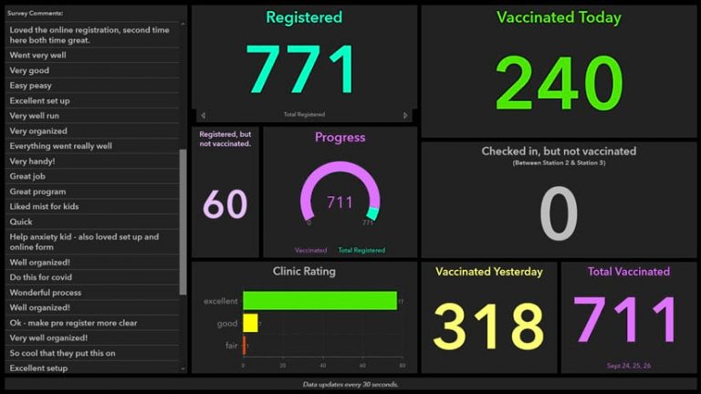
This one is interesting. The GIS Department for Carlton County, Minnesota, used ArcGIS Survey123, ArcGIS Hub, and ArcGIS Dashboards to help administer a drive-through flu vaccine clinic. Online forms created with ArcGIS technology made registration for the clinic safer, faster, and easier for the public. Dashboards provided real-time statistics, enabling county officials to quickly analyze how many people were being vaccinated. Click below to read the article.