Interesting article about the resurgence of jigsaw puzzles and how puzzles from centuries ago were mostly made out of maps. You can even try digital map puzzles online! Check it out.
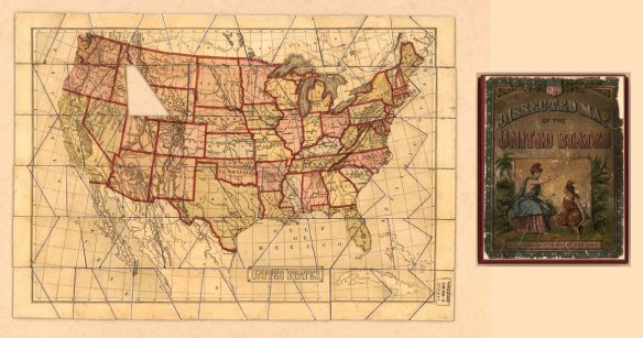
Interesting article about the resurgence of jigsaw puzzles and how puzzles from centuries ago were mostly made out of maps. You can even try digital map puzzles online! Check it out.
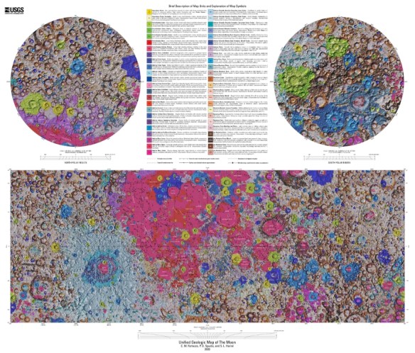
The USGS has released the first unified geologic map of the moon. This new work represents a seamless, globally consistent, 1:5,000,000-scale geologic map derived from the six digitally renovated geologic maps. The goal of this project was to create a digital resource for science research and analysis, future geologic mapping efforts, be it local-, regional-, or global-scale products, and as a resource for the educators and the public interested in lunar geology. Click below to check it out!
What role do postal carriers play in census preparations? What new response category will be featured on this year’s census form? Test your Census expertise on these questions and more with the Pew Research Center’s U.S. Census Knowledge Quiz. The 12-question quiz covers the history, purpose, and changes to the U.S. Census and provides test-takers with answers and explanations immediately following their attempt.
Readers who are displeased with their results may want to sign up for the Pew Research Center’s “short email mini course” on the U.S. Census (accessible by clicking the linked text “email mini-course”). This free course is divided into five sections including “What is the census and why is it taken?” and “What is new and possibly challenging about the 2020 census?” Enrolled users will receive “an email with a lesson every few days,” allowing for a manageable way to better understand why this data collection process is so important.
If you are stuck at home with kids right now, a great teaching tool too! Check it out by clicking here.
Also check out the Census Historical Timeline. AND check out the 1940 Census website. You can search for images of the pages people signed. I was able to find my Grandparents who also listed my father and his sister when they were children, pretty cool!
From XKCD.com:

The GIS Certification Institute is hosting a Map Contest. Submissions are open through the end of March 2020. First prize is $250. For more info click here.
Check out this 1947 film about map projections. Film Description: “Development in long-range travel and the growing importance of the Arctic and Antarctic regions make it necessary to understand how maps may be misleading. Experiments with a grapefruit illustrate the difficulty of presenting a true picture of the world on a flat surface and it is concluded that the globe is the most accurate way of representing the earth.” — National Film Board of Canada
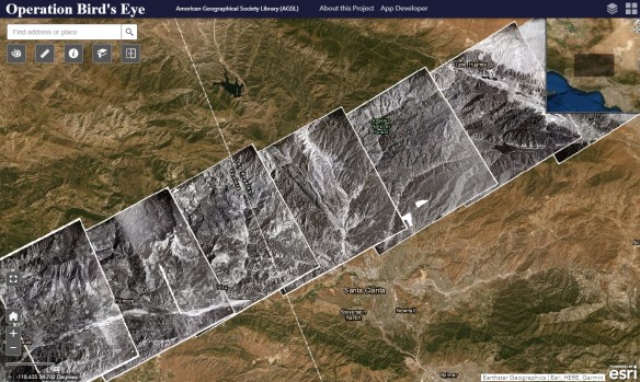
Operation Bird’s Eye is a photographic collection of nearly 400 overlapping aerial images which form a continuous strip spanning the United States from coast to coast. Beginning in Ventura, California and ending over Long Island, New York, these nine by nine inch prints capture a sliver of the American landscape as it looked in 1948. The images were captured during one continuous flight, and when joined together the physical prints stretch 192 feet, showing a slice of land 2,700 miles long.
The flight from which these images were captured took off from the Air Force Flight Test Center (now Edwards Air Force Base) in Muroc, California at 7:40 AM local time on September 1, 1948, first gaining altitude out over the Pacific Ocean before turning east. The plane was a Republic XR-12, an experimental aircraft of which only two were ever built. It was outfitted with K-17 cameras able to shoot a continuous roll of film up to 200 frames. The camera shot at 50 second intervals throughout the duration of the flight, at a constant altitude of 40,000 feet, resulting in a field of vision of around 130 square miles.
The purpose of the XR-12 was photo reconnaissance, and Operation Bird’s Eye was meant as a demonstration of its capabilities. The plane, able to fly high and fast enough to avoid conventional enemy aircraft and fighters, was essentially a flying photography laboratory, with the crew able to process film mid-flight. The Operation Bird’s Eye flight broke records as it crossed the continent, capturing the longest span of aerial photos ever accumulated in a single trip to that point. After 6 hours and 55 minutes, the crew landed at Mitchel Field in Garden City, New York on Long Island.
Click below to read more and check out the images!
Over eighty years after it was originally published, Charles O. Paullin’s Atlas of the Historical Geography of the United States remains one of the most impressive and most useful atlases of American history. Containing nearly 700 individual maps spread across 166 plates, it addresses a broad range of issues. Beginning with a chapter consisting of 33 maps on the natural environment and a second containing 47 maps documenting the evolution of European and later American cartographic knowledge about North America, the atlas mapped an exhaustive number of historical topics: exploration and settlement of the continent, the location of colleges and churches, disputes over international and state boundaries, voting in presidential elections and in Congress, reforms from women’s suffrage to workmen’s compensation, transportation, industries, agriculture, commerce, the distribution of wealth, and military history. Continue reading
Wishing everyone a very Merry Christmas and a Happy New Year. Enjoy this year’s Christmas Card Map! -mike

If you are looking for last minute gifts for that mapper type, check out National Geographic’s site!
As Christmas rapidly approaches … only 7 more shopping days … check out this map by General Mills showing the most popular holiday cookies by state. You can also get the recipes to make them!