Though just a map of the United States, you can click on a month, then a state to see what ingredients (fruits and vegetables) are in season for that state. They also have links for the ingredient description and buying guide.
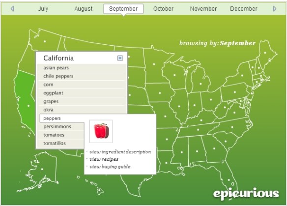
Though just a map of the United States, you can click on a month, then a state to see what ingredients (fruits and vegetables) are in season for that state. They also have links for the ingredient description and buying guide.
Are you ready for beer? Fall means Oktoberfest celebrations around the globe, and ESRI has created the Oktoberfest Score app that ranks your community against others in the US. The app uses demographic, consumer spending, and market potential data and lets you explore beer consumption in your area and discover other communities with similar tastes. Prost!

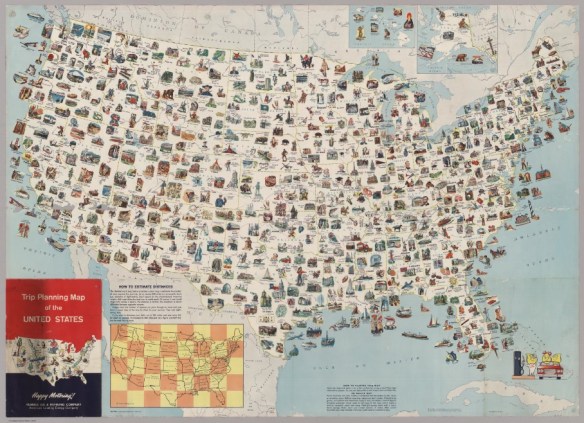
Ready for an epic road trip? Visit every place on this 1962 trip planning map. This map has it all. Originally produced by General Drafting Company, it was one of many produced for oil and gas companies that either freely distributed or sold maps at their service stations.
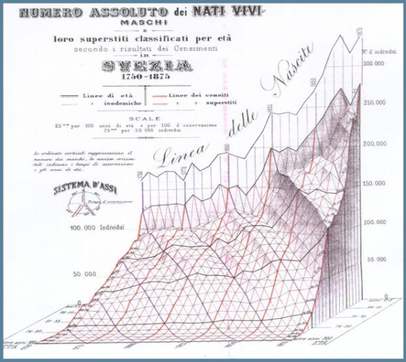
The first world map created by Anaximander. The Catalan atlas commissioned by King Charles V of France. Dr. John Snow’s map of cholera deaths in London. Check out these early data visualizations and see how they developed over time without computers.
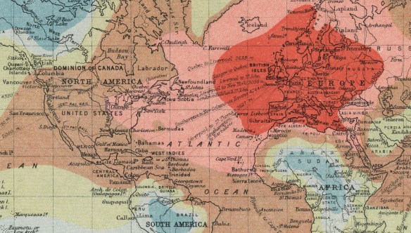
Travel in the slower days of 1906! Here is an interesting map using “isochronic” lines, specifically lines depicting points which may be reached in the same number of hours or days from London in 1906. Need to go to New York? That will be about 8 days of travel. San Francisco? That will be about 15 days. Santiago, Chile? You are looking at over 40 days of travel.
xx
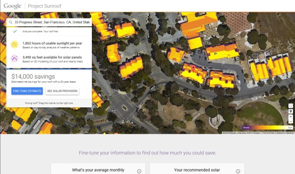
Looks like Google is starting to calculate solar information on their building data. They started Project Sunroof to make installing solar panels easy and understandable for anyone by calculating the best solar plan.
Does that sound familiar? It should since LA County has done that already with their Solar Map.
When you enter an address, Project Sunroof looks up the address in Google Maps and combines the map data with other databases to create a personalized roof analysis. They compute how much sunlight hits your roof using their 3D building models, shadows cast by nearby structures and trees, sun positions over the year, and historical cloud and temp patterns. They then recommend an installation size for your roof and reference local solar providers.
Currently Project Sunroof only covers Boston where the Sunroof Team is, the San Francisco Bay area where Google is, and Fresno … where one of the engineer’s mom lives.
Once they figure out the LA area, it will be interesting to compare it to LA County’s Solar Map information.
Take a look at the short video and visit the Project Sunroof website for more info.
The Soviet Military secretly mapped the entire world, but few outsiders have seen the maps … until now. Check out this article from Wired Magazine about the secret world of Russia’s cold war mapmakers.

Thanks goes to Barry Waite from the City of Carson for sending us this link.
If you are looking for images of old maps, OldMapsOnline.org is the resource for you. It is the world’s largest portal for freely available, high-resolution images of historic maps, bringing together many of the world’s largest online historic map collections in a single search interface. Check it out.

This year in July will be Disneyland’s 60th anniversary. Disneyland opened on July 17, 1955 in Anaheim California and was the only theme park designed and built under the direction of Walt Disney.
Opening day was broadcast live by ABC (one of the investors and joint owner of Disneyland) and was hosted by three of Walt’s friends: Art Linkletter, Bob Commings, and Ronald Reagan. About 28,000 people visited the park. Watch the whole thing below!
Believe it or not, Disneyland was built in 7 months before opening day! Also, Tomorrowland construction was delayed and was put together in the last 2 months! Before building began, Walt Disney was insightful to place towers around the area to film time-lapse movies during the construction. Check out this video of one of the film reels. It is really cool to see what that area of Anaheim looked like before Disneyland was built.
When guests entered the park, they were given little guides that told them about all the attractions at Disneyland. Check out this 1958 guide and maps.
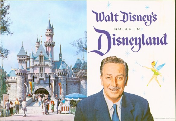
I like in the Tomorrowland section there is a caption that reads “The colorful Avenue of Flags marks the entrance to Tomorrowland, the world of 1987”. I don’t remember 1987 looking like that!
Note no Monorail, Matterhorn, or Submarine Voyage. Those came in the summer of 1959. Check out this insert that was placed in the guides.

If you plan on visiting Disneyland tomorrow on anniversary day … all I can say is good luck to you and stay sane!
Check out this map showing the best-selling vehicles in each state for 2014. Besides the brand, states are color coded for the popular models. Click below to read the short article.


