For the past several centuries, cartographers have tried to find different ways to portray the globe on a two-dimensional map. Many of these attempts, including the Mercator projection, distort the true size of different countries and regions. As a result, many of us have false perceptions about the proportional size of different geographical areas.
Category Archives: Fun Stuff
Persuasive Cartography
Looking for unusual maps? Check out this website that makes available to the public a collection of more than 800 examples of persuasive cartography, maps intended primarily to influence opinions or beliefs – to send a message – rather than to communicate geographic information. You can search for maps by subject and there are also links to download the high resolution image of each map.
Geography of the Post Office
During the second half of the nineteenth century, the introduction of the post office changed daily life in the Western United States. Over the course of 50 years, the number of post offices in this region expanded from just a handful to several hundred. Some post offices were established and stayed in operation long term; others had much shorter life spans as the west continued to change.
Tax Fun Facts!
Ah yes, taxes are due today! And here are a few interesting sites you might want to visit.
Why are taxes due today, April 18th?
Basically because the 15th fell on a Saturday and Monday was Emancipation Day in Washington DC. Read more about it here.
Tax Freedom Day
Tax Freedom Day is a significant date for taxpayers because it represents how long Americans as a whole have to work in order to pay the nation’s tax burden. Basically you are working for the government! Continue reading
Flex Projector
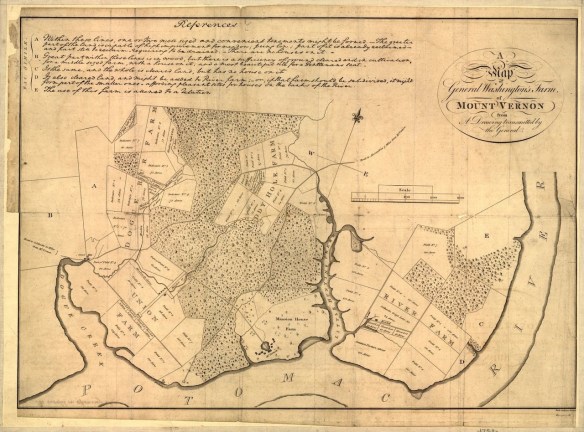
George Washington the Cartographer
Valentine’s Day Maps & Charts
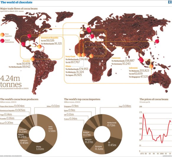
Thanks goes to LA County GIS for finding this one. Here are the top 14 maps and charts that explain Valentine’s Day.
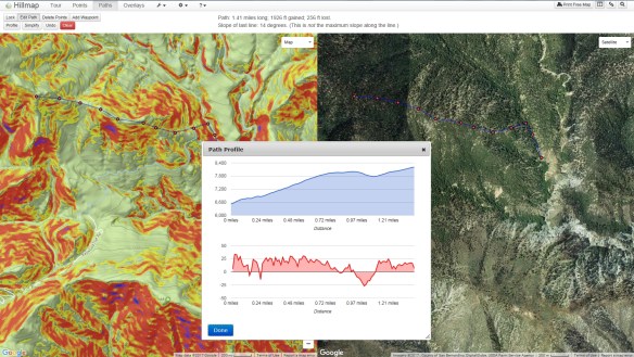
Hillmap for Backcountry Travelers
Hillmap is a web based mapping app that lets you create and print free, customizable maps from high quality map layers. You can also use Hillmap tools to calculate slope and distance, check the weather at your destination, analyze snowpack, and more.
This app is definitely handy to calculate your hiking route and check on the slope. You can also turn on multiple overlays, like slope, weather radar, and other map information. Give it a spin!
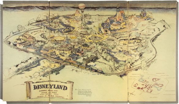
The Maps We Wandered Into As Kids
California As An Island Map Exhibit
Throughout the 17th and 18th centuries, many believed California was a remote island with plenty of gold, free-loving amazons, and strange beasts.
A new exhibit at Cal State Fullerton’s Pollak Library features a selection of maps from the Roy V. Boswell Collection for the History of Cartography, one of the University’s special collections. The exhibit, “California As an Island and Worlds That Never Were,” will be on display Jan. 22 to March 29 in the Salz-Pollak Atrium Gallery.