Scholarship for Community College Students in Geography

If you are a community college student in Geography that plans on transferring to California State University Northridge (or you just did), here’s a deal you should not pass up.  The Tamborro Scholarship pays all normal university fees to fulltime undergraduate geography majors who will or already have transferred to CSUN from a community college!  What a deal!

Continue reading →

CSULB Masters of Science in GIS

Dear GIS Community:

We are currently accepting applications to the Masters of Science in Geographic information Science (MSGISci) at California State University, Long Beach (CSULB). The MSGISci is a 1-year, 30-unit MS degree program. Classes are offered on weeknights and weekends to accommodate working professionals.

Please encourage potential applicants to visit www.beachgis.com for more details. 

Review of applications begins April 1, 2017 (note the upcoming FAFSA application deadlines (fafsa.ed.gov/deadlines.htm; March 2nd for CA residents).

Thank you in advance.

Sincerely,

Suzanne

_________________________________
Suzanne P. Wechsler, Ph.D.
Associate Professor
Department of Geography
California State University Long Beach (CSULB)
Director, Master of Science in Geographic Information Science (MSGISci)
www.beachgis.com


College of the Canyons GIS

Are you looking to learn more about GIS than just how to push buttons in the software?  Want to build a GIS skill set that will set you apart from others?  Desiring to be exposed to the practical and real world use of GIS?  Then come join me at College of the Canyons and sign up for GIS 101, Introduction to Geographic Information Systems.  The class will be challenging and rewarding!  Also, your earned units are UC/CSU transferrable.

Registration for the Spring semester has started, so make sure to register early.  The GIS class will meet at the Valencia campus every Wednesday from 6:30pm to 9:35pm, February 8 to May 31.  The textbooks for the course can be found here.

Feel free to contact me, Michael Carson (michael.carson@canyons.edu), if you have any questions.

Rio Hondo College GIS

Start off the new year right and take a GIS class or two at Rio Hondo College.  Courses start the week of January 30th.  Apply for admission and register for classes entirely online. Available courses include two Introduction to GIS (GIS 120) courses including one located off site at the LA County Department of Public Works (900 S Fremont Ave, Alhambra), also offered is Cartography (GIS 221), Crime Mapping (GIS 281) and Intermediate GIS (GIS 281).

To register for classes, you must first apply for admission (entirely free online). Directions for applying for admission and registering for the classes can be found at http://riohondo.isteaching.com/spring-semester-2017.html  For additional information, contact Prof. Warren Roberts wroberts@riohondo.edu (P.S. Did you know select Rio Hondo GIS courses are transferable courses to CSU and other universities?)

New Maps Plus Program

Thinking about developing your skills in digital mapping?  Then check out University of Kentucky’s New Maps Plus program.

New Maps Plus is a completely online program consisting of three courses (MAP671, MAP672, and MAP673) that focus on online and open source mapping solutions (like QGIS), JavaScript programming, and cartographic design for the web.  Students completing the program will earn a Graduate Certificate in Digital Mapping from the UK Geography Department and the College of Arts & Sciences.  The courses are taught during 10-week terms that are offered four times a year (see schedule).  The next term will be starting January 23rd, with an application deadline of January 8th.

The 2016-17 academic year cost per credit hour is $639.50, plus a $10 per credit hour distance learning fee. Thus the MAP 671 course (3 credits) costs $1948.50 and the MAP 672/673 courses (4 credits) cost $2598 each.

Check it out by clicking below:

newmapsplus

ArcGIS User Seminar

ESRI will be holding ArcGIS User Seminars where you will learn how to be more effective with ArcGIS and get a close look at what’s new in version 10.5.  You’ll return to the office with practical tips and skills to use right away, including:

  • Collect authoritative data faster
  • Use and pair ArcGIS apps
  • Communicate with spatial analysis
  • Develop and share insights from your data
  • Improve collaboration

Register today to save your seat for the ArcGIS User Seminar.

Free GPO Webinars

Check out these free, educational webinars from the U.S. Government Publishing Office (GPO), taking place this November.

Beyond Google – Another Look at Finding Government Information, November 9, 2:00 p.m. – 3:00 p.m. (Eastern): https://www.fdlp.gov/about-the-fdlp/fdlp-events-calendar/event/220-beyond-google-another-look-at-finding-government-information

OSHA’s Web Pages: A Wealth of Occupational Safety Information, November 10, 2:00 p.m. – 3:00 p.m. (Eastern): https://www.fdlp.gov/about-the-fdlp/fdlp-events-calendar/event/223-osha-s-web-pages-a-wealth-of-occupational-safety-information

Measuring America Series: Accessing International Data, November 16, 2:00 p.m. – 3:00 p.m. (Eastern): https://www.fdlp.gov/about-the-fdlp/fdlp-events-calendar/event/221-measuring-america-series-accessing-international-data

U.S. Naval War College Information Resources: Maritime, Naval History, Geopolitical, and Educational Treasures, November 17, 2:00 p.m. – 3:00 p.m. (Eastern): https://www.fdlp.gov/about-the-fdlp/fdlp-events-calendar/event/222-u-s-naval-war-college-information-resources-maritime-naval-history-geopolitical-and-educational-treasures

Science Soup: Mix Your Way through the Ingredients of Some Major Science Databases: Science.gov, PubMed, and WorldWideScience, November 29, 2:00 p.m. – 3:00 p.m. (Eastern): https://www.fdlp.gov/about-the-fdlp/fdlp-events-calendar/event/226-science-soup-mix-your-way-through-the-ingredients-of-some-major-science-databases-scitence-gov-pubmed-and-worldwidescience

Using the BEA Interactive Data Tool to get Local Data, November 30, 2:00 p.m. – 3:00 p.m. (Eastern): https://www.fdlp.gov/about-the-fdlp/fdlp-events-calendar/event/224-using-the-bea-interactive-data-tool-to-get-local-data

Presenters from GPO, other Federal Government agencies, and from Federal depository libraries across the Nation will present on topics related to Federal Government information and the Federal Depository Library Program. All sessions are presented virtually through GPO’s FDLP Academy: https://www.fdlp.gov/about-the-fdlp/fdlp-academy.

Attendees will receive a Certificate of Participation from GPO for each webinar they attend. Closed captioning is available for all webinars. Registrants will be sent access information upon registering. View their complete archive of recorded webinars and webcasts at http://login.icohere.com/public/topics.cfm?cseq=1172.

Test Drive ArcGIS Online’s Analysis Tools

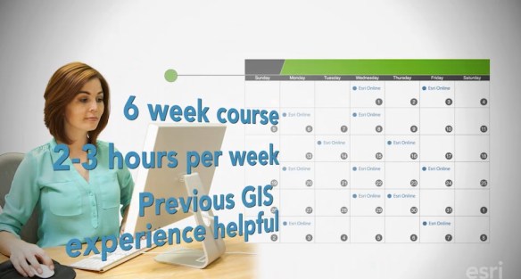
This course is for people who know something about spatial analysis and want to learn what ArcGIS Online has to offer. You’ll get free access to the full analytical capabilities of ArcGIS Online during the course. Course at a glance:

  • Hands-on exercises, short video lectures, quizzes, case studies, and discussion
  • Six weeks, two to three hours of study per week
  • Certificate of completion and awards
  • Course dates: November 9 – December 20, 2016

esrispatialcourse

Map Use: Reading, Analysis, Interpretation

Very soon ESRI Press will be releasing the 8th edition of “Map Use: Reading, Analysis, Interpretation”.  The e-book will be available September 19th and the print book on November 7th.

Map Use is a comprehensive, foundational textbook, providing students with the knowledge and skills to read and understand maps, and offers professional cartographers a thorough reference resource.  Continue reading →