If you missed the 2022 ESRI Developer Summit back in March, check out this recap posting. It includes videos about the new animated flow renderer, ArcGIS Maps SDK for game engines, knowledge graphs in ArcGIS Pro, using CAD and BIM in ArcGIS, automating deployments, spatial statistics, and other topics.
In collaboration with the US Department of Labor, the National Geospatial Technology Center is updating the Geospatial Technology Competency Model (GTCM) and is seeking input. Your input is hugely valuable in helping to define which professional and technical competencies are crucial to a successful GIS employee. For more information, click here.
The US Census Bureau has a new data tool, called My Community Explorer, that allows users to view the demographics of their individual communities. The interactive dashboard offers profiles of all US counties based on the data collected from the census survey. Beginning with a state, users can filter by demographic data including race and ethnic makeup, income and economic statistics, and industry and business profiles. Check it out!
CGIA has openings for its Board of Directors and for the Board Officer – Vice Chair position. These are important roles and leadership opportunities for the California GIS community of practice. They are two-year positions and the term of service will begin in July 2022. Self nominations are welcome. Nominations are due no later than close of business May 20, 2022.
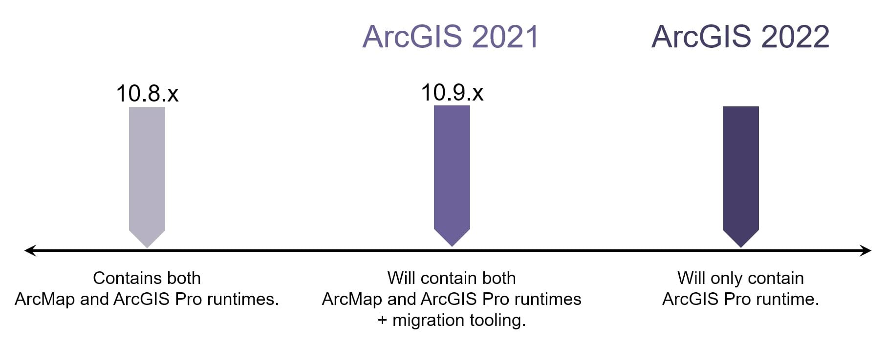
ArcGIS Enterprise 10.9.1, part of the ArcGIS 2021 releases, will be the last release to support the publishing and consumption of services from ArcMap.
If you are an ArcGIS Enterprise administrator, click below to read more. The article was published last year.
2022 Spring Technical Session Hosted by Pacific Southwest Region ASPRS. May 18, 2022 at 6pm in Concord, CA.
Please join colleagues, students and peers in the Remote Sensing profession for an evening of insightful presentations, thoughtful discussion and snacks!
Featured presentations include “Airborne Thermography for Bridge Decks”, “Statewide Ground Surface Subsidence: Precise Measurement via Remote Sensing Survey – 2015 through 2024”, and “Mapping Accuracy Assessment of UAS Platforms”.
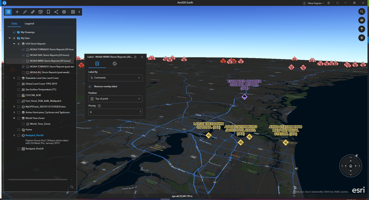
The new on-screen navigationcontroller offers a more flexible navigation of the globe by adding zoom functionality, viewport navigation, vantage point, and orientation control into a sleek and user-friendly on-screen component. It’s also great for navigating on laptops without a mouse!
Vector tile layers have been a highly requested and long-awaited addition to ArcGIS Earth—now you can add vector tile layers to the My Data or Startup layer folders or set them as the basemap, depending on the data and what suits your workflow.
With the new 3D labeling capability in ArcGIS Earth, you can customize the style and visualization of 3D labels on the fly and set the label position and style in a 3D global view.
Click below to read the latest on new features and functionality including KML, multi-selection and batch editing, and attribute tables.
Love maps and want to save California’s wild spaces? This site is for you!
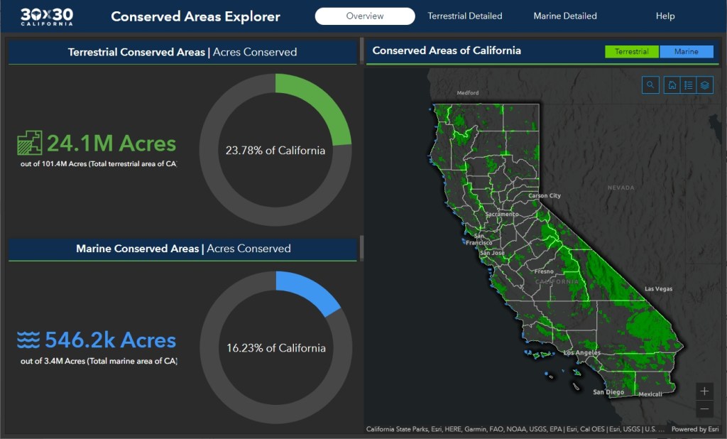
California is making plans to protect 30% of its lands and coastal waters by 2030 (called 30×30). And with it is a new mapping tool to support their “30×30″ goal.
The CA Nature website allows you to explore the landscape and consider which areas you might want to see protected in the future. The site’s “conserved areas explorer” shows the 24.1 million acres that are already conserved, many of them as parks, forests, and preserves. Other interactive maps show which lands and waters offer the greatest biodiversity, and how rising temperatures and changing rainfall patterns are expected to alter the state’s landscapes. Check it out!
Usually April 15th is when our taxes are due, but not this year. Due to a holiday in Washington DC today, Emancipation Day, our taxes will be due on Monday the 18th.
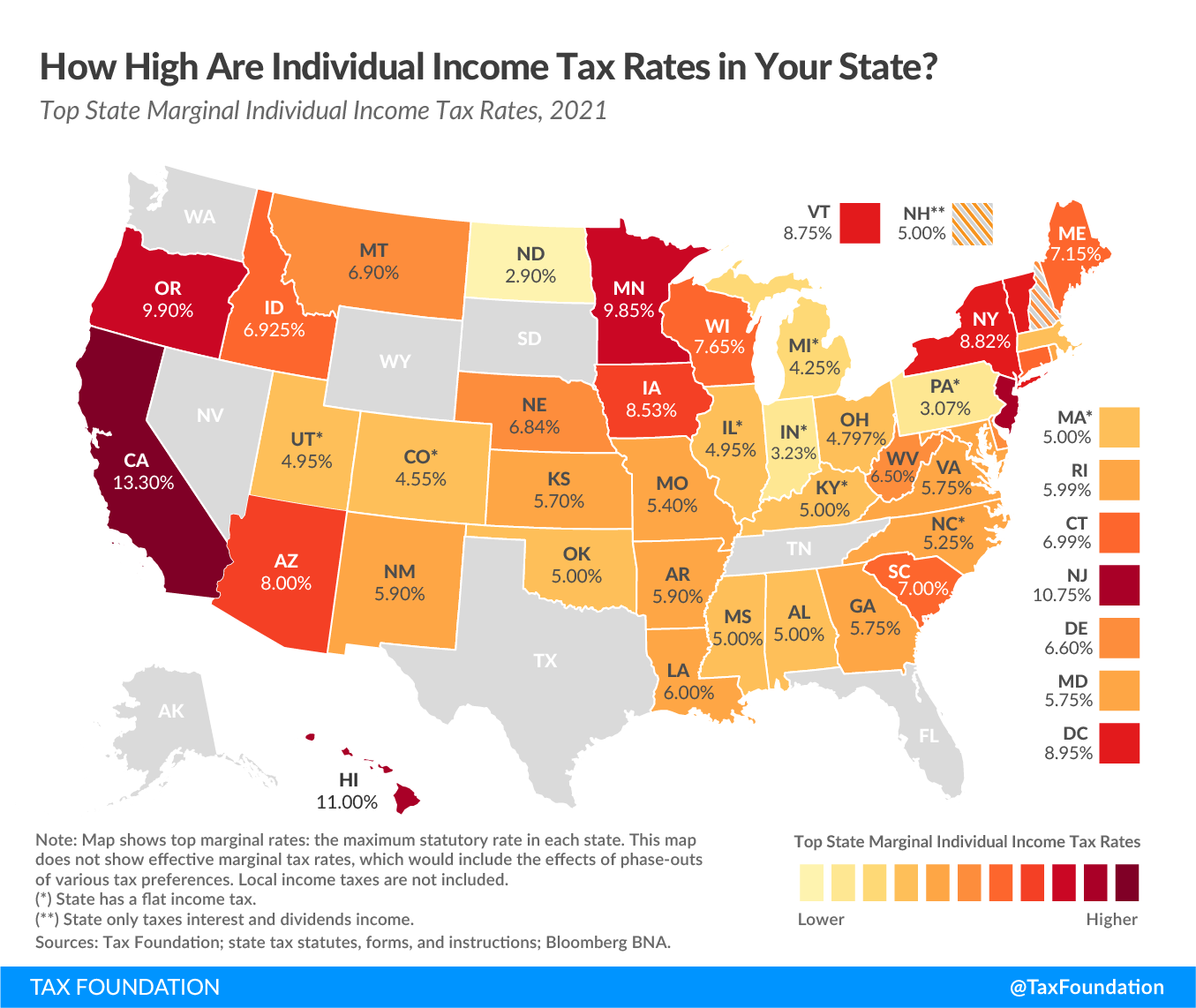
Which brings up a question, which states pay the highest tax rates? Check out the map below:
Unfortunately California is the highest … probably not a good idea to retire in California! Note that Tennessee has joined seven other states that do not levy any individual income tax. Also note there are 10 states that have flat income tax. Click here for more info.