During the Great Depression, President Franklin D. Roosevelt promised the American people a “New Deal”. From 1933 to 1943 a constellation of federally sponsored programs put millions of jobless Americans back to work and helped revive the economy. The result was a rich landscape of public works projects across the nation. No city , town, or rural area was untouched. Hundreds of thousands of roads, schools, theaters, libraries, hospitals, post offices, courthouses, airports, parks, forests, gardens, and artworks – created in only one decade by our parents and grandparents – are still in use today!
Category Archives: Maps/Apps/Charts/Data
Out With the Old, In With the New National Map Viewer
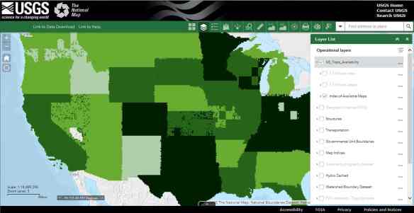
At the end of September 2017, the USGS discontinued service to the previous versions of the National Map viewer application. This was done to move toward frameworks that support HTML5 web environments, improve mobile access, add GIS capabilities, and minimize having to maintain custom viewer code.
The National Map Advanced Viewer application is now an ArcGIS Online viewer for public use. It was built using ArcGIS Online Web AppBuilder. Click below and give it a spin!
The help doc for the new viewer can be found here.
Note that the USGS already has a separate application focused on data download and that download functionality is not part of the new viewer application at this time.
Geo4LibCamp 2018
If you are a librarian or someone that deals with a geospatial data repository, this might be for you.
Geo4LibCamp is a hands-on “unconference” meeting to share best-practices, solve common problems, and address technical issues with integrating geospatial data into a repository and associated services. The main event will be held at Stanford University on January 29-31, 2018 (Monday, Tuesday, and Wednesday), with optional working sessions on February 1-2 (Thursday and Friday).
Historical Urban Bike Maps
Carpet Maps and Abyss Tables
Ah yes, I was at Costco this weekend and Christmas decorations are out … as well as Halloween and Thanksgiving! Insane right? What alternate universe am I in?
Anyway, checking the Christmas Clock, there are only 97 days left until Christmas! You better hurry and buy that perfect gift!
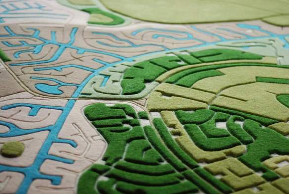
Here is one: Land Carpet Map Rugs! Yes, get that map in carpet form so your loved one can walk all over it.
New ArcGIS Pro Style Files
ESRI has released three new ArcGIS Pro styles for Emergency Management, Local Government, and State Government industries for version 2.0. For example, the Local Government style contains symbols for election polling places, real estate transactions, community events, parks, damage assessment, right of way assets, non-emergency problem reports, catch basins, and fire hydrants.
Visit the ArcGIS Blog post for more info.
Creating Bilingual Apps
2017 ArcGIS User Seminar
Missed the 2017 ArcGIS User Seminar? Did you know there was one? I actually forgot about it myself. However, ESRI kindly sent me an email to remind me I missed it and had a link to the videos. The seminar covers ArcGIS Pro, Insights for ArcGIS, ArcGIS apps, and much more, to help you get the most out of ArcGIS. Check it out.
ArcGIS API for Python
ArcGIS API for Python provides GIS users with a Python API for their Web GIS (Online, Portal, or Enterprise in the cloud). It provides simple and efficient tools for GIS users sophisticated vector and raster analysis, geocoding, map making, routing and directions, as well as for organizing and managing a GIS with users, groups and information items.
In addition to working with your own data, the library enables access to ready to use maps and curated geographic data from Esri and other authoritative sources. It also integrates well with the scientific Python ecosystem and includes rich support for Pandas and Jupyter notebook. Continue reading