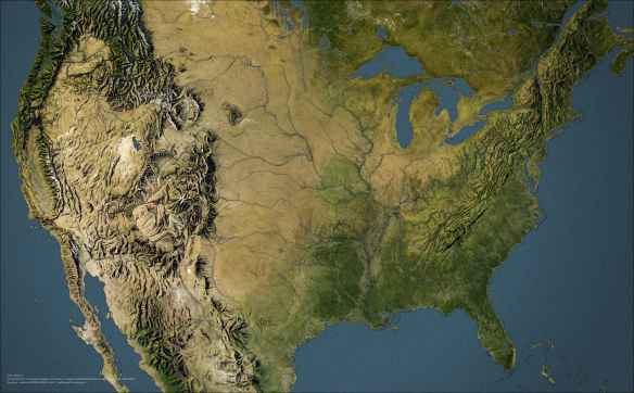
Here is an interesting article on how one can take vintage hand painted hillshade and incorporate it into current imagery in GIS. Click below and read on!
Category Archives: Maps/Apps/Charts/Data
Instructional Story Maps
Maps can be beautiful, engaging, and informative ways to learn or educate about a topic, and story maps offer a way to add multimedia and narrative to the mix as well. But for the uninitiated, the prospect of creating a high-quality digital map may be daunting. Fortunately, ESRI has created a free resource to help … Instructional Story Maps. Here you will find approximately 20 story maps, each focused on a different cartographic concept or technique. Examples include tutorials on creating visuals such as glowing borders or sunrise effects, an explainer on making heat maps to communicate density, as well as a series of tutorials featuring ESRI’s Cascade story map template and a series focused on the platform’s smart mapping features. Check it out!
ArcGIS Online March 2019 Release
ESRI just updated ArcGIS Online. Click here to get the scoop on all the new features.
Plant Hardiness Zone Map
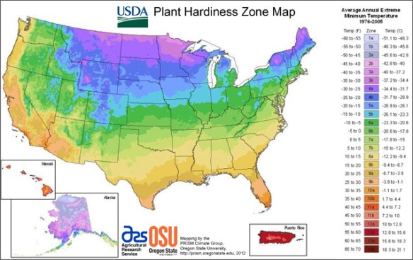
Some of you might be familiar with USDA’s Plant Hardiness Zone Map. It is the standard by which gardeners and growers can determine which plants are most likely to thrive at a location. The map is based on the average annual minimum winter temperature, divided into 10-degree zones. Besides the static map, there is also an interactive GIS map. You can also enter a zip code and find your hardiness zone. Check it out!
How Animals Interact With Cities
Top Searched Trader Joe’s Items
Finally, a Trader Joe’s map of food items! This map shows the most popular item that was searched for on Google by state. The winner? 13 states favored Sweet Chili Sauce. California was the only state that favored Unexpected Cheddar. Click below to read on!
This map is even more interesting because I could not find any Trader Joe’s locations in Montana, Wyoming, North Dakota, South Dakota, Mississippi, Arkansas, West Virginia, Hawaii, and Alaska using the Trader Joe’s location tool. I guess people are buying on Amazon and Ebay?
Why Paper Maps Are Still Needed
Internet Bird Collection
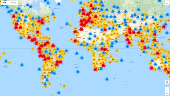
If you like birds, the Internet Bird Collection (IBC) is an excellent place to spend some time. The IBC is an online audiovisual library of videos, photos, and sound recordings of the world’s birds created with the ultimate goal of disseminating knowledge about the world’s avifauna. You can explore multimedia materials and recordings of thousands of bird species crowdsourced by birdwatchers around the world, with their species identifications cross-checked by trained ornithologists. This vast collection can be searched and filtered by family name (common or scientific), country, keyword, date, and more, and each media entry includes a location map and shows other media recorded nearby. Those interested can create a free account and contribute their own bird photos, videos, and sound recordings. Check it out!
Atlas of Endangered Alphabets
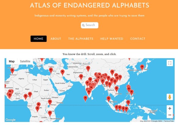
The Atlas of Endangered Alphabets is a fascinating project that anyone curious about written languages can enjoy and learn from. Visitors to the atlas can browse dozens of writing systems by their place of origin via the interactive map. While many of the languages represented in the atlas are spoken today, their written forms may have declined in use or have only recently been developed. Each language has its own page with images, profile, and links to additional resources. Check it out!
Valentine’s Day Map 2019
For Valentine’s Day this year, enjoy this old world map in a double cordiform map projection. Published by Antonio Lafreri, c. 1564.