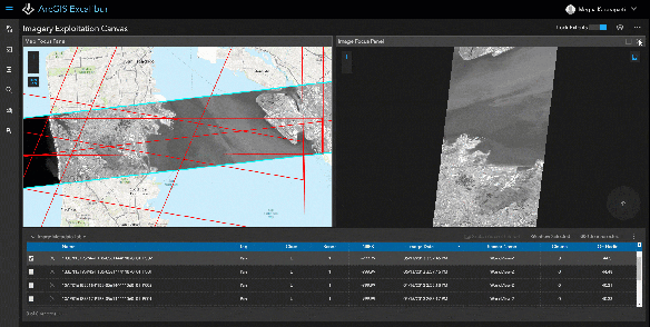
Ever heard of ArcGIS Excalibur? I have not. Apparently it is a new web-based application that allows you to work with imagery layers in your web GIS, providing you tools and capabilities for streamlining image and geospatial analysis. It is a premium web application available as part of ArcGIS Enterprise 10.7.
Powered by Image Server, you can perform on-the-fly processing and dynamic enhancements through raster functions. The initial release will enable you to easily:
- Perform image interpretation and exploitation including dynamic image manipulation, enhancements and measurements.
- Work with orthorectified and oblique imagery side-by-side, which includes display of your GIS features providing context and increased value when working with your imagery layers.
- Enable feature creation and editing capabilities when working with imagery to facilitate effective image interpretation workflows like collecting and recording observations from imagery.
Click below for more info on ArcGIS Excalibur.