Check out this map showing the autocomplete predictions of a “cost search” for each state’s capital. The search phase was “how much does a * cost in …”. Some of the autocomplete predictions were rather … well, you will see!

Check out this map showing the autocomplete predictions of a “cost search” for each state’s capital. The search phase was “how much does a * cost in …”. Some of the autocomplete predictions were rather … well, you will see!
Back in 1913, the National Highway Association drew up the first proposed highway plan. Their campaign stressed that good roads lead to things like good schools, good health, good morals, good times, etc. Check out the article and maps leading up to the nation’s first nationwide system of numbered highways adopted in November 1926.

Check out this story about how a previously unknown map collection of a hospital dietician ended up doubling the size of the Los Angeles Public Library’s map archives in one single day!

Interested in map history? Doing a research projected in map history or cartography? You might want to check out The International Directory of Researchers in Map History.
The purpose of the directory is to promote communication among researchers who study the history of maps and to provide information about the field to the public. The directory is an open source for contact information, current interests, research projects, and publications related to map history. Check it out.
Looking to buy a home? Or should you just rent? Here is a neat little map app from LA Times showing where you can afford to live. You enter your household income, percent of income you want to dedicate to housing, a down payment you can afford to place on a house if you were buying, and the length of mortgage in years. Once calculated, a nice map is displayed showing how much you are willing to spend on housing and the areas that are cheaper to own, cheaper to rent, or difficult to afford. Areas are divided by zip codes. Hover over an area to get median home prices, monthly home costs, and median rent.

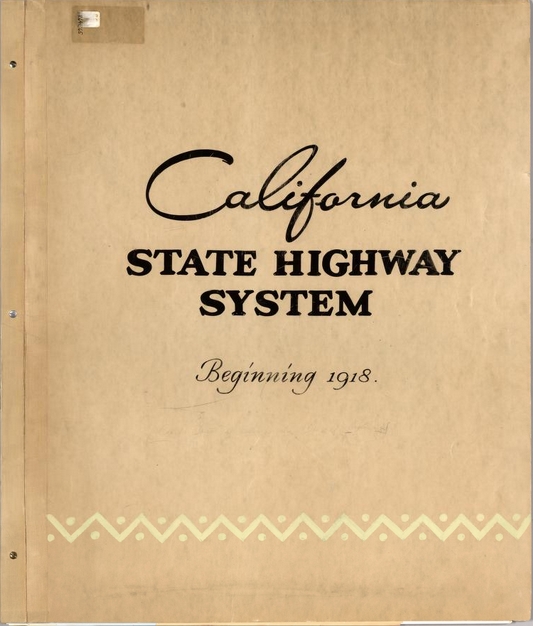
Check out this historical atlas of the California State Highway System. The atlas has a reversed chronological assembly of official California highway maps from 1990 back to 1918. The maps are bound together with a custom cover and include regional enlargements, illustrations, descriptive text, route descriptions, and construction and funding status. Download the maps in their high resolution glory!
Looks like ESRI is running a little contest on their GeoNet site. You earn points by completing “missions”, like answering questions, getting replies marked as helpful, and contributing content. First place grand prize is a MVP GeoNet Badge, Certificate of Achievement, choice of either ESRI UC Conference registration or Dev Summit Conference registration, and a choice between an Apple iPad or Microsoft Surface Tablet. There are also second and third place prizes as well.
Though I think this is ESRI’s way to get more people to participate on GeoNet, you cannot pass up that free conference pass and iPad! Good luck!
Check this map out showing how much snow it takes to cancel school by state. Click it to read the article about how it was created.
/cdn0.vox-cdn.com/uploads/chorus_asset/file/3341866/1086833227377542722.0.png)
Into a little history in LA County? I found this interesting map showing historic sites, old highways, battle fields, indian villages, gold mines, camps, towns, and other historical places of interest in old Los Angeles County. The map was created by George W. Kirkman and titled “The Kirkman-Harriman Pictorial and Historical Map of Los Angeles County 1860-1937”. Check it out on the LA Public Library website!

Just found this one on the XKCD site. Pretty funny.

I don’t think I would live so close to that volcano!
