I had to throw this one on here. Check out the James Bond Travel Map!


I had to throw this one on here. Check out the James Bond Travel Map!
After you view the Halloween Candy Map, check out this one showing the craziest urban legends from each state!

Interesting map showing each state’s favorite Halloween candy. The online survey was conducted in September with a total of 42,238 users. The candy that polled the highest was Reese’s Peanut Butter Cup.

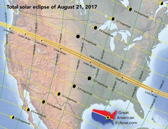
On August 21, 2017, the continental United States will experience a rare total solar eclipse that sweeps the nation from Oregon to South Carolina. Taking 94 minutes for the Moon’s shadow to race across the country, the duration of the total solar eclipse can last from 2 minutes near Depoe Bay, Oregon, to 2 minutes 41 seconds (the max) near Carbondale, Illinois, and 2 minutes 30 seconds near Awendaw, South Carolina. This will not happen again in the US until 2023 for an annular eclipse and 2024 for a total eclipse.
To help you plan your trip, take a look at these many maps including a 10 foot long strip map of the eclipse path. For more info, click below.
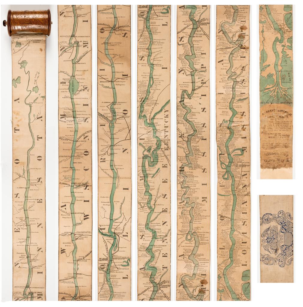
I have always liked strip maps. They go from one point to the other, maybe traversing a very long distance. The paper map can be very long and show a lot of stuff along the way. It’s like going on a trip without leaving your chair.
Here is an interesting 1866 strip map of the Mississippi River, allowing you to see the Father of Waters all at once. It was made for the steamboat traveler at the time and rolled up into a spool. Check it out and the history behind it.
If you are interested in illustrated conceptual maps, want to learn more about creative cartography, or want to see examples from illustrators around the world, The Art of Illustrated Maps by John Roman might be interesting to you. This is the first book ever to fully explore the fascinating world of illustrated conceptual maps. Check it out!

Happy Columbus Day to you, and a map too!

You also might find interesting the Top 5 Misconceptions About Columbus.
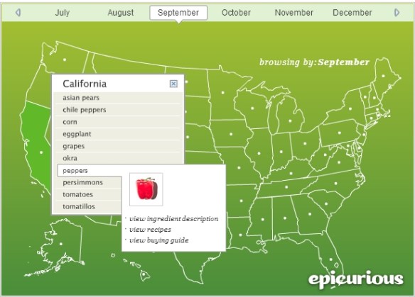
Though just a map of the United States, you can click on a month, then a state to see what ingredients (fruits and vegetables) are in season for that state. They also have links for the ingredient description and buying guide.
Are you ready for beer? Fall means Oktoberfest celebrations around the globe, and ESRI has created the Oktoberfest Score app that ranks your community against others in the US. The app uses demographic, consumer spending, and market potential data and lets you explore beer consumption in your area and discover other communities with similar tastes. Prost!

Ready for an epic road trip? Visit every place on this 1962 trip planning map. This map has it all. Originally produced by General Drafting Company, it was one of many produced for oil and gas companies that either freely distributed or sold maps at their service stations.

