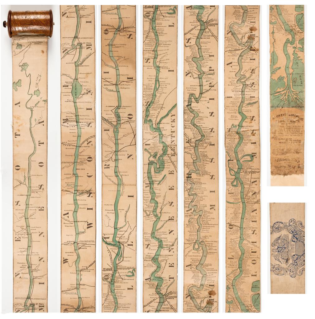
I have always liked strip maps. They go from one point to the other, maybe traversing a very long distance. The paper map can be very long and show a lot of stuff along the way. It’s like going on a trip without leaving your chair.
Here is an interesting 1866 strip map of the Mississippi River, allowing you to see the Father of Waters all at once. It was made for the steamboat traveler at the time and rolled up into a spool. Check it out and the history behind it.