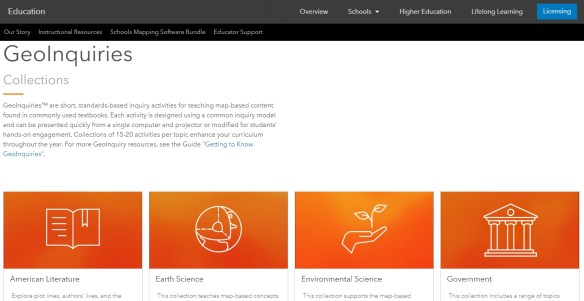
GeoInquiries

Teachers of a variety of subjects and grade levels who would like to incorporate maps into their classroom activities may want to check out ESRI’s GeoInquiries, a collection of short, standards-based inquiry activities for teaching map-based content found in commonly used textbooks. You will find a library of activities organized by topic, with each topic containing 15-20 different activities. Each GeoInquiry activity includes a teachers’ guide in PDF format, an interactive webmap, and an optional worksheet for students. Most activities are Level 1, which are “activities that teach standards-based content without a login to or installation of ArcGIS Online.” Some topics also offer Level 2 activities that use ArcGIS Online analysis tools. Those new to using GeoInquiries should be sure to read through the guide Getting to Know GeoInquiries, which is linked in the introductory paragraph on the collection’s main page. Check it out!

geoinquiries

Today: Implementing Open Geography Education Webinar

Open Education Global (OEG), an international network for open education, recently announced Adam Dastrup, Professor of Geosciences at Salt Lake Community College (SLCC), won OEG’s prestigious Open Geography award. In 2014, Adam Dastrup started the Open Geography Education initiative as a way to provide educators with OER textbooks to students. The philosophy of the initiative is to provide open resources, products and services to anybody interested in learning about the earth, its places and the relationships between people and their environments.

In this webinar you will:

  • Learn How the initiative began
  • See Examples of Textbooks
  • Explore implementation

The webinar will be today, Wednesday, January 15th, 2020 11:00 AM- 12:00 PM PST.  Click here to register for the webinar.

GIS at College of the Canyons

Looking to fill a beginning GIS requirement?  Then come join me at College of the Canyons this Spring 2020 semester and sign up for GIS 101, Introduction to Geographic Information Systems.  I promise you the class will be challenging and rewarding!  Also, your earned units are UC/CSU transferable.

GIS 101 is filling up fast, so register for the Spring 2020 semester as soon as possible.  The class is a hybrid class, so there is an online component as well as meeting in person.  The class will meet at the Valencia campus every Tuesday from 6:30pm to 9:35pm, February 11 to June 2.

Feel free to contact me, Michael Carson (michael.carson@canyons.edu), if you have any questions.  More info on the GIS 101 class can be found here.

GIS Courses at Rio Hondo

Rio Hondo College offers several GIS courses starting January 25th https://gisteacher.wixsite.com/riohondo/spring2020

Available courses include hybrid Introduction to GIS (GIS 120) on Thursday 7pm at Rio Hondo College, also offering on Wednesday morning 8am.  We have a new course Small Unmanned Aircraft System (GIS 150) for survey mapping and preparation for the FAA107 on Saturday 9am.  At the LA County DPW in Alhambra we have the Intermediate GIS (GIS 220) on Thursday 6pm.  Friday on campus, we have Cartography (GIS 221) at 9am.   Environmental GIS (GIS 230) is offered Monday & Wednesday 7:00pm.  Tuesday we have the Geospatial Programming (Python) & Web Services  (GIS 280) at 7pm.

Did you know you can apply for admission and register for classes entirely online and should be done as early as possible.  Waivers are available if you meet prerequisites with experience or attended an introductory course elsewhere. Contact wroberts@riohondo.edu for support. For more information on the courses you can view here and you can follow the steps here to register

P.S. Did you know select Rio Hondo GIS now offers the GIS AS Degree in addition to the CA state approved GIS Certificate and includes courses that are transferable courses to CSU and other universities?

Today: Drone Usage Webinar

SoCal URISA is hosting a Webinar on Drone Usage.  The webinar is today at noon.  It is hosted by Professor Warren Roberts.  Prof Roberts teaches GIS at Rio Hondo Community College and has completed his certification for the FAA 107 License for sUAV Drone Pilot.

In the webinar, Warren will share with you the many growth areas including surveying, public safety, biology, and other industries.

We’ll explore: how you prepare for the FAA 107 to enable you to commercially perform services, using the sUAV, best practices for survey mapping, and processing to capture accurate orthomosaics and surface models for inputs into GIS.

Click here for more info and to register.

History of Cartography Competition

Students of the history of cartography are invited to submit papers for the 2020 Ristow Prize competition. Undergraduate, graduate, and first-year postdoctoral students of any nationality are eligible to compete. Papers must be in English, not exceeding 7500 words, and should be submitted digitally as a PDF document to kaparker18th@gmail.com by 1 June 2020. Appropriate illustrations, especially maps, are encouraged. The winning essay will receive a cash prize of $1000 and will be published in The Portolan, the journal of the Washington Map Society. The prize, named in honor of the late Dr. Walter W. Ristow, is sponsored by the Washington Map Society of Washington, D. C. For more information, including a list of previous winners, go to the website www.WashMapSociety.org or contact Dr. Katherine Parker at kaparker18th@gmail.com.

GIS Day Next Week

GIS Day 2019 is almost upon us.  If you have an event and want to get the word out, send an announcement request through the About page and I will get it posted right away.

Here is one for the City of Irvine.  They are celebrating GIS Day on November 14.

The big one at LA County will happen on November 13.

GIS Day will be celebrated at a number of colleges like: Pierce College, CSUN, and USC.

Channel Islands Regional GIS Collaborative (CIRGIS) will have GIS Day on December 6 at Ventura College.  The keynote speaker will be Michael Goodchild.

Also make sure to register your event on the GIS Day website.


The Huntington Fellowship

The Huntington is pleased to announce an addition to its fellowship program that may hold particular interest for members of this group. This fellowship is unusual among the Huntington’s offerings in having no specific degree requirements. To apply, please go to https://fellowships.huntington.org/; for further details, contact Natalie Serrano at nserrano@huntington.org.

The Huntington Fellowship in the Materiality of Print Culture
This newly created fellowship in the materiality of print culture provides one month of support for research in any aspect of printing history, book production, or illustration technologies including photography. Applications are welcomed from those inside and outside the academy, but are especially encouraged from librarians, curators, conservators, and advanced practitioners of any of the allied arts of printing, printmaking, photography, graphic design, or book production. Applicants must have a focused research project that centers on some material aspect of print culture and must demonstrate how research in The Huntington’s Library collections is critical to its development.

GIS Essentials Workshop

GIS Essentials Workshop Announcement: Thursday, September 26th, 2019

In the GIS Essentials: Mapping Your Community™ workshop you’ll learn to create maps and analyze data about your local community. The class is perfect for beginners and anyone that would like a refresher on mapping and ArcGIS. Workshops are taught by bestselling author Gina Clemmer using the GIS 20: Essential Skills (included in registration) as a guide. 

These half day, hands-on workshops run from 9 AM / 12 EST to 2 PST / 5 EST. Each workshop is taught online, by a live instructor. Students dial in to a conference call and login from any computer to view the screen share. The interactive class makes it easy for students to ask questions and participate in group discussions. The cost is $495.

► The workshop: Focuses on teaching the fundamentals of using a Geographic Information System (GIS) for community analysis and mapping. Participants will learn how to create basic reference maps, color shaded maps and geocoded maps (address mapping).

► Upcoming Dates: Visit https://thegis20.com to sign up.

Thursday, September 26th
Thursday, October 10th
Thursday, November 14th

► Materials: The GIS 20: Essential Skills, Third Edition is included with your registration. The book is currently in the top ten Cartography books on Amazon and is the only ESRI book in the Library of Congress. It will be used for exercises and class discussion. The book includes a six month version of the software.

► Instructor: The class is taught by Gina Clemmer, bestselling author and GIS expert.

► Praise: Class participants consistently give the workshop the highest rank. Students appreciate the direct teaching method which offers a fast and comprehensive learning experience.

“Great materials, great instructor and great organization. Thanks!” – Institute for Health Research and Policy, University of Illinois at Chicago

“I especially liked the comprehensiveness of the course as well as the 2-hour segments of learning. Breaking up the learning really helped me retain what I learned. I have taken many IT trainings, but I have to say that Gina Clemmer is one of the best instructors I’ve ever had. I recommend this training to anyone that is interested in learning or improving their GIS skills.” GIS Project Coordinator, NYS Council on Children and Families

“I knew I needed to learn geo-analysis skills and I had to start somewhere. The GIS Essentials course was just the right level to get me where I needed to go. Starting with the basics, working through real-life examples, and upping the complexity made it worth my time. I also appreciated being able to ask questions specific to the projects I was working on. ” Research Data Analyst, Stanford University, School of Medicine

Free Next Gen 9-1-1 Workshop

Take advantage of this free NG9-1-1 workshop.  Topics include:

  • What is the role of Public Safety in NG9-1-1?
  • What is the role of GIS in NG9-1-1?
  • What is Next Generation 9-1-1 (NG9-1-1?)
  • How 911 location information, validation, and routing is determined (MSAG, ALI, LDB, LVF, ECRF, and other alphabet soups)?
  • What is the rush… Where is the fire?

The workshop is for:

  • 9-1-1 Center and PSAP Personnel
  • Regional & State 9-1-1 Coordinators, MSAG Coordinators
  • GIS Managers, GIS Data Stewards, Addressing Authorities
  • Anyone who may benefit from a discussion regarding 9-1-1, GIS, and their roles in Next Gen 9-1-1

The workshop will be held September 24, 2019 from 10am to 2:30pm at 333 Olympic Drive, Santa Monica.  Lunch will be provided.  Park in the Civic Parking Structure on the corner of 4th & Olympic.

To RSVP, visit http://bit.ly/SantaMonicaScissors .