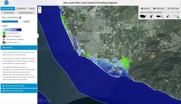
The NOAA Office for Coastal Management has released a sea level rise viewer. You can use the web mapping tool to visualize community-level impacts from coastal flooding or sea level rise (up to 6 feet above average high tides). You can also download the data used in the app or access the map services. Check it out!
Author Archives: socalgovgis - Michael Carson
College of the Canyons GIS
Are you looking to learn more about GIS than just how to push buttons in the software? Want to build a GIS skill set that will set you apart from others? Desiring to be exposed to the practical and real world use of GIS? Then come join me at College of the Canyons and sign up for GIS 101, Introduction to Geographic Information Systems. The class will be challenging and rewarding! Also, your earned units are UC/CSU transferrable.
Registration for the Spring semester has started, so make sure to register early. The GIS class will meet at the Valencia campus every Wednesday from 6:30pm to 9:35pm, February 8 to May 31. The textbooks for the course can be found here.
Feel free to contact me, Michael Carson (michael.carson@canyons.edu), if you have any questions.
Airports & Lounges Wireless Passwords
Rio Hondo College GIS
Start off the new year right and take a GIS class or two at Rio Hondo College. Courses start the week of January 30th. Apply for admission and register for classes entirely online. Available courses include two Introduction to GIS (GIS 120) courses including one located off site at the LA County Department of Public Works (900 S Fremont Ave, Alhambra), also offered is Cartography (GIS 221), Crime Mapping (GIS 281) and Intermediate GIS (GIS 281).
To register for classes, you must first apply for admission (entirely free online). Directions for applying for admission and registering for the classes can be found at http://riohondo.isteaching.com/spring-semester-2017.html For additional information, contact Prof. Warren Roberts wroberts@riohondo.edu (P.S. Did you know select Rio Hondo GIS courses are transferable courses to CSU and other universities?)
Merry Christmas 2016
I want to wish everyone a very Merry Christmas and a Happy New Year. As usual, you should check out the Christmas Map as well as The Physics of Santa Claus.
And if you are looking for something to do with the family, head on over to the new Santa’s Village in Skyforest. -mike
CIA Cartography Division 75th Anniversary
For decades the CIA relied on geographers and cartographers for planning and executing operations around the world. During the 1940’s in support of the military’s efforts in WWII, cartographers pioneered many map production and thematic design techniques, including the construction of 3D map models. To celebrate 75 years of serious cartography, the Central Intelligence Agency has declassified and put decades of once secret maps online. Check it out!
You can read more about it here too.
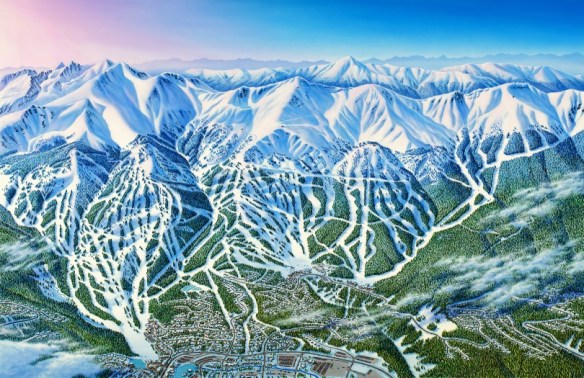
The Ski Resort Mapper
Drones Flying Free
Megaregions of the US
New Maps Plus Program
Thinking about developing your skills in digital mapping? Then check out University of Kentucky’s New Maps Plus program.
New Maps Plus is a completely online program consisting of three courses (MAP671, MAP672, and MAP673) that focus on online and open source mapping solutions (like QGIS), JavaScript programming, and cartographic design for the web. Students completing the program will earn a Graduate Certificate in Digital Mapping from the UK Geography Department and the College of Arts & Sciences. The courses are taught during 10-week terms that are offered four times a year (see schedule). The next term will be starting January 23rd, with an application deadline of January 8th.
The 2016-17 academic year cost per credit hour is $639.50, plus a $10 per credit hour distance learning fee. Thus the MAP 671 course (3 credits) costs $1948.50 and the MAP 672/673 courses (4 credits) cost $2598 each.
Check it out by clicking below: