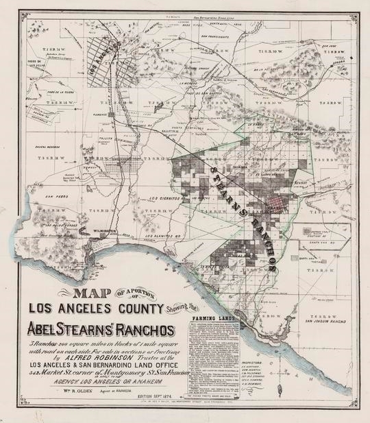
52 19th and early 20th century maps of California have been added to the California Historical Society’s new Digital Library. The images represent a sampling of unique or uncommonly held titles ranging geographically from an 1863 map of the copper region of Del Norte County in the north, to a circa 1866 Topographical Map Showing the Locations of the Sutro Tunnel and the Comstock Lode, to a colorful 1913 townsite map of Date City (now called Calipatria) in Imperial County in the south. In between are city, county, mining, real property, water-supply, road, and railroad maps of various localities throughout the state. Check it out!