Sea Level Rise Viewer

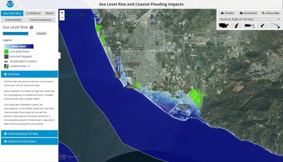
The NOAA Office for Coastal Management has released a sea level rise viewer.  You can use the web mapping tool to visualize community-level impacts from coastal flooding or sea level rise (up to 6 feet above average high tides).  You can also download the data used in the app or access the map services.  Check it out!

sealevelriseapp

Leave a Reply

Fill in your details below or click an icon to log in:

WordPress.com Logo

You are commenting using your WordPress.com account. Log Out /  Change )

Twitter picture

You are commenting using your Twitter account. Log Out /  Change )

Facebook photo

You are commenting using your Facebook account. Log Out /  Change )

Connecting to %s