Besides being our first president of the United States, George Washington was also a chart maker, cartographer, and land surveyor. Check out this article about him and the map depicting his Mount Vernon estate.
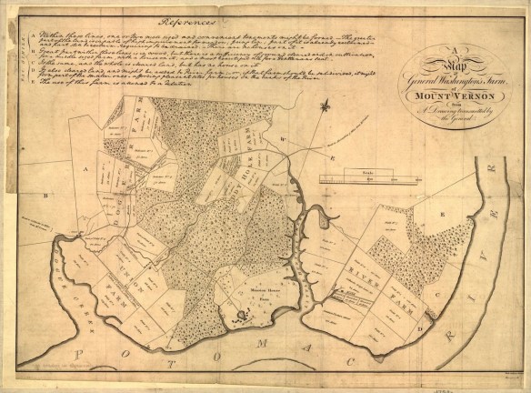

Besides being our first president of the United States, George Washington was also a chart maker, cartographer, and land surveyor. Check out this article about him and the map depicting his Mount Vernon estate.
The National Weather Service models are showing a very wet storm for the LA area today, including flash flood watches, high surf advisories, and wind advisories.
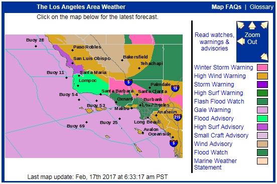
Here are some forecast rain totals for today and tomorrow (Friday night being the heaviest). Continue reading
In January, the City of Long Beach launched an open data portal that aims to give the public clear, visual information they can use. In addition to maps, DataLB provides access to applications that put city data in context.
Developed with ESRI, DataLB’s applications focus on visualizing the impact of initiatives and public investments. Check it out!
Thanks goes to LA County GIS for finding this one. Here are the top 14 maps and charts that explain Valentine’s Day.
After almost 80 years in business, the owner of The Map Store in Milwaukee will be closing the doors in April. Read about the owner and the store history, and maybe buy a few maps before they close! Click below for the story.

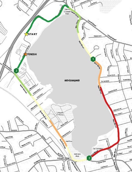
Do you gather GPS points while you are running? If so, here is an article about the best way to symbolize your point data to show your running information.
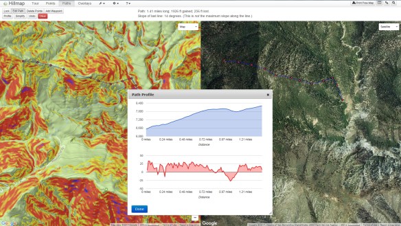
Hillmap is a web based mapping app that lets you create and print free, customizable maps from high quality map layers. You can also use Hillmap tools to calculate slope and distance, check the weather at your destination, analyze snowpack, and more.
This app is definitely handy to calculate your hiking route and check on the slope. You can also turn on multiple overlays, like slope, weather radar, and other map information. Give it a spin!
Looking for an alternative to ArcGIS Server but still want to use ESRI’s other products? Maybe CloudSpatial is for you. Announcing the Beta release of CloudSpatial GIS Server – an ESRI Geoservices REST Implementation. CloudSpatial is a drop in replacement for ArcGIS Server that works with all ESRI API’s and ArcGIS Desktop. CloudSpatial was created as an alternative to ArcGIS Server for organizations that have existing investments / apps built with ESRI technology but would like to reduce the ongoing expense of ArcGIS Server and/or ArcGIS Online. CloudSpatial can also be used by customers that want an ESRI compatible, inexpensive, lightweight and easy to use system for their spatial infrastructure. See how easy it is to setup and use by watching the screencasts. More info at cloudspatial.com/gisserver.
ArcGIS Pro 1.4 is now available. Some of the new features include supporting the production of georeferenced ortho products, sharing dynamic image services, georeference CAD data, create graticules, multipatch editing, changing the interface theme, controlling feature layers with display filters, new interactive selection tool for 2D views, new 3D symbols, create vector tile packages, vector tiles can now be printed and exported, and much more!
Here is a listing of what’s new. You can download the software from your ESRI account.
Check out this interesting article about books with maps that you might have read when you were young. The maps were used to describe the fictional world you were reading about.


