Check out this story about James Niehues, the person that hand paints all those ski resort maps that you probably have used or seen before.
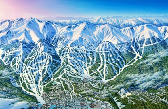

Check out this story about James Niehues, the person that hand paints all those ski resort maps that you probably have used or seen before.
Check out these webinar mini-conferences on drones and geospatial technology. They will help you understand the updates to FAA drone regulations, the legal issues surrounding drones, and what equipment and software you need for your drone mission.

Check out this study that was done to identify megaregions in the US by using commuter data.

Thinking about developing your skills in digital mapping? Then check out University of Kentucky’s New Maps Plus program.
New Maps Plus is a completely online program consisting of three courses (MAP671, MAP672, and MAP673) that focus on online and open source mapping solutions (like QGIS), JavaScript programming, and cartographic design for the web. Students completing the program will earn a Graduate Certificate in Digital Mapping from the UK Geography Department and the College of Arts & Sciences. The courses are taught during 10-week terms that are offered four times a year (see schedule). The next term will be starting January 23rd, with an application deadline of January 8th.
The 2016-17 academic year cost per credit hour is $639.50, plus a $10 per credit hour distance learning fee. Thus the MAP 671 course (3 credits) costs $1948.50 and the MAP 672/673 courses (4 credits) cost $2598 each.
Check it out by clicking below:

Want to learn programming with Python in ArcGIS but don’t know where to start? This guide tells you what to do to become a confident ArcGIS Python scripter and programmer. Check it out!

You also might want to check out the book Python Scripting for ArcGIS.

Today is Pearl Harbor Remembrance Day. On this date 75 years ago, Pearl Harbor was attacked by Japanese forces, leaving over 3,400 casualties and pushing the U.S. to join the Allies in World War II.
National Geographic has an interesting site with an audio/visual timeline tour showing what went down during that day through attack maps. Check it out!

San Diego map collector, William Speidel, would like to donate his map collection of about 1,000 maps to a library, geography or geology department in the United States. The collection is current with maps dating from the 1960s to the 2000s. While the collection would be a donation, the accepting library would need to pay for the mailing of materials. Included in the donation are the following types of maps: * Nautical charts (Alaska, Australia, China, Japan, US Gulf of Mexico, US Pacific, US Atlantic, Thailand, Vietnam, Western Mediterranean); * Bathymetric charts (Australia, US Atlantic, California, China, Gulf of California, Thailand); * USGS topographic maps (1:24k, 1:62.5K) (California, Arizona, Texas, Mississippi, etc.); * Other maps including miscellaneous geologic maps, Gebco Charts, soil charts, sediment distribution. Excel spreadsheets are available detailing the full collection.
Mr. Speidel is interested in the whole collection going to one library rather than breaking it up into pieces. If you are interested, please contact Julie Sweetkind-Singer (sweetkind@stanford.edu) and she will pass along his contact information and the spreadsheets to you directly.
Registration for the 2017 ESRI User Conference is now open! Register now and get the best hotel rates!

The Library of Congress signed a memorandum of understanding with the Digital Public Library of America to become a Content Hub and will ultimately share a significant portion of its rich digital resources with DPLA’s database of digital content records.
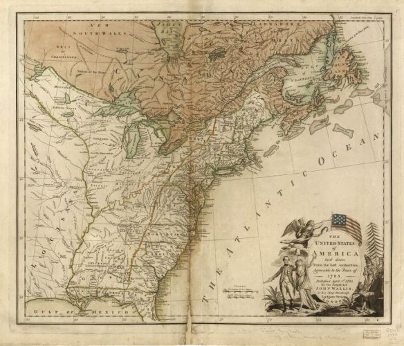
The first batch of records will include 5,000 items from three major Library of Congress map collections: the Revolutionary War, Civil War, and panoramic maps.
PostGIS 2.2.4 was recently released. It is a patch release. For all the details and to download, click below.
![]()
Also version 2.3.1 was just released. Click here for more details.
