ESRI GeoNet Contest

Looks like ESRI is running a little contest on their GeoNet site.  You earn points by completing “missions”, like answering questions, getting replies marked as helpful, and contributing content.  First place grand prize is a MVP GeoNet Badge, Certificate of Achievement, choice of either ESRI UC Conference registration or Dev Summit Conference registration, and a choice between an Apple iPad or Microsoft Surface Tablet.  There are also second and third place prizes as well.

Though I think this is ESRI’s way to get more people to participate on GeoNet, you cannot pass up that free conference pass and iPad!  Good luck!

Say Goodbye to Google Maps Engine

Google has announced that they are ending support for Google Maps Engine (GME).  If you are using GME to store your vector and raster data in the cloud, be aware that your GME data will be removed in a year on January 29, 2016.

So where can you migrate your data now?  Safe Software has written an article listing some options that you have.  Of course if you use their FME product, it’s just a one-step process!  However, besides the sales pitch, they do present some options that you have to migrate your data to.

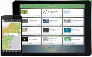
I personally have used ArcGIS Online and Amazon Relational Database Service (RDS) to store spatial data.  With ArcGIS Online you have to buy a plan first, then you will consume credits when you store your data there.  With Amazon RDS you can use SQL Server, Oracle, MySQL, PostgreSQL, or the new Amazon Aurora with costs for the instance (server) size/database type, consumed storage, and traffic.  Keep in mind that ArcGIS Online has tools built-in to analyze and display spatial data as well as being integrated with their ArcGIS software products.  Amazon RDS is just a storage solution, so you will need to come up with other options for analyzing and map display of your spatial data in the cloud, like using ArcGIS software or something else.

Move from Silverlight to HTML5

If you have apps using Silverlight, this is the year to plan and move them to HTML5.  ESRI plans on deprecating ArcGIS APIs and Viewers for Silverlight, and Google plans to remove support for NPAPI (and therefore Silverlight) in Chrome.  Note that IE and Firefox will still support Silverlight for some time.

If you have apps built on Geocortex technology, it is time for you to move to HTML5 for sure.  Watch this video from a past webinar to help get your applications where they need to be for the transition.

geocortexhtml5

Also read this document from the webinar Q&A.

GIS Conferences and User Group Meetings 2015

Here are a few of the first GIS Conferences and User Group Meetings in California this year:

  • SoCal Geocortex User Group Meeting – January 22, 2015, Arcadia
  • Geodesign Summit – January 22-23, 2015, Redlands
  • Los Angeles Geospatial Summit – February 27, 2015, Los Angeles

For more information about these and other GIS conferences, visit the GIS Conferences page.

NHGIS

Looking for aggregate census data and boundary files?  Check out the National Historical Geographic Information System.  They include census information from 1790 to the present.

Through the NHGIS Data Finder, users may:

  • Filter and sort through thousands of available tables and boundary files
  • Select and download multiple tables and boundary files, for different geographic levels and from different years, all in one request

All free of charge!

They have currently released:

  • 2013 American Community Survey 1- and 3-Year Summary Files
  • 2012 American Community Survey 1-, 3-, and 5-Year Summary Files and associated GIS boundary files
  • 2009 American Community Survey 5-Year Summary Files and associated GIS boundary files
  • Time Series Release 5: 17 new tables including Poverty Status, Ratio of Income to Poverty Level, Means of Transportation to Work, and Households by Household Type
  • Data Finder improvements for a better user experience

NHGIS is also preparing the 2013 ACS 5-year Summary Files and 2013 GIS boundary files for release by early 2015.