Just in case you have some extra change to spend on a Christmas present, check out the map auction at Swann Auction Galleries. There are a few deals!
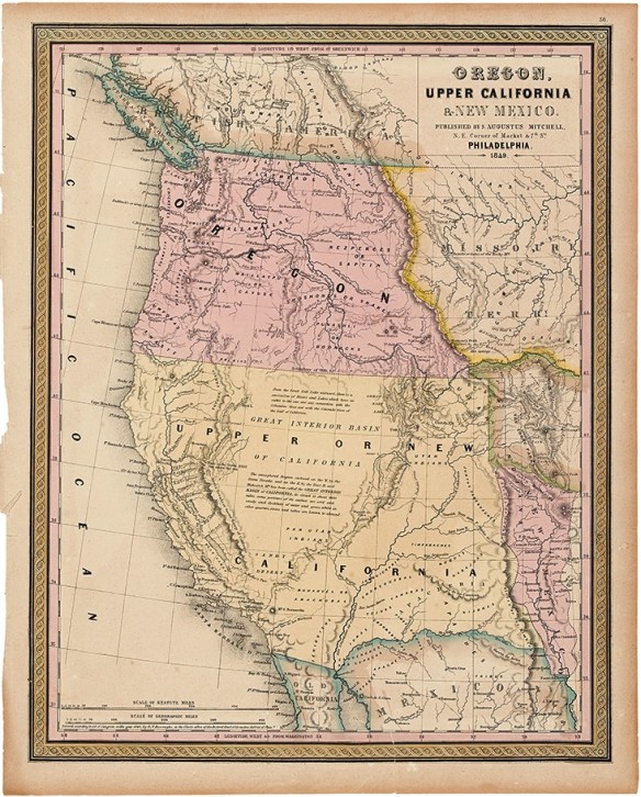

Just in case you have some extra change to spend on a Christmas present, check out the map auction at Swann Auction Galleries. There are a few deals!
Here is an interesting article and map showing the largest employers in each state. Here in California it is the Naval Station in San Diego with 42,951 employees.

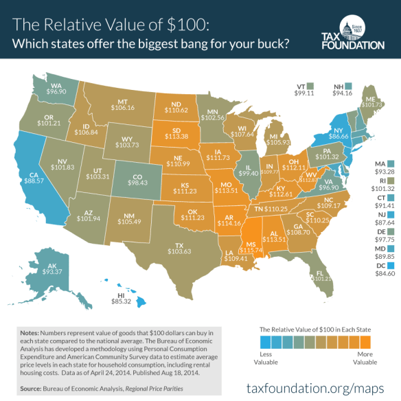
This map from the Tax Foundation uses data from the Bureau of Economic Analysis and answers the question state by state. In Mississippi, your $100 could buy $115.74 worth of stuff relative to the national average. On the other hand in California you would only get $88.57 worth.
A common, frequent complaint about Los Angeles is that it’s so big and so sprawly and it feels like it goes on forever. Is it really? Let’s get a better grasp of LA’s relative size, care of self-storage-focused site Spare Foot, which superimpose LA’s city limits over the borders of other major cities (and even a few landmarks). The pairings also show how LA compares to other metropolises in terms of land area, population, and density per square mile. Check it out.

Google Maps is now available offline. That means on your Android you can select an area to download from your phone and use it to navigate offline in areas that you don’t get good coverage in. And better yet, Google Maps can switch seamlessly between offline and online. Click here to read more.

GIS Day is Wednesday, November 18th. If you are looking for a site to visit, check out this interactive map for the SoCalGIS area (and beyond).

Location data from gisday.com.
Need access to Tract and Parcel maps for a particular property? Maybe you want to incorporate Tract and Parcel map data in your applications? Take a look at the Land Records data provided by the Los Angeles County GIS Data Portal. The data has links to thousands of scanned documents online.
Here you can download shapefiles with links to Tract maps, Parcel maps, Records of Survey, Township plats and Landgrants, Subdivision activity, and City boundaries. Most of the data seems to be updated every quarter.
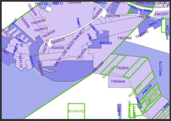
You can also take a look at their Land Records Viewer too.
After you view the Halloween Candy Map, check out this one showing the craziest urban legends from each state!

Interesting map showing each state’s favorite Halloween candy. The online survey was conducted in September with a total of 42,238 users. The candy that polled the highest was Reese’s Peanut Butter Cup.

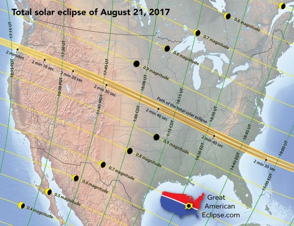
On August 21, 2017, the continental United States will experience a rare total solar eclipse that sweeps the nation from Oregon to South Carolina. Taking 94 minutes for the Moon’s shadow to race across the country, the duration of the total solar eclipse can last from 2 minutes near Depoe Bay, Oregon, to 2 minutes 41 seconds (the max) near Carbondale, Illinois, and 2 minutes 30 seconds near Awendaw, South Carolina. This will not happen again in the US until 2023 for an annular eclipse and 2024 for a total eclipse.
To help you plan your trip, take a look at these many maps including a 10 foot long strip map of the eclipse path. For more info, click below.