CSULB Geography Get Together at TOP GUN

If you graduated with a Geography degree from CSULB, attended some classes in Geography or GIS, still there trying to figure out when it will all end, know someone from CSULB Geography, know Frank, know someone who knows Frank, had the privilege of taking a class “taught” by Frank, suffered in Frank’s class, heard a story about a guy named Frank, or now you are just curious who this Frank guy is anyway, then come join us at our annual CSULB Geography get together at TOP GUN, Wednesday night around 6pm during the ESRI Conference in San Diego next week.

Hope to see you all there!  And yes, you too Frank!  -mike

New Wiki for Education Users of ArcGIS Online

If you are a faculty or staff member in a higher education institution that teaches GIS, you might want to take a look the new wiki titled “ArcGIS Online Coaching Points for Higher Education“.  ESRI states:

ArcGIS Online is an evolving cloud-based GIS software as a service. It is updated several times a year. Educators and Esri staff need a dynamic medium to share problems and advice. This wiki supports the ArcGIS Online education community by providing such a medium.

We encourage education users to post the challenges they face as scenarios in the relevant sections of this wiki. Experienced ArcGIS Online users and Esri staff will respond with advice (i.e., “coaching points”) that help users overcome challenges. To add your scenarios and coaching points to the wiki, simply create an account to gain editing privileges. The team that hosts wiki.gis.com provides plenty of online help.

Probably something to check out before you go to the 2014 Education GIS Conference.

SoCal URISA Hosts an Open Source Workshop

SoCal URISA hosts an Open Source Workshop With Jeff Johnson
Palomar College: 1140 W Mission Rd, San Marcos, CA 92069
Date: 28 Jun 2014 8:00 AM PDT

You have probably heard about open source geospatial tools. Here is the chance to experience them under the direction of experts. Bring your laptop and dive into some of the most powerful, widely used and innovative tools in this area.

Open-Source developer, Jeff Johnson, will lead us into a high level look at the ecosystem of Open Source geospatial tools from QGIS on the desktop to GeoServer and PostGIS on the server and the web application frameworks used to deliver applications using these services on the web. We will then dive deeper into raster and vector spatial analysis on the desktop with QGIS and look at the various freely available QGIS extensions and plugins that GIS practitioners can use in their own projects and workflows. The course material will be drawn from the following 2 workshops. http://workshops.boundlessgeo.com/suiteintro/ and http://docs.qgis.org/2.2/en/docs/training_manual/ and users are encouraged to install the tools ahead of time by downloading from http://boundlessgeo.com/solutions/opengeo-suite/download/ and http://www.qgis.org/en/site/forusers/download.html

We will host a light continental style breakfast along with coffee and a sandwich lunch.

Location: Palomar College, San Marcos in the Natural Science Bldg.  NS-127 (GIS Lab)

Directions and parking pass will be emailed out to registrants closer to the date.

Preliminary Schedule:

7:30 am – Registration opens, grab a light breakfast too.
11:30 am – Lunch
5:00 pm – Conclude Workshop

The workshop is Free for SoCal URISA members, otherwise purchase or renew your membership.

$30  Annual Fee
$10 Student Annual Fee

Please don’t forget to save you receipt from this event and use it towards your GISP credit.

Speaker Bio:

Jeffrey is a geospatial software engineer with 15+ years of experience building and delivering applications for the web. Jeff is a developer with a broad range of skills who can work at any level, from writing code and fixing bugs to managing complex projects and making architectural decisions while coordinating technical policy with corporate strategy. He spent the past 3.5 years working for Boundless (formerly OpenGeo) on GeoNode, GeoGit and various related open source projects and has given presentations and workshops on these technologies around the country and the world. Jeff is also deeply involved with the City of San Diego’s Open Data and Civic Technology initiatives. He is a graduate of Humboldt State University where he studied Geography, Cartography, Geology and Geospatial Technology.

Jeff can be reached at ortelius@gmail.com with questions about this workshop or for advice and consulting on projects leveraging open source geospatial tools.

More information and online registration: SoCal URISA hosts an Open Source Workshop With Jeff Johnson

Best regards, Southern California Chapter of URISA

Master’s Thesis Grants

Applications for the next round of AAG Cartography Specialty Group Master’s Thesis Research Grants are due by June 15, 2014.

Masters students enrolled full time are invited to apply for the CSG Master’s Thesis Research Grants. These grants are intended to promote scholarly research in cartography by students enrolled in Geography or a related degree program. Grants are available up to a maximum of $500 and may be used for items necessary and relevant to research, such as travel, materials, equipment, and human subject fees.

Deadlines for application are March 15, June 15, and November 1 of each year. Applications and inquiries should be directed to the CSG Non-Academic Director, Sarah Bell, at sbell@esri.com.

For more information and the application form, please visit http://www.csun.edu/~hfgeg003/csg/master.html. You can also access that page from the Awards and Competitions section of the main CSG Web site, http://www.csun.edu/~hfgeg003/csg.

Please share this announcement with your students or other organizations that may have potential applicants.  Good luck in the competition!

Disasters in the Golden State

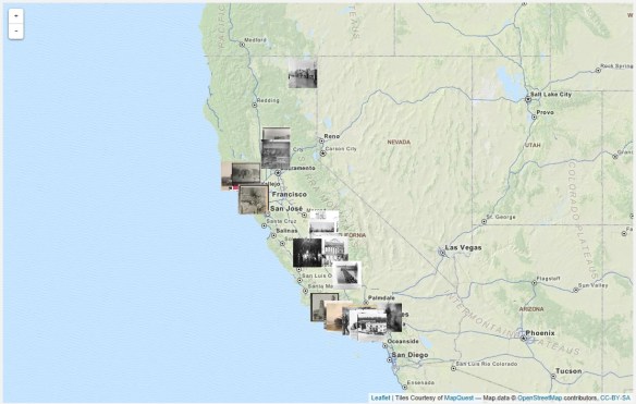
The talented archivists at Calisphere have curated a range of subjects on California history as part of their Local History Mapped series. This particular feature takes on Disasters in the Golden State by looking into the way disasters have affected buildings during the 19th and early 20th centuries. It’s a great subject and visitors can use the View Map feature to explore the state.

calisphere

The homepage provides a brief synopsis of each major disaster type, along with resources for teachers, including class activities based on thematic collections of these images. Additionally the site includes a helpful document titled “How to Use Local History Mapped” and some complementary links from the Joint Committee on Geographic Education.

That reminds me of this book:

It’s very interesting with first hand accounts of California disasters from 1800 to 1900.

Free Python Courses

Looking to learn a little Python programming?  Take a look at these free courses:

Learn to Program: Crafting Quality Code

An Introduction to Interactive Programming in Python

Codecademy: Python

Pythonmonk: Learn Python

ESRI: Python for Everyone

Using Python in ArcGIS Desktop 10

PennState: Geography 485

Google: Python Class

Learnpython.org

The Python Tutorial

MIT: A Gental Intro to Programming Using Python

Other Python Training


Free Self-Paced GIS Course

There is a free self-paced introductory GIS course available from Simon Fraser University.  Participants will learn about GIS and how the technology is being used in the real world to support problem-solving and decision-making. Participants will create and manage spatial databases, produce well-designed maps, and undertake spatial data analysis using free online software tools.

sfu_gis_class

Spatial@UCSB 2014

The University of California, Santa Barbara will once again be hosting their annual Spatial@UCSB on June 3, 2014 at UCSB for the 7th year. The meeting will allow an opportunity for local GIS practitioners to interact with GIS students and exchange ideas and insights in an academic setting.

For more information and details visit the Spatial@UCSB website.

Webinar: GIS Strategic Planning for Local Government

Overview
Strategic planning is a vital tool for local government. For the past 17 years, Geographic Technologies Group (GTG) has been helping local governments harness the power of geographic information systems through careful planning, intelligent implementation, and expert guidance at every phase of the process.

An effective strategic plan is critical to ensuring that a GIS program gets off the ground. An effective strategic plan will help you gain the approval of key decision makers and most importantly, the funding needed for the program. Additionally, an effective strategic plan will ensure that the program sees a return on investment.

This webinar will guide you through 7 Steps needed in developing a successful strategic plan. Participants will learn about the key factors essential for a successful GIS strategic plan. Whether it’s a refresh, update, or enterprise-wide plan, this webinar will help you get started.

Audience
GIS Managers, GIS Users, IT Decision Makers, executives and other professionals involved in GIS programs.

Topics Covered
• 7 Steps to Strategic Planning
• 7 Keys to Success
• GIS Return on Investment

When
Tuesday, May 6, 11am to 12pm PDT
Click Here to sign up!