Unknown's avatar

About socalgovgis - Michael Carson

Michael Carson, GIS Manager (retired) for the City of Burbank and President of Southern California Government GIS User Group. Currently teaching GIS at College of the Canyons in Santa Clarita.

GIS Day 2016

Today is GIS Day!  If you are looking for a place to check out, may I suggest the GIS Day celebration at Los Angeles County.  They put on a big show and have many booths and presentations.

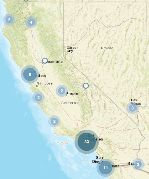
You can find other places that are celebrating GIS Day by checking out the GIS Day map below.

gisday2016map

Happy GIS Day!

ArcGIS User Seminar

ESRI will be holding ArcGIS User Seminars where you will learn how to be more effective with ArcGIS and get a close look at what’s new in version 10.5.  You’ll return to the office with practical tips and skills to use right away, including:

  • Collect authoritative data faster
  • Use and pair ArcGIS apps
  • Communicate with spatial analysis
  • Develop and share insights from your data
  • Improve collaboration

Register today to save your seat for the ArcGIS User Seminar.

Street Trees Interactive Map

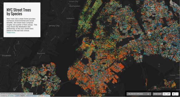
If you are a tree lover or interested in urban spaces, you will want to check out Jill Hubley’s interactive map of New York City Street Trees by Species. You can choose to zoom in on a particular neighborhood (or even block) to learn about the particular tree species in that area. Alternatively, you may conduct a search for a particular species to see where that species is distributed across the city.

nycstreettrees

Cartographic Grounds

Mapping has been one of the most fertile areas of exploration for architecture and landscape in the past few decades. While documenting this shift in representation from the material and physical description toward the depiction of the unseen and often immaterial, Cartographic Grounds by Jill Desimini and Charles Waldheim takes a critical view toward the current use of data mapping and visualization and calls for a return to traditional cartographic techniques to reimagine the manifestation and manipulation of the ground itself.  Continue reading →

Fall SoCal Marine GIS User Group Meeting

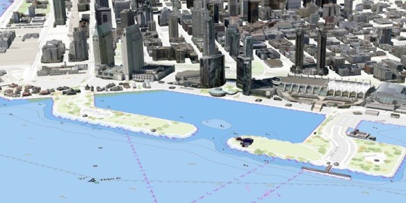
The Southern California Marine GIS User Group has announced it’s 2016 Fall Meeting hosted by the Port of San Diego.  The Southern California Marine GIS is a welcoming group of GIS professionals and aficionados doing work in and about the Southern California marine and maritime community. Their goal is to create connections and foster innovation to improve and accelerate marine and maritime GIS in the local area.  Click below for more info.

https3a2f2fcdn-evbuc-com2fimages2f257015822f1483288050472f12foriginal

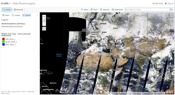
Daily Planet Imagery

This ArcGIS Online web map shows imagery for the planet that is updated on a daily basis. It features the NASA MODIS imagery True Color band composition (Bands 1 4 3 | Red, Green, Blue) which most accurately shows how we see the earth’s surface with our own eyes.

modiswebmap

The image service supporting this map is time enabled, but time has been disabled on this image layer so that the most recent imagery displays by default. If you would like to view imagery over time, you can update the layer properties to enable time animation and configure time settings. The results can be saved in a new web map to use later or share with others.  More about the MODIS imagery image service here.

Early Earthquakes in LA Area May Have Been Man-Made

A new study from the USGS suggests that some early 20th century earthquakes in southern California might have been induced (man-made) by past practices that were used by the oil and gas industry.

In the new study, scientists evaluated the likely cause of several significant earthquakes within the Los Angeles Basin between 1900 and 1933, together with consideration of available oil industry records over this period.

They found that several damaging earthquakes, Continue reading →