Looking for that perfect Christmas gift for a map aficionado? Check out these ideas in the 2019 Holiday Gift Guide.
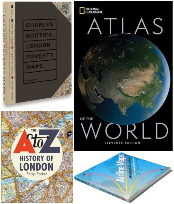


Looking for that perfect Christmas gift for a map aficionado? Check out these ideas in the 2019 Holiday Gift Guide.
Click below to check out data and maps about individual meal items you find during Thanksgiving dinner. Have a happy Thanksgiving!

Students of the history of cartography are invited to submit papers for the 2020 Ristow Prize competition. Undergraduate, graduate, and first-year postdoctoral students of any nationality are eligible to compete. Papers must be in English, not exceeding 7500 words, and should be submitted digitally as a PDF document to kaparker18th@gmail.com by 1 June 2020. Appropriate illustrations, especially maps, are encouraged. The winning essay will receive a cash prize of $1000 and will be published in The Portolan, the journal of the Washington Map Society. The prize, named in honor of the late Dr. Walter W. Ristow, is sponsored by the Washington Map Society of Washington, D. C. For more information, including a list of previous winners, go to the website www.WashMapSociety.org or contact Dr. Katherine Parker at kaparker18th@gmail.com.
ESRI’s ArcGIS Living Atlas of the World can be described as an evolving collection of authoritative, curated, read-to-use global geographic information curated by ESRI and the GIS user community. It includes imagery, basemaps, demographics and lifestyle, landscape, boundaries and places, transportation, earth observations, urban systems, oceans, and historical maps, all of which can be combined with your own data.
Most can be used without signing in, but you will need an ArcGIS Online account for the more interesting ones. Here are a few I found that were interesting. Continue reading
There are some ArcGIS users that export their maps to an Adobe format so a graphic artist can finish it up. Now inside Adobe Photoshop and Illustrator you can import data-driven maps with ArcGIS Maps for Adobe Creative Cloud. Check out the video below and read the Seattle Times case study.
Reminds me of my digitizing days!
If you have been making maps for a long time, then you remember ink on mylar, Leroy lettering sets, and adhesive-backed screentones like Zip-A-Tone and Letraset.
Now replaced with computer techniques, check out these five production processes in map making that are no longer in use.

Registration for the CalGIS 2020 conference in Long Beach next year is now open. Check out their website and register today!

Twenty years ago, Ralph Nader suggested to Jack Dangermond that GIS deserved its own day as a means for outreach, celebration, and awareness building. Read more about it here.
Happy GIS Day to all those that are celebrating GIS Day!
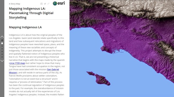
The Mapping Indigenous Los Angeles project from the University of California Los Angeles is creating a series of story maps that bring together a variety of stakeholders to help highlight “multiple layers” of diversity and identity. At the heart of the site are the story maps themselves, which unfold to reveal the complex history of place and the Indigenous peoples who have helped shape and been shaped by them. The story maps vary in length and depth, but all feature a variety of text, photos, podcasts, and other materials that help viewers immerse themselves in the subject matter and deepen their understanding. Check it out!
GIS Day 2019 is almost upon us. If you have an event and want to get the word out, send an announcement request through the About page and I will get it posted right away.
Here is one for the City of Irvine. They are celebrating GIS Day on November 14.
The big one at LA County will happen on November 13.
GIS Day will be celebrated at a number of colleges like: Pierce College, CSUN, and USC.
Channel Islands Regional GIS Collaborative (CIRGIS) will have GIS Day on December 6 at Ventura College. The keynote speaker will be Michael Goodchild.
Also make sure to register your event on the GIS Day website.

