
ESRI’s ArcGIS Living Atlas of the World can be described as an evolving collection of authoritative, curated, read-to-use global geographic information curated by ESRI and the GIS user community. It includes imagery, basemaps, demographics and lifestyle, landscape, boundaries and places, transportation, earth observations, urban systems, oceans, and historical maps, all of which can be combined with your own data.
Most can be used without signing in, but you will need an ArcGIS Online account for the more interesting ones. Here are a few I found that were interesting.
World Traffic Service – This map service presents historical and near real-time traffic information for different regions in the world. The data is updated every 5 minutes. This map service requires an ArcGIS Online organizational subscription.

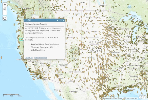
Current Weather and Wind Station Data – Created from hourly METAR station data provided from NOAA and contains approximately 11 weather variables for each location.
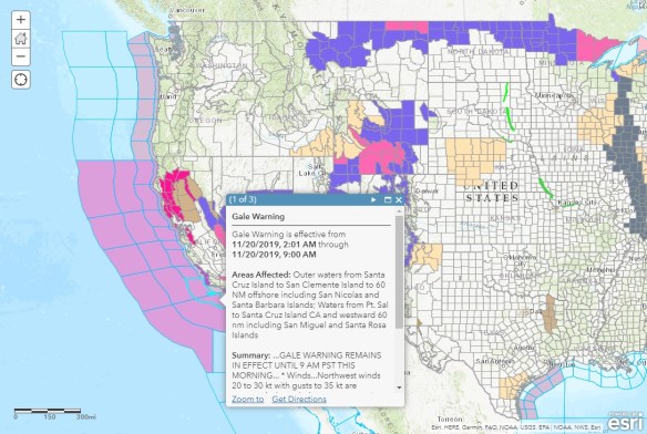
USA Weather Watches and Warnings – A live data feed from the National Weather Service containing official weather warnings, watches, and advisory statements for the United States.
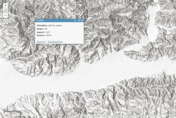
Terrain Multi-Directional Hillshade – This map provides a hillshaded surface generated dynamically using a multi-directional hillshade server-side custom function on the World Elevation Terrain layer.
Terrain Elevation Tinted Hillshade – This world elevation layer provides access to a tinted hillshade for use as a base map or in other visualization.
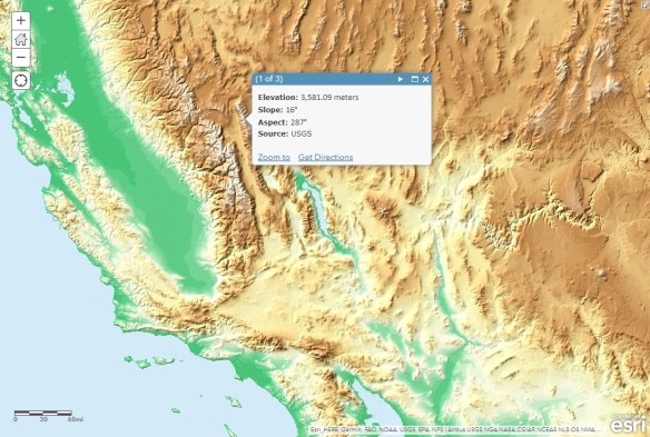
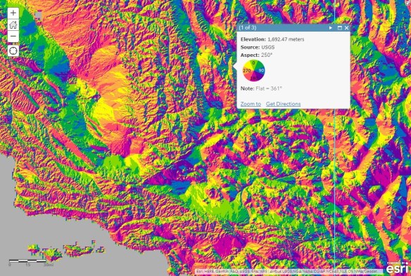
Terrain Aspect Map – This world elevation map provides a colorized representation of aspect for visualization.
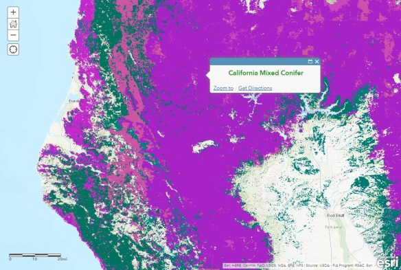
USA Forest Type – This layer contains the Forest Type across the contiguous United States and Alaska.
Terrain 3D – The Terrain 3D layer provides global elevation for your work in 3D.

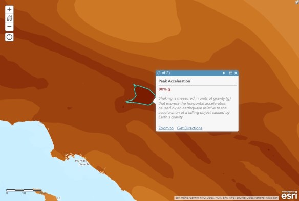
USA Earthquake Risk – This layer shows the probability of a 10% chance of exceeding the displayed horizontal ground acceleration within 50 years.
2019 USA Traffic Counts – This feature layer contains traffic counts in the United States.

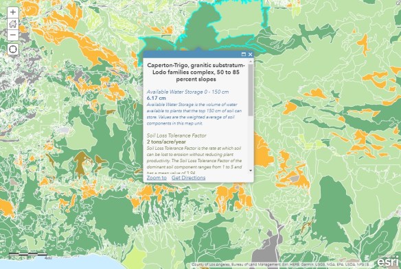
USA Soils Map Units – This map image layer displays the soils of the United States and associated territories derived from the SSURGO dataset.
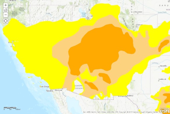
USA Drought Intensity (Current Conditions) – Current drought conditions from the U.S. Drought Monitor, updated weekly.
There is a lot more neat stuff. Check it out!
