It might be a good idea to start Christmas shopping early this year. For your map maniac, how about a Street Carvings map, 3 layers of precision cut wood using a 100 watt laser. Check it out!


It might be a good idea to start Christmas shopping early this year. For your map maniac, how about a Street Carvings map, 3 layers of precision cut wood using a 100 watt laser. Check it out!
Check out this world map made out of recycled wool!

Join us today at 7pm for a Day in the Life and the path to becoming a Crime Analyst. Free webinar and everyone welcome. Click below to sign up.

Prof Warren Roberts
Rio Hondo College
Looking to get outside for a few hours? Join us at a large area to social distance and watch Wingtra demonstrate the fixed wing vertical takeoff mapping drone starting at 10am Thursday October 15th above the San Antonio Dam, just 5 minutes from the Baseline offramp to the 210 freeway. Masks required.
Here is the 3 meter square location: https://what3words.com/unplanned.kings.nationals
And also let us know here so we can give any last minute updates if necessary: https://tinyurl.com/y48assbf
Hope to see you there!
Prof Warren Roberts
Rio Hondo College
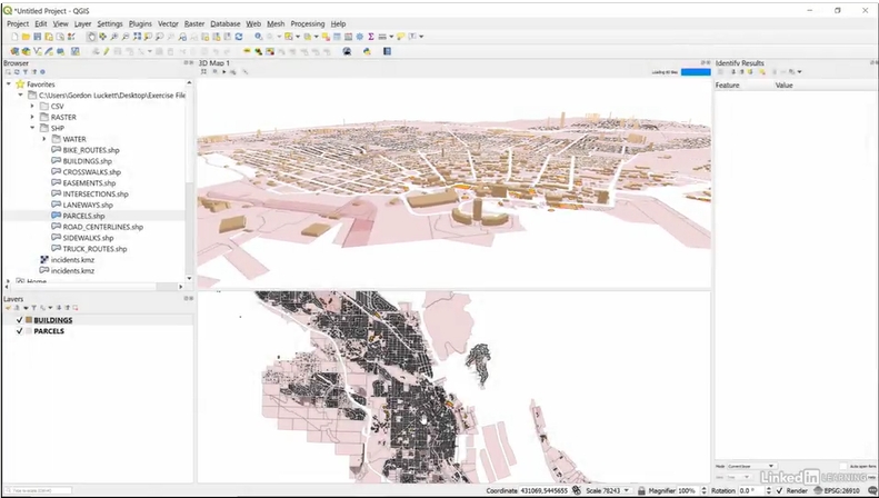
Always wanted to learn QGIS, but did not have the time? Maybe an online video format is for you, then you can pause it and get back to the lessons when you have time to continue! Check it out.
Looking for a voting center in LA County to vote in person? Check out their interactive map of voting centers. Some centers will be open as early as October 24th!
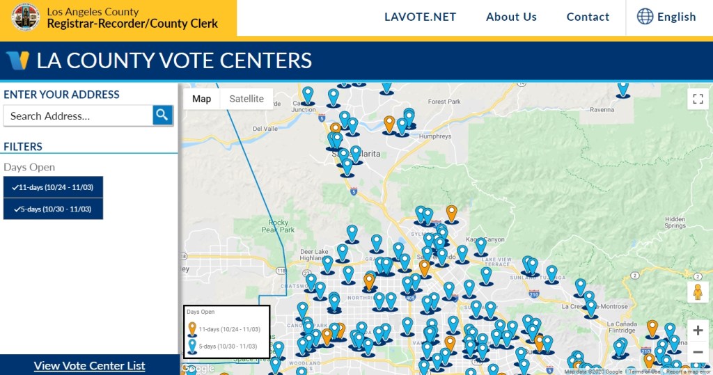
More info here: https://lavote.net/home/voting-elections/voting-options/voting-in-person
Ever get that annoying “Required Microsoft driver not installed” message when you try to open an Excel file in ArcGIS Pro? Check out ESRI’s guide to connecting to Excel files in ArcGIS Pro and fix it for good!

Here is a cool video of a year through the distant eyes of meteorological satellite Himawari-8, from December 21, 2015 to December 21, 2016. The satellite observes Earth in geostationary orbit at 140.7 degrees East following Earth’s rotation by travelling at approximately 11068 km per hour at a distance from Earth at 35768 km. Check it out and look for the March 9, 2016 total solar eclipse!
According to Google Maps Help, there is a COVID-19 layer that you can turn on in the Google Maps app on your phone. It displays the 7 day average for the number of new cases per 100,000 people. It also indicates whether cases are increasing or decreasing. More info on the Google blog.
I updated Google Maps on my phone, but it was not there in the layer list. I found this on a Google Maps Help page that new features are rolled out in stages and you might not get it right away. Perhaps it is working for you? Add a comment if you got it to work along with type of cell phone and carrier you have.
UPDATE 9/29/2020 – The COVID-19 layer magically appeared in Google Maps on my Android phone. Looks like the info is at the county level.
Need to automate data prep and aggregation? ArcGIS Notebooks might be your ticket! Sign up for a 60-minute webinar by ESRI’s spatial data science experts as they walk through how you can leverage the latest updates to ArcGIS Notebooks along with popular open source frameworks to automate, data prep and aggregate for a variety of workflows. The webinar is on September 30, 2020 at 9am PDT. Click here to register.
This webinar is an intermediate level session and serves as a follow up session to the previous recorded webinar, “How to use ArcGIS and Jupyter for Geospatial Data Science.” Watch the recording to learn about the fundamentals of ArcGIS Notebooks, data engineering concepts and more, prior to this session.
