Go to Google Maps, zoom to a location, and you will see the Pac-Man icon displayed in the lower left. Click on it to play Pac-Man using the streets!
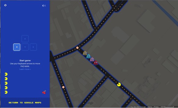


Go to Google Maps, zoom to a location, and you will see the Pac-Man icon displayed in the lower left. Click on it to play Pac-Man using the streets!
If you use Geocortex Viewer for HTML5, update your apps!
From Drew Millen, Geocortex Product Manager at Latitude Geographics Group:
Yesterday we were made aware of a potential security issue affecting all versions of Geocortex Viewer for HTML5, thanks to a vigilant customer contacting our Support team. While we don’t know of any specific attacks that may have exploited this vulnerability amongst our customers, we take potential security issues very seriously. We’re happy to report that we were able to respond quickly, and a patch will be available for download in the Geocortex Support Center in the coming hours. The patch involves replacing a single JavaScript file and does not require a re-install or that you update Geocortex Essentials. We recommend customers with applications that use Geocortex Viewer for HTML5 (all versions) apply the patch. Note that the upcoming release of Geocortex Viewer for HTML5 2.4 will not expose this vulnerability. Here’s what you need to know:
Here’s what we recommend you do:
We apologize for any inconvenience this issue may cause you. Please get in touch with us if you have any questions or if we can help.
GeoTech PCC Guest Lecture Series Spring 2015
Thursday, April 2, 7-9pm
Pasadena City College, Room E220
More details at http://geotechpcc.eventbrite.com
GeoTech PCC is a new program that just started this semester. We’re fortunate to have Jonathan Robinson and Chandler Sterling from the City of Pasadena give our first guest lectures. We want to make sure that those in the surrounding communities know about it!
Check out this map showing the autocomplete predictions of a “cost search” for each state’s capital. The search phase was “how much does a * cost in …”. Some of the autocomplete predictions were rather … well, you will see!

Back in 1913, the National Highway Association drew up the first proposed highway plan. Their campaign stressed that good roads lead to things like good schools, good health, good morals, good times, etc. Check out the article and maps leading up to the nation’s first nationwide system of numbered highways adopted in November 1926.

According to Jay Famiglietti, the senior water scientist at the NASA Jet Propulsion Laboratory/Caltech and a professor of Earth system science at UC Irvine, California has about one year of water supply left in its reservoirs. Are you ready to ration? What is your government agency you work for going to do? Imagine what this will do to California’s economy … and the way we will live here, or leave for greener pastures. Check out the LA Times Op-Ed piece.
See also USGS California Drought.
Check out this story about how a previously unknown map collection of a hospital dietician ended up doubling the size of the Los Angeles Public Library’s map archives in one single day!

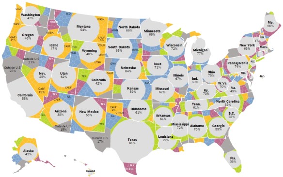
This interesting and interactive map comes from the New York Times. A lot of information is displayed showing migration information by state. Very good use of colors and symbols to show multi layered migration data. Select a year, then hover over the different areas of the state to get more info. Check it out.
Curious on how to make a wind map? Or maybe just a map of magnitude and direction of flow? I found this post that steps you through the process using ArcGIS Desktop.

Interested in map history? Doing a research projected in map history or cartography? You might want to check out The International Directory of Researchers in Map History.
The purpose of the directory is to promote communication among researchers who study the history of maps and to provide information about the field to the public. The directory is an open source for contact information, current interests, research projects, and publications related to map history. Check it out.

