The Ordnance Survey has a great posting of online resources for map design. Resources for colors, fonts, symbols, and inspiration. Check it out.
Online Resources for Map Design
Reply

The Ordnance Survey has a great posting of online resources for map design. Resources for colors, fonts, symbols, and inspiration. Check it out.
Android and iPhone users can now use their mobile devices as digital topo maps, leveraging USGS maps together with the power of GPS to zoom in on their precise location while hiking, biking, running, or any other activity that benefits from precision navigation.
The type of data that are available includes USGS imagery and topographic maps from The National Map, as well as road and contour layers. For more info, visit http://www.usgs.gov/newsroom/article.asp?ID=3580 .
Kenneth Appel, who used a computer to solve the four color map problem, dies at 80.

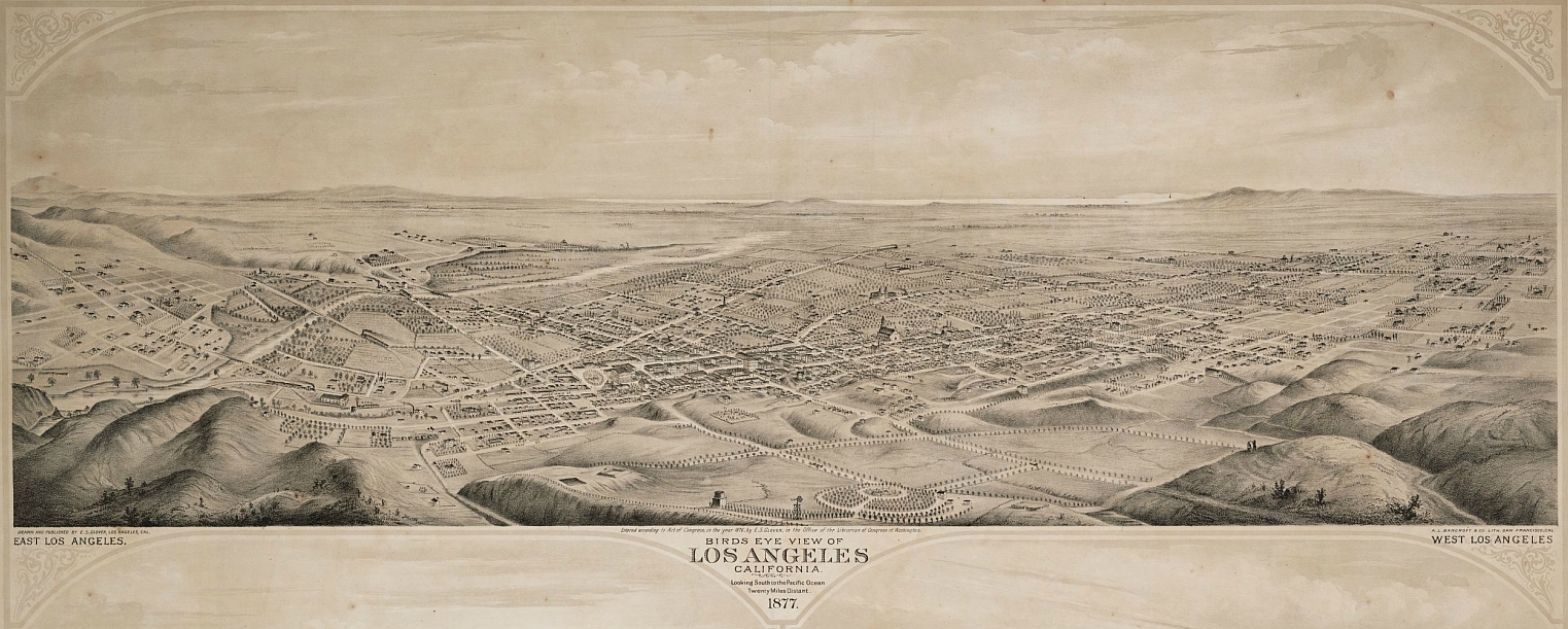
Check out UCLA Library’s collection Maps of Los Angeles, California, the United States, and the World.
Check out the new TopoView site. TopoView is intended to serve the immediate need for the older, conventionally printed topographic maps to become easily searched, viewed, and downloaded. The approximately 163,000 maps available through this interface were scanned by the USGS Historical Topographic Mapping Collection (HTMC) project.
Using a site that tracks dollar bills (Where’s George?), a theoretical physicist noticed that our state boundaries are rather arbitrary, but that money tends to stay within new, more realistic boundaries. Read the story here.

The State of California has a new GeoPortal web site for access to geospatial data resources. Check it out at http://portal.gis.ca.gov .
The California Geological Survey (CGS) has developed a new online tool that allows you to search all of CGS’s Regulatory Maps, Landslide Maps, and Tsunami Maps. Also included are related reports and GIS data.
Regulatory Maps include:
Landslide Maps include:
Tsunami Maps include:
CGS will be adding more product to the warehouse. Visit their site at http://www.quake.ca.gov/gmaps/WH/index.htm .
From govloop.com and ESRI, a very cool infographic on how GIS technology powers our daily lives.

Take a look at the Sea Level Rise and Coastal Flooding Impacts application from NOAA.

Besides setting sea level rise up to 6 feet, you can also display levels of confidence of the inundation areas, flood frequency, and socioeconomic vulnerability of nearby communities.
