Here is an interesting article from ESRI that shows you how to quickly make a fire map using ArcGIS Online and ArcGIS Living Atlas. Check it out!

Here is an interesting article from ESRI that shows you how to quickly make a fire map using ArcGIS Online and ArcGIS Living Atlas. Check it out!
If you use Survey123 in your organization, a new update is now available. With this release, Survey123 Connect and the Survey123 web designer will help you create more powerful forms, including ranking questions, choice randomization, and choice filters. You will also be able to more easily create Survey123 report templates. Click below for more info.

Since wind is the topic today through tomorrow in SoCal, check out the Windfinder interactive map. You can move forward and backward in time to see what is forecast for wind in your area.

Have a favorite wind app? Post a comment so others can check it out.
GIS Day 2020 is about a month away, November 18. For most of us, we will need to do something virtual this year. Check out this ESRI article about making a virtual GIS Day event a success.

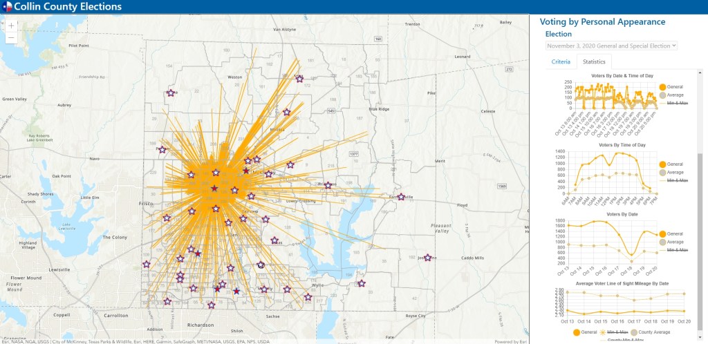
I found this one to be pretty interesting. It is an interactive map from Collin County, Texas. During early voting right now, voters can vote at any polling location. The GIS team there takes daily voter roster counts and displays a spider diagram for each voting center (when you click on one), showing you where voters are traveling from to each voting center. Statistics like voters by time of day and date are also displayed to the right. You can also change what voting days you want to look at. Pretty cool!
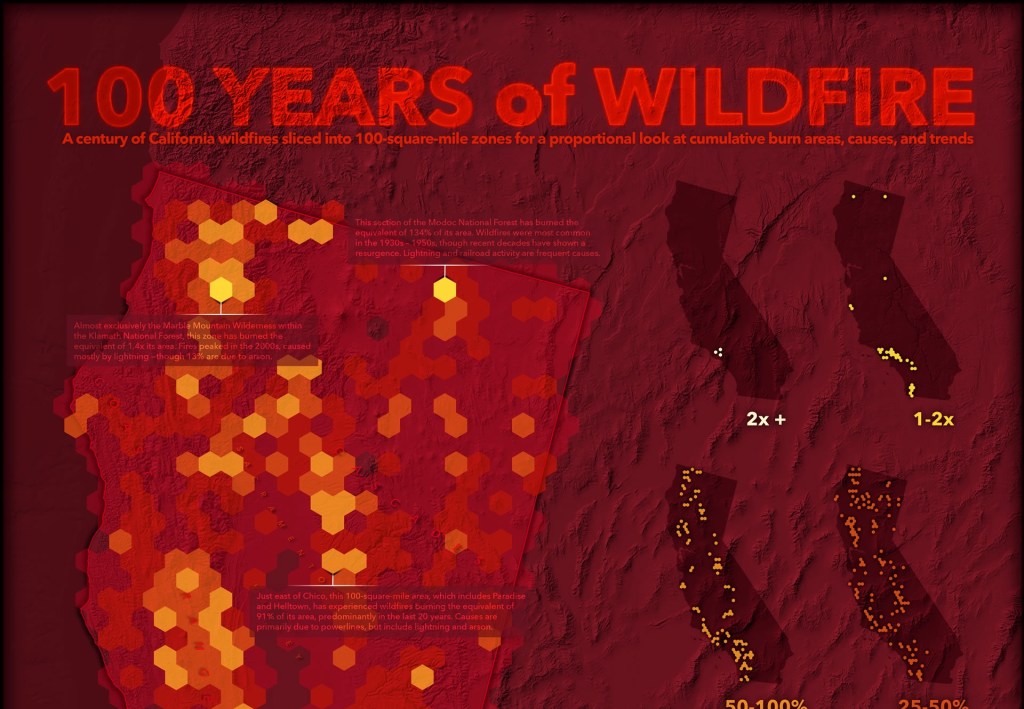
Here is an interesting ESRI article about using ArcGIS Pro geoprocessing to create aggregated fire cells of fire data, symbolizing the data, and using ArcGIS Maps for Adobe Creative Cloud to finish the cartography for a 100 Years of Wildfire map. Some great techniques show here. Check it out!
It might be a good idea to start Christmas shopping early this year. For your map maniac, how about a Street Carvings map, 3 layers of precision cut wood using a 100 watt laser. Check it out!

Looking to get outside for a few hours? Join us at a large area to social distance and watch Wingtra demonstrate the fixed wing vertical takeoff mapping drone starting at 10am Thursday October 15th above the San Antonio Dam, just 5 minutes from the Baseline offramp to the 210 freeway. Masks required.
Here is the 3 meter square location: https://what3words.com/unplanned.kings.nationals
And also let us know here so we can give any last minute updates if necessary: https://tinyurl.com/y48assbf
Hope to see you there!
Prof Warren Roberts
Rio Hondo College
Looking for a voting center in LA County to vote in person? Check out their interactive map of voting centers. Some centers will be open as early as October 24th!
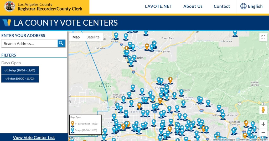
More info here: https://lavote.net/home/voting-elections/voting-options/voting-in-person
Ever get that annoying “Required Microsoft driver not installed” message when you try to open an Excel file in ArcGIS Pro? Check out ESRI’s guide to connecting to Excel files in ArcGIS Pro and fix it for good!