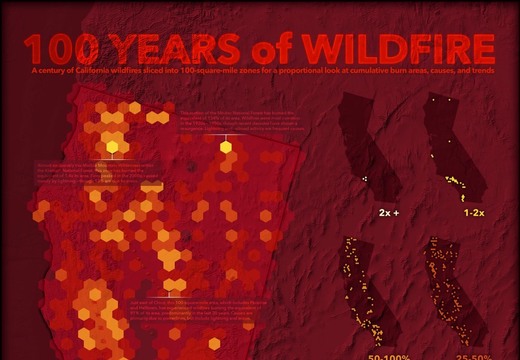
Here is an interesting ESRI article about using ArcGIS Pro geoprocessing to create aggregated fire cells of fire data, symbolizing the data, and using ArcGIS Maps for Adobe Creative Cloud to finish the cartography for a 100 Years of Wildfire map. Some great techniques show here. Check it out!