Do you like maps? Do you like lamps? If you said YES to both, then you must get a map lamp! You know you want one!
4 out of 5 GIS Analysts think map lamps are cool. Even Chuck Norris approves map lamps.

So go get yours today! 🙂


Do you like maps? Do you like lamps? If you said YES to both, then you must get a map lamp! You know you want one!
4 out of 5 GIS Analysts think map lamps are cool. Even Chuck Norris approves map lamps.
So go get yours today! 🙂
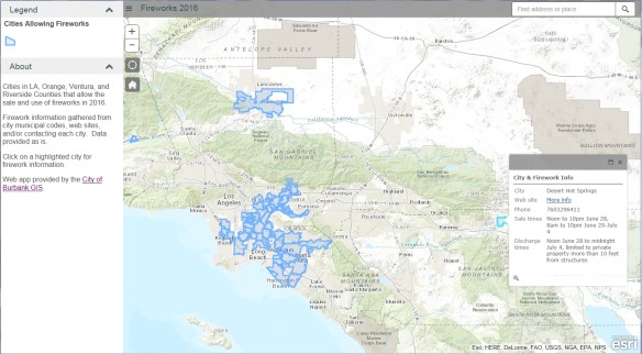
Our next stop for California Friday is actually many locations. July 4th will be here soon and that means Fireworks! The fireworks app I have used for the past few years has been updated once again. This year I added Riverside County. If you love fireworks and want to find out where you can legally buy and shoot them off in SoCal, check out the app!
You can view cities in LA, Orange, Ventura, and Riverside County that allow the sale and discharge of fireworks. Included are days and times when fireworks will be sold and when you can light them up, as well as links to city web sites and telephone numbers. Data was collected from municipal codes, web sites, and/or contacting each city. Enjoy!
For a list of 296 communities permitting state-approved fireworks in California, check out the California Fireworks Newswire website.
Check out this article about Tom Harrison, a Californian cartographer who started his own mapmaking business in the 1970’s. His maps are made for hiking, backpacking, and mountain biking in the parks and wilderness of California. He explains what goes into a good map and why making one can take nearly two years.
You can order his maps from here.
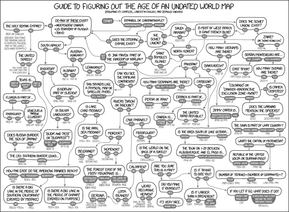
Fantastic flowchart by xkcd showing how you can determine the age of an undated world map … or sometimes not!
Our next stop for California Friday is Gravity Hill in Sylmar. For those of you that grew up in the San Fernando Valley, you probably remember going to Gravity Hill to experience your car rolling “uphill” without any power. To make it extra creepy, it was best to experience this phenomena in the dark of night because Gravity Hill was next to a cemetery. Then add in a legend about a school bus crash that happened there and the children that died will push your car to keep you from the same fate … that makes it even more creepy! Continue reading
I thought I would start a fun blog series called California Friday which focuses on underrated or unusual places to visit in California. Sure, it’s not GIS related, but might make for interesting weekend trips or places to stop at while staring at your GPS as it recalculates your route! We will see how this goes for a few months. Let me know how you like it, or if you visited the place add a comment to tell us some insider stuff to do.
Our first stop is little Amador County, just southeast of Sacramento. Here you can step back in time and visit wine country as it was with tiny, family owned wineries tasting vinos you would not find elsewhere. Continue reading
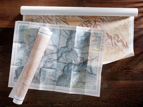
At the close of the Second World War, the United States government embarked on an enormous artistic enterprise. It is estimated to have cost nearly $3 billion and, at its height, employed more than 2,000 people. I am talking about the topographic mapping program of the United States Geological Survey.
Read more on the New York Times Magazine website by clicking below.
Check out this interactive Zika Virus Outbreak map and timeline. You can map other outbreaks as well from their main page at Healthmap.org.

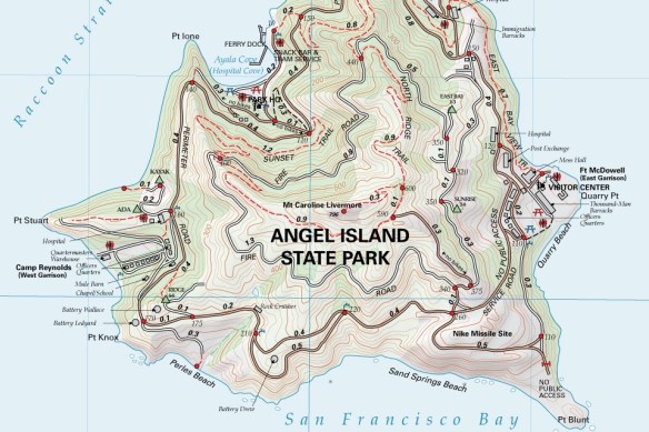
If you find yourself near Stanford University on April 19th to 22nd, you should drop by the grand opening of the David Rumsey Map Center. Continue reading
On 1 April 1977 the Guardian produced a 7 page travel supplement on the tiny tropical republic of San Serriffe, “a small archipelago, its main islands grouped roughly in the shape of a semicolon, in the Indian Ocean”, which was apparently celebrating ten years of independence. The article included a map of the island republic. Continue reading
