The 2014 ESRI User Conference Proceedings are available for viewing. Included are papers, presentations, case studies, and technical workshops.
2014 ESRI User Conference Paper Sessions/Workshops
Reply

The 2014 ESRI User Conference Proceedings are available for viewing. Included are papers, presentations, case studies, and technical workshops.
Kristina Jacob from the City of Santa Clarita is sharing her photos from the 2014 ESRI Conference. Check them out!
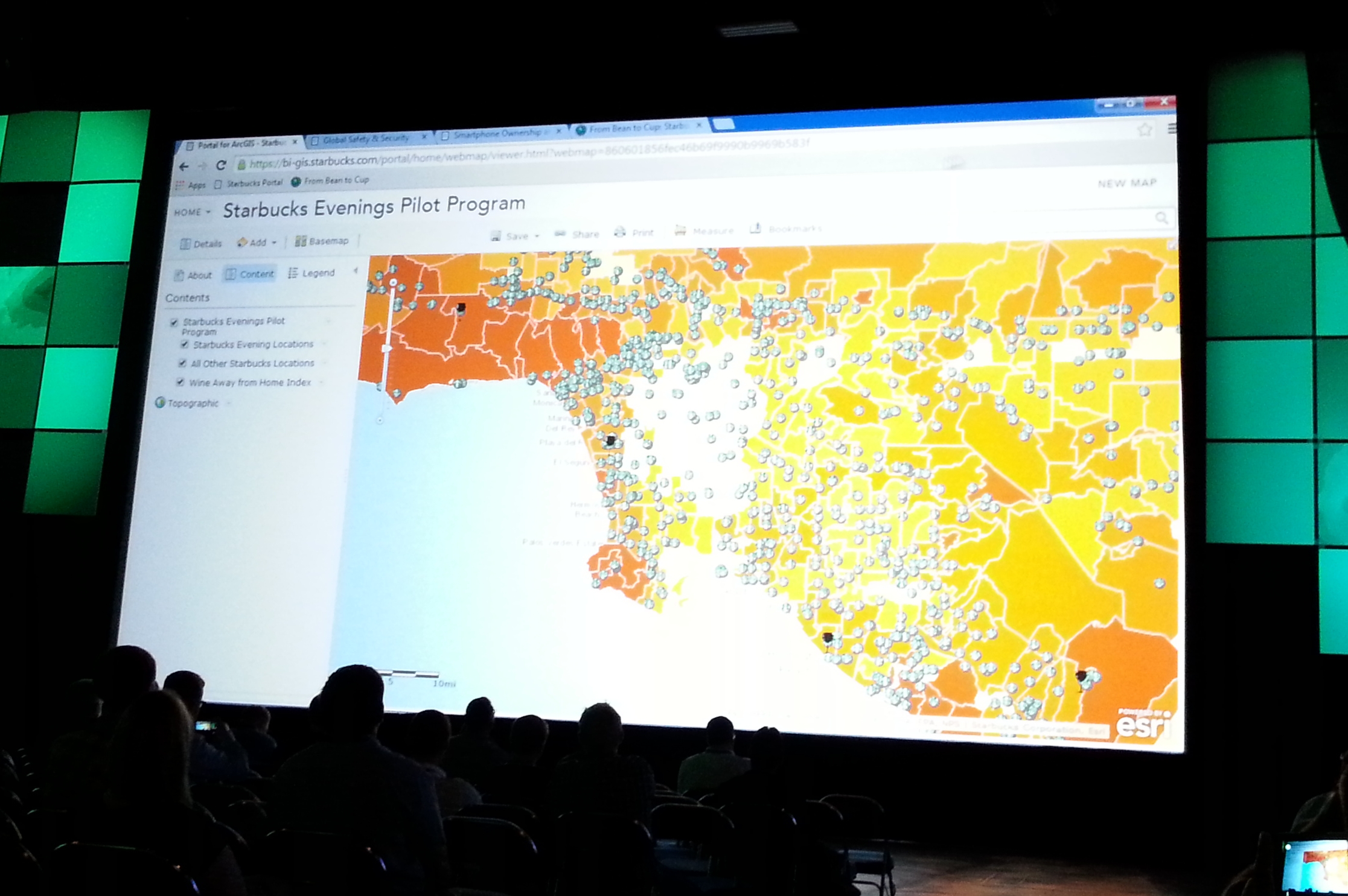
For those of you that could not make the conference this year, here are some highlights that I took away from the first day:
So there you go. And also, I bet if you wait a day, ESRI will put their first day presentations online at video.esri.com. Check it out! -mike
Found this article interesting reviewing the Q&A for this years ESRI Conference:
You can see how ESRI is really pushing the cloud option. Also ArcGIS Pro will be tightly linked to ArcGIS Online or Portal.
Hope to see some of you there at the conference next week! -mike
Southern California GIS Community Meeting
ESRI Conference in San Diego next week
Tuesday, July 15, 2014, 12pm to 1pm
Room 25C, San Diego Convention Center

This meeting is an opportunity for the GIS community in Southern California to meet and socialize. If you are a GIS professional, student, instructor, or interested person, you are invited to get together and meet each other. The event is open to everyone, and is supported by SoCalGIS.org, Geospatial LA, the LA Regional GIS Forum, and LA County Enterprise GIS. So go ahead and grab your lunch and bring to the 2nd annual meeting of the Southern California GIS Community!
If you graduated with a Geography degree from CSULB, attended some classes in Geography or GIS, still there trying to figure out when it will all end, know someone from CSULB Geography, know Frank, know someone who knows Frank, had the privilege of taking a class “taught” by Frank, suffered in Frank’s class, heard a story about a guy named Frank, or now you are just curious who this Frank guy is anyway, then come join us at our annual CSULB Geography get together at TOP GUN, Wednesday night around 6pm during the ESRI Conference in San Diego next week.

Hope to see you all there! And yes, you too Frank! -mike
NAPSG Foundation is holding a one-day Los Angeles Region Summit on September 15, 2014, in Los Angeles, California. Just one block from the historic Union Station in downtown Los Angeles. This event will convene current and new NAPSG partners from the Los Angeles Region and across Southern California, from all public safety disciplines and levels of government.
The Summit will provide you with an opportunity to learn about the status of Public Safety GIS in the Los Angeles Region and to interact with other public safety officials and GIS professionals.
Who Should Attend? Operations and technical public safety officials, across all disciplines, who are interested in learning more about the requirements and application of GIS in day-to-day public safety operations. Including:
And all other Public Safety & GIS Personnel
Agenda topics will include:
Registration will open in early August, and space will be limited. There is no cost for public safety and other government officials.
Where & When
The California Endowment
1000 N Alameda St
Los Angeles, CA 90012
September 15, 2014, 8:30-4:30pm
Hey CalGIS folks,
We’re starting preparations for the 2015 CalGIS and I’m super excited. As mentioned during 2014 CalGIS, we want to get your opinions on a few things before we move forward with location selections. I really appreciate you taking the time to respond to this survey, it should take you less than 2 minutes. We’ll be closing the survey on June 18 so if you want a say, respond before then.
Here’s the link: 2015 CalGIS Location Survey
Thanks!
Christina Boggs
2015 CalGIS Conference Chair
Christina.Boggs@norcalurisa.org
Group: Geospatial LA
Subject: Geospatial LA is THIS WEDNESDAY, June 4th @ CalTech – 5:30pm
Imagin’ Labs & PIXIA Corporation are hosting the meeting this Wednesday in Pasadena for an evening focused on imagery, sensor data collection, processing and remote sensing.
PRESENTERS:
MEETUP DETAILS (hosted by Imagin’ Labs):
Date: Wednesday, June 4th Time: 5:30pm
Where: Caltech, 1200 E California Blvd, Pasadena, CA 91125 In the Buwalda room, first floor of the Arms building, which is building #25 on the campus map: http://www.caltech.edu/map/
Parking:
Free after 5pm in the campus structures, I suggest parking in structure #123 on the map, which is approximately at: 485 S Wilson ave, Pasadena, CA 91106
MEETUP SOCIAL (hosted by PIXIA Corporation):
When: Approximately 7:30pm – on
Where (New Location!): Lucky Baldwins Trappiste – 1770 East Colorado Blvd.
Hi all,
Attached you will find the agenda for the GIS Council Meeting to be held this Thursday May 22nd from 9am until noon in Sacramento. The address and teleconference/webinar information is included. We encourage people from all regions of California to participate in Thursday’s meeting, and in future California GIS Council Meetings. One agenda item is to plan out the meeting times and locations for at least the coming year, so please think about where/when we may hold some of the meetings in Southern California.
Please remember that this is the first meeting of the Council in over three years, so we do have a lot to cover. The agenda is meant as a guideline for the discussion, and we will follow it as closely as possible while still remaining flexible.
If you have any questions, please contact one of us (below). We look forward to seeing you (or hearing from you) on Thursday at 9am.
Sincerely,
Karen Beardsley, PhD, GISP
Managing Director, Information Center for the Environment (ICE)
Department of Environmental Science and Policy
One Shields Avenue
University of California
Davis, CA 95616
Ph: (530) 752-5678
Fax: (530) 752-3350
Cell: (530) 848-3310
kbeardsley@ucdavis.edu
