Starting April 11, 2018, ESRI will update their Landsat Image Services. Improvements include revised scaling of Top of Atmosphere (TOA) reflectance values, daily updates, new QA band, a new field to keep track of Landsat product ID, and WCS/WMS compatibility. For more info visit ESRI’s blog posting here.
Author Archives: socalgovgis - Michael Carson
Tracking the Falling Chinese Space Station
The Chinese space station Tiangong-1 was launched in 2011. It stopped communicating with ground control back in March 2016. With no way to bring it down into a controlled descent, it is now slowly falling closer to Earth’s atmosphere. Scientists have only been able to wait for its orbit to decay and now it’s expected to tumble to the ground or ocean in the next few days.
Both amateurs and government agencies are trying to figure out where and when it will arrive. Some sites like SatView are running live streams of Tiangong-1’s current location and predict where it might fall to Earth.
The most current prediction at the time of this writing is Monday April 2 at 01:05 UTC. Check it out!
ArcGIS Offline Data Collection Without a Named User
Use ArcGIS Server? Want to edit data out in the field with disconnected editing capability but don’t want to be forced into the ArcGIS named user model just to use Collector? Webmapsolutions.com might have an answer for you! They have built an offline-enabled ArcGIS data collection app which works with ArcGIS Server (no named user required), but can also work with Portal and ArcGIS Online! Check it out.
LARIAC5 Imagery
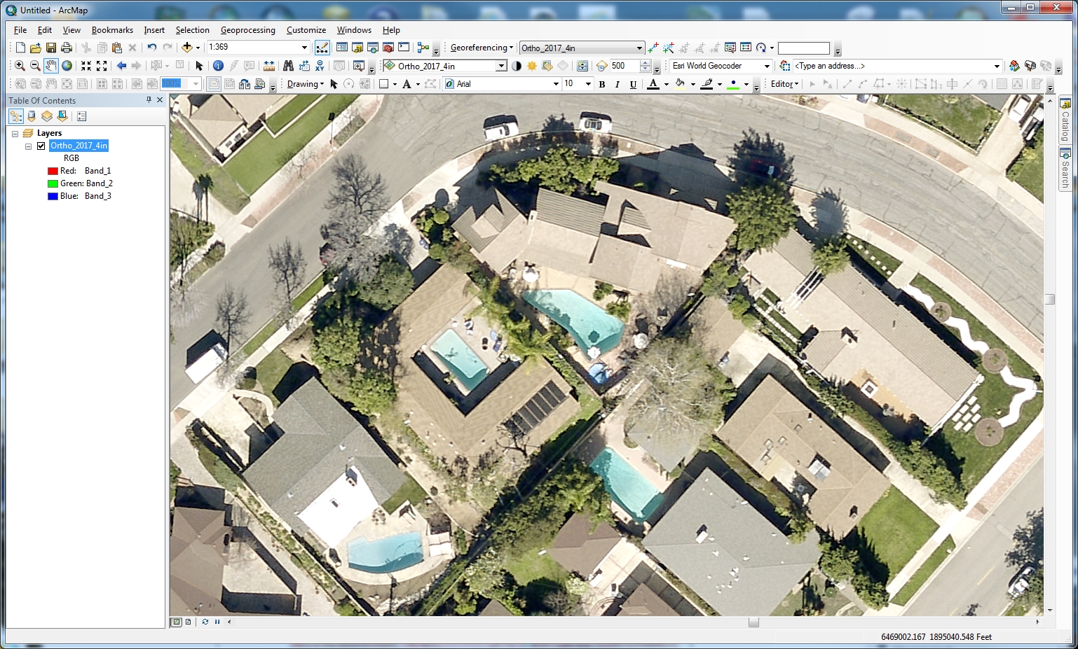
Burbank received the LARIAC5 2017 imagery and I must say it looks great! Click to enlarge.
Also, this time around the imagery has 4 bands, band 4 being near infrared, so you can display color infrared (CIR) to make the vegetation pop. Just set the Red band to 4, the Green band to 1, and the Blue band to 2:
Very cool. Great job LA County! -mike
Extracting MORE Features from Map Services
Back in August 2015 I posted information about how you can extract features from a map service. Since then, I have had many contact me about modifying the code so it can extract features beyond the record limit set in the map service. So today I decided to work on one that does!
To test the script, I headed over to the map services provided by the State of California GIS. Specifically, the one for wildfires:
http://services.gis.ca.gov/arcgis/rest/services/Environment/Wildfires/MapServer
When you scroll down a quick look will reveal that there is a maximum record count of 1000:

California Releases “EQ Zapp”
The California Earthquake Hazards Zone Application (“EQ Zapp”) is an online map that allows anyone with a computer, tablet, or smartphone to conveniently check whether a property is in an earthquake hazard zone. Earthquake hazard zones include fault rupture areas, liquefaction areas, and earthquake induced landslides. Check it out!
Free Story Maps Training for Students
This afternoon at 1:30 PM, SCAG has a free Story Maps training class with Bern Szukalski at SCAG’s offices in Downtown LA at 1:30pm. Sign up now and hurry: https://t.co/cX7GvGEGBJ .


USGS Water Resources and Land Change Information
The USGS Library provides reference services and instructional sessions to library users on finding print, digital, and online library materials. They are offering two webinars.
The first will focus on how to find and use information sources and products related to water use, surface water, groundwater, water quality, floods, droughts, and hurricanes (data, databases, publications, maps, and field and laboratory methods). Click here for more info and to register.
The second will focus on how to find and use information sources and products related to long-term and short-term land changes from natural-hazard events, land-use change, and example reference inquiries related to finding current and historical land information. Click here for more info and to register.
Both webinars will also cover education tools available from the USGS and other geoscience stakeholders.
ESRI Acquires ClearTerra Location Data Extraction Technology
ESRI has announced it has acquired technology from ClearTerra, a creator of geospatial and activity-based intelligence tools. This acquisition will provide the ArcGIS platform users the ability to easily discover and extract geographic coordinates from unstructured textual data like emails, briefings and reports, instantly generating intelligent map-based information.
This capability will make mapping this information easier across many industries. Defence, intelligence, and public safety organizations tend to have massive volumes of unstructured data, as do other fields such as petroleum, utilities, and maritime, where locating information on the earth is not as easy as searching for a street address. ESRI’s acquisition of ClearTerra technology brings workflow-enhancing software technologies into the ArcGIS platform.
ClearTerra LocateXT technology allows analysts to rapidly scan through documents without having to spend hours reading, copying, pasting and running spreadsheet formulas, placing the results instantly into geospatial features. Additionally, ClearTerra FindFZ technology provides enhanced search capabilities for the ArcGIS platform, incorporating the powerful techniques found in internet search engines.
ClearTerra has been an active member of the ESRI partner program, providing their software to ArcGIS users via desktop, server and the cloud. Support and maintenance for the software will continue via ESRI with no interruption of service and is readily available for licensing.
Waldo Tobler
Waldo R. Tobler, professor emeritus of Geography, famed cartographer and founder of the first law of geography, passed away on February 20, 2018 at the age of eighty-eight. Some of you might remember Waldo Tobler. I remember his work while studying Geography and GIS in college many years ago.
Waldo Tobler trained as a mathematical cartographer, and is best known for his contributions to that field. He coined the term “analytical cartography” to reflect the combination of mapping and analysis. He was also responsible for the statement known as Tobler’s First Law of Geography, “all things are related but nearby things are more related than distant things”, a somewhat offhand comment in an early paper that has proven to be enormously important in the development of geographic information science.
Click here and here for more information about Waldo Tobler.