Unknown's avatar

About socalgovgis - Michael Carson

Michael Carson, GIS Manager (retired) for the City of Burbank and President of Southern California Government GIS User Group. Currently teaching GIS at College of the Canyons in Santa Clarita.

Geo Innovation and Entrepreneurship

The Center for Information Systems and Technology, at Claremont Graduate University, is expanding its outreach to the GIS community. As part of this effort, they are co-hosting with ESRI, a one-day conference entitled “Geo Innovation and Entrepreneurship”.

The event is scheduled for April 11th and will be held on their campus in Claremont. There are two sessions and you are welcome to attend one or both. You are also invited to attend their evening reception at the end of the day should you not be able to attend the other sessions.

A detailed outline regarding the conference, sessions, and presenter biographies is located on Eventbrite.

There is no cost to attend, other than your time, and they will be providing refreshments during the sessions as well as lunch.  Check it out!
“Daylight Saving” Time?

Once again “Daylight Saving” is upon us.  I put that in quotes because nothing is being saved … more like stolen!

timezones

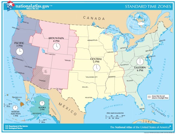
You heard the expression “robbing Peter to pay Paul”?  That is what Daylight Saving Time does, it pushes your state into the time zone to the east, so California moves into the Mountain Time Zone.  But nature does not care, the sun will rise and set as usual, however because you shifted your clock to the east it GIVES THE ILLUSION of setting later in the day … and rising later as well!  If you are a morning person, dealing with that extra darkness in the morning really sucks!

Continue reading →

SCAG 2019 Student Showcase

The Southern California Association of Governments, or SCAG, is excited to announce a major opportunity for college and university students in the region. On May 2, 2019 SCAG’s annual Regional Conference & General Assembly will feature a special Student Showcase session featuring sustainability planning posters and GIS Story Maps selected through a competitive application process. This will be an opportunity for students to share their work with more than 1,000 elected officials, planners, and regional leaders.

Students whose projects are chosen will be designated as SCAG Conference Fellows, receiving complimentary event registration, hotel accommodation and admission, and access to local elected officials and planning experts on Southern California. Additionally, projects from each category will be will be selected to compete for thousands of dollars in cash prizes, four cash prizes totaling $6,000.

For more information about the contest, click here.

Students may also sign up for free Story Map training on March 15th at SCAG.  To register for the training session, please RSVP here.

For questions, please contact Mike Jones at (213) 236-1978 or jonesm@scag.ca.gov.

Earn Your MSGISci at CSULB

If you are interested in earning a graduate degree in GIS, consider the Masters of Science in Geographic Information Science (MSGISci) degree at California State University Long Beach (CSULB). The MSGISci is a 1-year, 30-unit MS degree program. In-person classes are offered on weeknights and weekends to accommodate working professionals. Program details and application instructions can be found at http://www.beachgis.com. Review of completed applications begins April 1, 2019.

Top Searched Trader Joe’s Items

Finally, a Trader Joe’s map of food items!  This map shows the most popular item that was searched for on Google by state.  The winner?  13 states favored Sweet Chili Sauce.  California was the only state that favored Unexpected Cheddar.  Click below to read on!

traderjoesitems

This map is even more interesting because I could not find any Trader Joe’s locations in Montana, Wyoming, North Dakota, South Dakota, Mississippi, Arkansas, West Virginia, Hawaii, and Alaska using the Trader Joe’s location tool.  I guess people are buying on Amazon and Ebay?

Internet Bird Collection

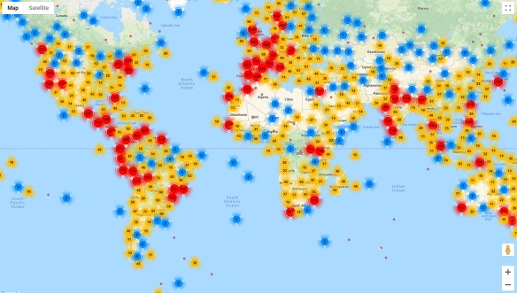
If you like birds, the Internet Bird Collection (IBC) is an excellent place to spend some time.  The IBC is an online audiovisual library of videos, photos, and sound recordings of the world’s birds created with the ultimate goal of disseminating knowledge about the world’s avifauna.  You can explore multimedia materials and recordings of thousands of bird species crowdsourced by birdwatchers around the world, with their species identifications cross-checked by trained ornithologists.  This vast collection can be searched and filtered by family name (common or scientific), country, keyword, date, and more, and each media entry includes a location map and shows other media recorded nearby.  Those interested can create a free account and contribute their own bird photos, videos, and sound recordings.  Check it out!

internetbirdcollection

Atlas of Endangered Alphabets

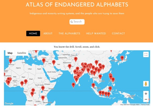
The Atlas of Endangered Alphabets is a fascinating project that anyone curious about written languages can enjoy and learn from. Visitors to the atlas can browse dozens of writing systems by their place of origin via the interactive map. While many of the languages represented in the atlas are spoken today, their written forms may have declined in use or have only recently been developed. Each language has its own page with images, profile, and links to additional resources. Check it out!

atlasofendangeredalphabets