Just a shout out to Pasadena for the great job on their presentation at the ESRI User Conference on Monday! If you missed it, check it out here.
I did not even know about the new ESRI software Tracker for ArcGIS and ArcGIS QuickCapture. Very cool!


Just a shout out to Pasadena for the great job on their presentation at the ESRI User Conference on Monday! If you missed it, check it out here.
I did not even know about the new ESRI software Tracker for ArcGIS and ArcGIS QuickCapture. Very cool!
Back in the 1920’s agriculture played a dominant role in the San Fernando Valley region. At one point 75,000 acres of Valley land between towns and subdivisions was used for farming, which included 750,000 citrus trees.
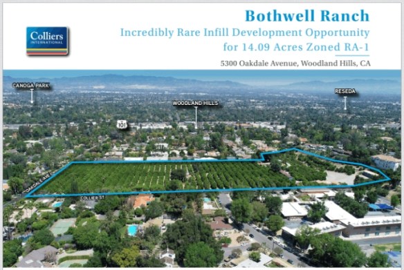
By the 1990’s the Valley’s working citrus industry dwindled to just one, the Bothwell Ranch. It is located in Tarzana at the corner of Oakdale Ave and Collier St, just a half mile south of Ventura Blvd.
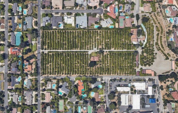
Now it is up for sale. The asking price is $13.9 million. Collier International and Coldwell Banker is billing the property as “an incredibly rare infill development opportunity”. Marketing materials include a site plan that would split the 14 acres into 26 half acre lots for development into 2-4 million dollar single family homes. How sad. Click below to read the article about it.
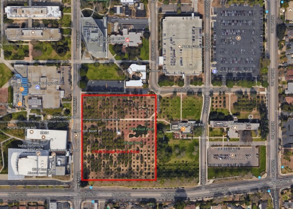
The good news is that not too far away is the last historic orange grove of San Fernando Valley owned and protected by CSUN. The area includes 400 orange trees, a pond, bistro, and observatory. The orange grove has thousands of fresh, free oranges waiting to be picked by you! Anyone from anywhere can pick oranges at any time from the orange grove. Have fun, and make sure to feed the red-eared slider turtles in the pond too!
July 4th is just around the corner, which means there will be fireworks again!
Use the app to view cities in LA, Orange, Ventura, Riverside, and San Bernardino County that allow the sale and discharge of fireworks. Included are days and times when fireworks will be sold and when you can light them up, as well as links to city websites and telephone numbers. Data was collected from municipal codes, websites, and/or contacting each city. Some cities allow sales to start today AND allow you to discharge them today as well! Check it out!

The standard slope tool in ArcGIS Desktop only examines a 3×3 cell neighborhood (and does not include the center cell) to determine slope for each cell. However, using Python you can create a method for calculating slope along a flow direction grid specific to your needs. Check out this article about using Python to calculate a fire “flow direction” based on a DEM and fire lines.

You are entrenched in your current GIS software. Can you do more by moving to a different GIS? Click below to see the 27 differences between ArcGIS and QGIS.

NASA has been directed to land astronauts at the lunar south pole by 2024. Check out the Lunar South Pole Atlas site that includes maps, images, and illustrations designed to provide context and reference for those interested in exploring the area.

Google Maps will now show you natural disasters leading up to and after they strike. Included are hurricanes, earthquakes, and floods. Click below to read all about it.

Just a reminder that Spatial@UCSB will be happening this Thursday, June 6. This year’s theme is Spatial Data for Smarter Cities.
Where: Corwin Pavilion, UCSB – 494 UCEN Rd, Isla Vista, CA
When: Thursday June 6th, 11:00 to 2:30 pm
Agenda:
11:00 Plenary Session:
12:30 – 2:30 Lunch and Poster Exhibit
Registration has been extended to the end of Tuesday, June 4th. Please contact Karen to RSVP: kdoehner@spatial.ucsb.edu or (805) 893-8224.