Unknown's avatar

About socalgovgis - Michael Carson

Michael Carson, GIS Manager (retired) for the City of Burbank and President of Southern California Government GIS User Group. Currently teaching GIS at College of the Canyons in Santa Clarita.

Twelve Things Worth Knowing from ESRI 2014 User Conference Q&A

Found this article interesting reviewing the Q&A for this years ESRI Conference:

http://apb.directionsmag.com/entry/twelve-things-worth-knowing-from-esri-2014-user-conference-qa/407604

You can see how ESRI is really pushing the cloud option.  Also ArcGIS Pro will be tightly linked to ArcGIS Online or Portal.

Hope to see some of you there at the conference next week! -mike

British Library Needs Your Georeferencing Help

Over 3,000 (primarily) 19th century maps in books from the British Library collections have been extracted from the scanned volumes and they need your help georeferencing and overlaying the scanned maps. To help, visit http://www.bl.uk/maps/ .

The images are public domain and may be downloaded from Flickr (jpeg), and the overlays (kml) and coordinate data (wld) from BL Georeferencer.

britishlibrary

Southern California GIS Community Meeting at ESRI Conference

Southern California GIS Community Meeting
ESRI Conference in San Diego next week
Tuesday, July 15, 2014, 12pm to 1pm
Room 25C, San Diego Convention Center

This meeting is an opportunity for the GIS community in Southern California to meet and socialize. If you are a GIS professional, student, instructor, or interested person, you are invited to get together and meet each other. The event is open to everyone, and is supported by SoCalGIS.org, Geospatial LA, the LA Regional GIS Forum, and LA County Enterprise GIS. So go ahead and grab your lunch and bring to the 2nd annual meeting of the Southern California GIS Community!


CSULB Geography Get Together at TOP GUN

If you graduated with a Geography degree from CSULB, attended some classes in Geography or GIS, still there trying to figure out when it will all end, know someone from CSULB Geography, know Frank, know someone who knows Frank, had the privilege of taking a class “taught” by Frank, suffered in Frank’s class, heard a story about a guy named Frank, or now you are just curious who this Frank guy is anyway, then come join us at our annual CSULB Geography get together at TOP GUN, Wednesday night around 6pm during the ESRI Conference in San Diego next week.

Hope to see you all there!  And yes, you too Frank!  -mike

New Wiki for Education Users of ArcGIS Online

If you are a faculty or staff member in a higher education institution that teaches GIS, you might want to take a look the new wiki titled “ArcGIS Online Coaching Points for Higher Education“.  ESRI states:

ArcGIS Online is an evolving cloud-based GIS software as a service. It is updated several times a year. Educators and Esri staff need a dynamic medium to share problems and advice. This wiki supports the ArcGIS Online education community by providing such a medium.

We encourage education users to post the challenges they face as scenarios in the relevant sections of this wiki. Experienced ArcGIS Online users and Esri staff will respond with advice (i.e., “coaching points”) that help users overcome challenges. To add your scenarios and coaching points to the wiki, simply create an account to gain editing privileges. The team that hosts wiki.gis.com provides plenty of online help.

Probably something to check out before you go to the 2014 Education GIS Conference.

NAPSG Los Angeles Regional Summit

NAPSG Foundation is holding a one-day Los Angeles Region Summit on September 15, 2014, in Los Angeles, California.  Just one block from the historic Union Station in downtown Los Angeles. This event will convene current and new NAPSG partners from the Los Angeles Region and across Southern California, from all public safety disciplines and levels of government.

The Summit will provide you with an opportunity to learn about the status of Public Safety GIS in the Los Angeles Region and to interact with other public safety officials and GIS professionals.

Who Should Attend? Operations and technical public safety officials, across all disciplines, who are interested in learning more about the requirements and application of GIS in day-to-day public safety operations.  Including:

  • Public Safety – Emergency Managers, Fire Service, EMS, Law Enforcement, Fusion Centers
  • Search & Rescue Coordinators
  • GIS Coordinators
  • Transportation Agencies
  • Public Safety & Homeland Security Officials
  • GIS Analysts, Specialists, Managers
  • IT Support Personnel
  • Industrial Emergency Responders

And all other Public Safety & GIS Personnel

Agenda topics will include:

  • Geospatial Information Sharing
  • US National Grid
  • GIS for Next Generation 911
  • Data Interoperability
  • Brush Fire Operations
  • Search & Rescue
  • Regional GIS Infrastructure
  • …and other technical and operational topics

Registration will open in early August, and space will be limited.  There is no cost for public safety and other government officials.
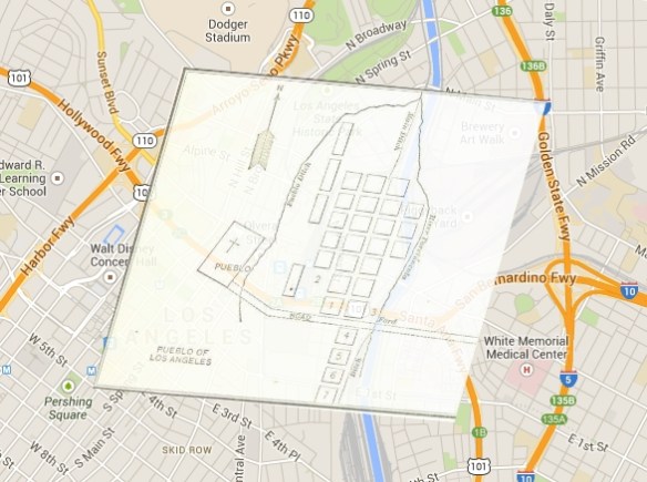
Where & When
The California Endowment
1000 N Alameda St
Los Angeles, CA 90012
September 15, 2014, 8:30-4:30pm

Fireworks 2014: Where to Buy and Light!

It’s that time again … Fireworks!  This year the fireworks app has been expanded to include cities in Orange County and Ventura County.  Included are days and times when fireworks will be sold and when you can light them up, as well as links to city web sites and telephone numbers.  Data was collected from municipal codes and/or contacting each city.  Enjoy!

fireworksapp2014